Posted by Meteorologist Beau Dodson
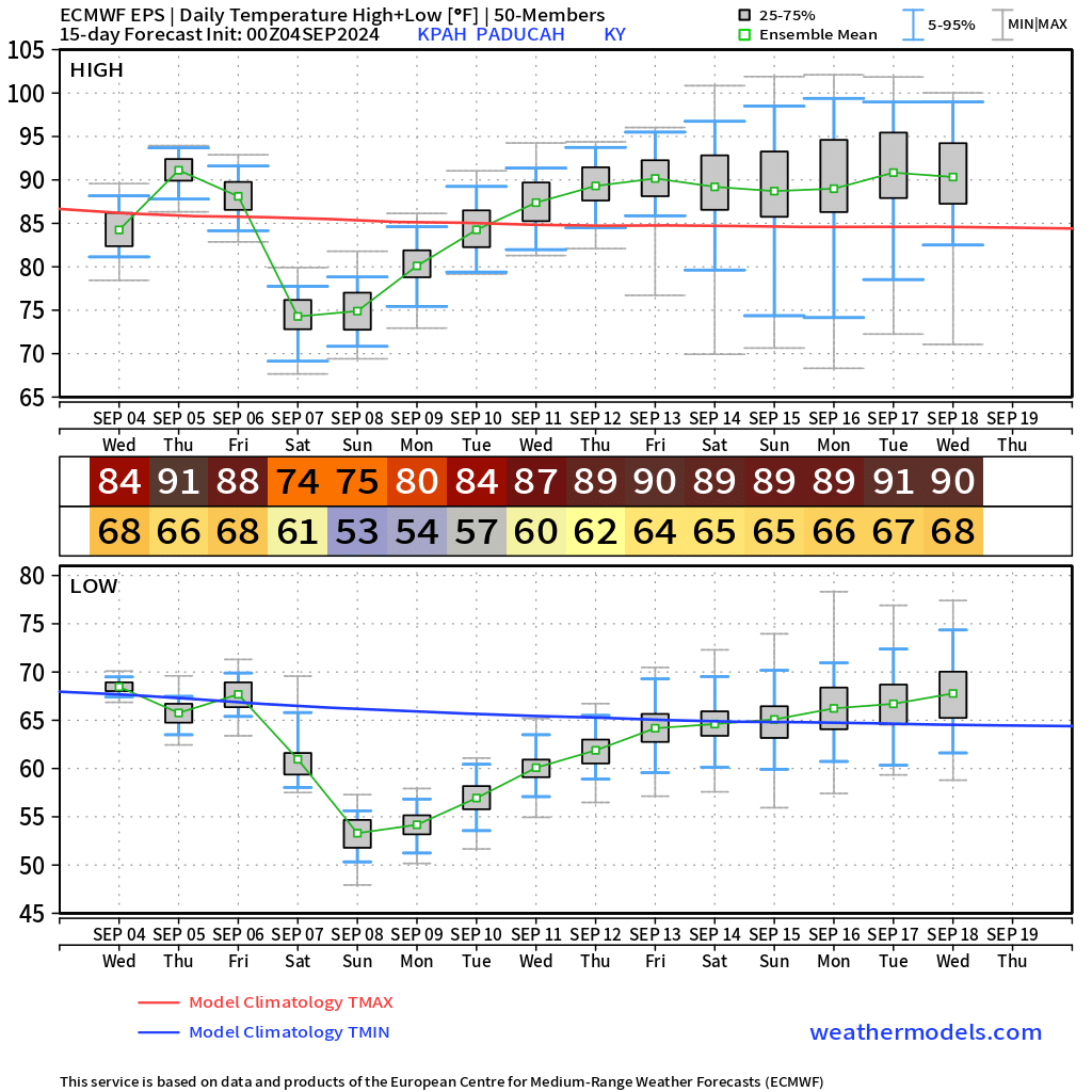
Well, we have a warm day ahead of us. Highs will reach well into the 80s. A few degrees warmer than 24-hours ago. We will also have some clouds in the region. A small chance of a sprinkle.
Thursday will be the warmest day of the week with highs around 90 degrees. Dry.
A cold front will push through the region Friday and Friday night. Clouds will accompany the front and widely scattered showers and thunderstorms. Much of the region may miss out on measurable rainfall. A few locations will pick up trace amounts. Don’t expect much. Drought conditions will worsen.
It will be much cooler Saturday through Monday with highs in the 70s and lows in the 40s and 50s. Some of the coolest air of the summer, thus far.
The EC model shows the temperature roller-coaster over the coming days. Summer isn’t quite over. You can see the upper 80s and 90s returning in the long range.