Posted by Meteorologist Beau Dodson
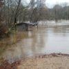
We desperately need rain in our region. We are experiencing severe short-term drought conditions. Some counties are going on five to six weeks with little or no rainfall. A rare occurrence.
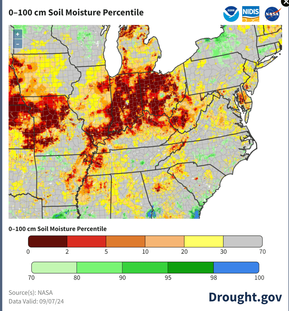
This graphic shows you where the most severe drought conditions are occurring. We forecasted this drought to develop in July. We were off by several weeks. It ended up developing in August and September.
Brush, leaves, and field fires are becoming an issue in many counties. Some counties even have burn bans in effect. Check with your local emergency management office before burning. 🔥
There won’t be any improvement through at least Thursday of this coming week. Not the best news.
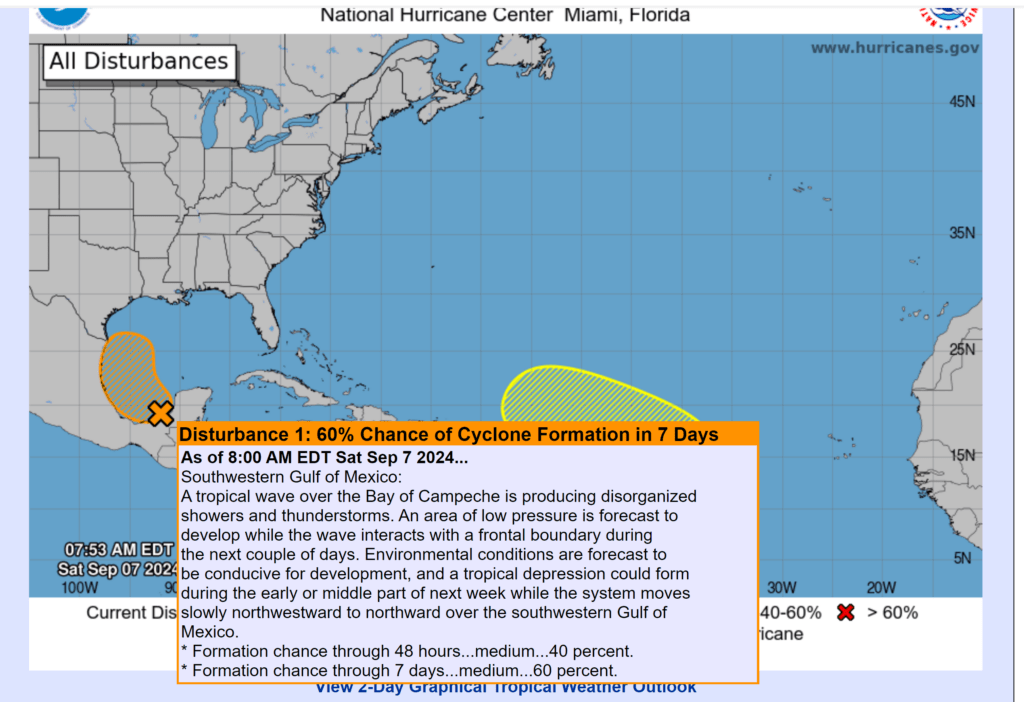
I am closely monitoring a system in the Gulf of Mexico. This system will likely strengthen into a tropical depression, storm, or hurricane over the coming days.
You can see it on this satellite imagery.
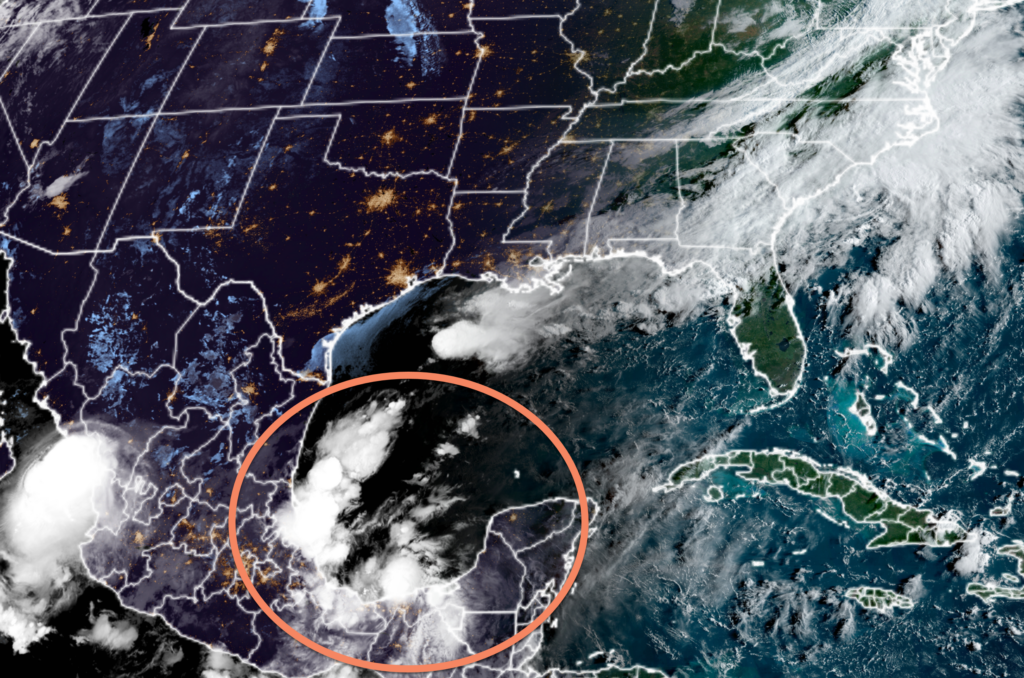
It will slowly move northward over the coming week.
The National Hurricane Center gives it a 60% chance of developing into a named tropical system. The Gulf of Mexico waters are extremely warm. Well above average.
Some model data brings the system into our region. You can see that on the GFS model. This is one run of that model. It runs four times each day.
Some runs show it staying to our south. Thus, it is still a long shot. Confidence this far out on the intensify and path is low.
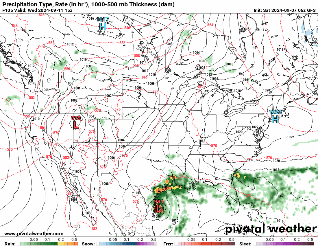
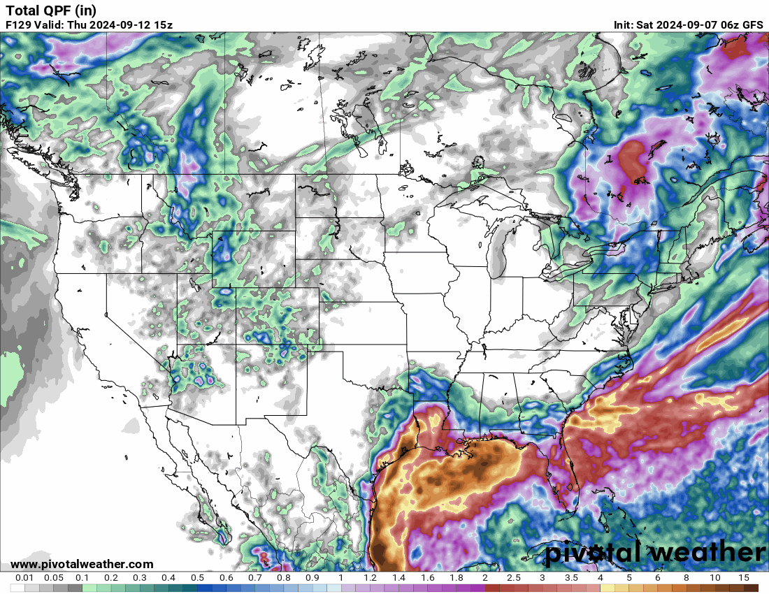
You can see how much rain falls along its path, as well. Again, this isn’t a sure bet in the weather world. It is one possibility of many. We sure could use the rain.
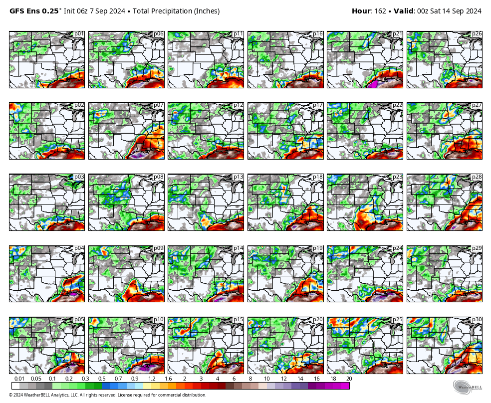
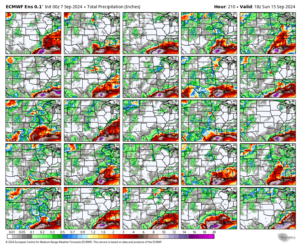
Let me show you some ensembles.
Ensembles are where they run the same model over and over and over again with slightly different beginning variables. The general idea is that the more squares that agree, the higher the confidence something will happen.
Unfortunately, the ensembles are not on our side when it comes to rain. Most of them show this system missing our region.
Here are the rainfall totals through next weekend. This is the GFS model. Maybe four of the squares bring us rain. Not the best odds.
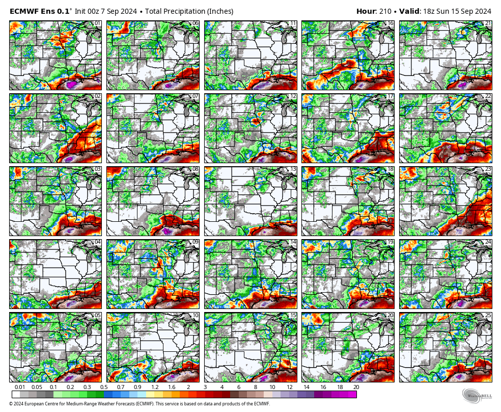
Here is the EC model. It shows five squares out of fifty that bring significant rain into our region.
For the time being, I will be monitoring the systems development, track, and intensity. Fingers crossed that it brings us some much-needed rainfall.
Want to receive more weather information? Straight to your phone!
Beau provides a service through www.weathertalk.com
Subscribe at www.weathertalk.com and then download the Beau Dodson Weather app from the app stores!
Apple users: Beau Dodson Weather App
https://wtalk.co/9EZYG8A8
Android users: Beau Dodson Weather App
https://wtalk.co/ZEWYU8ME
Be sure and have three to five ways of receiving your severe weather information.
One of those sources can be www.weathertalk.com
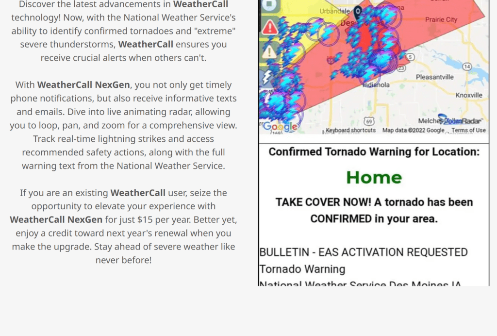
We also have a new service called WeatherCall that will call your cell phone or home phone number IF your home is INSIDE the severe thunderstorm or tornado warning. That service can be found here https://weathercallservices.com/beau-dodson-weather
Check out Beau’s live exclusive interactive weather radars.
Interactive local city-view radars. Clickable watches and warnings.
https://beaudodsonweather.com/weather-radars/