Posted by Meteorologist Beau Dodson
Good Sunday morning,
Wow, what an amazing weekend we are having. I hope you are enjoying it. I even raked some leaves. The leaves on some of my trees are dying because the ongoing drought.
It is a bit chilly outside this morning. Especially when compared with the past week. Some reporting stations are 50 degrees cooler than just a few short days ago! Amazing roller-coaster ride in the temperature department.
The dry ground is partly responsible for this. Dry ground heats up quicker during the afternoon hours. Dry ground cools off quicker at night. Sort of like a desert.
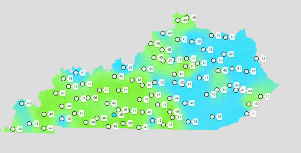
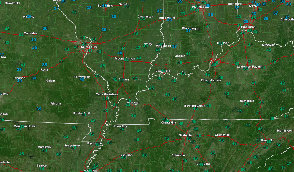
We are waking up to chilly temperatures. A few reporting stations in southeast Missouri dipped into the 30s. I also noted one northern Kentucky station at 39 degrees. Several in the lower 40s. What a change from a couple of days ago. About a 50-degree swing!
Here was the Kentucky 6 am temperature map. This is called a meso-net. Missouri, Illinois, and Tennessee do not have meso-nets.
Some local temperatures. 6 am readings. There was a 39-degree reading in Jefferson County, Illinois an hour ago, as well.
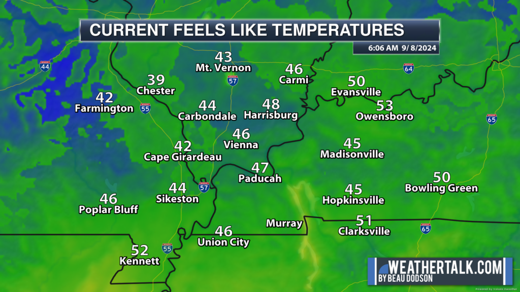
Some local feels like temperatures (6 am).
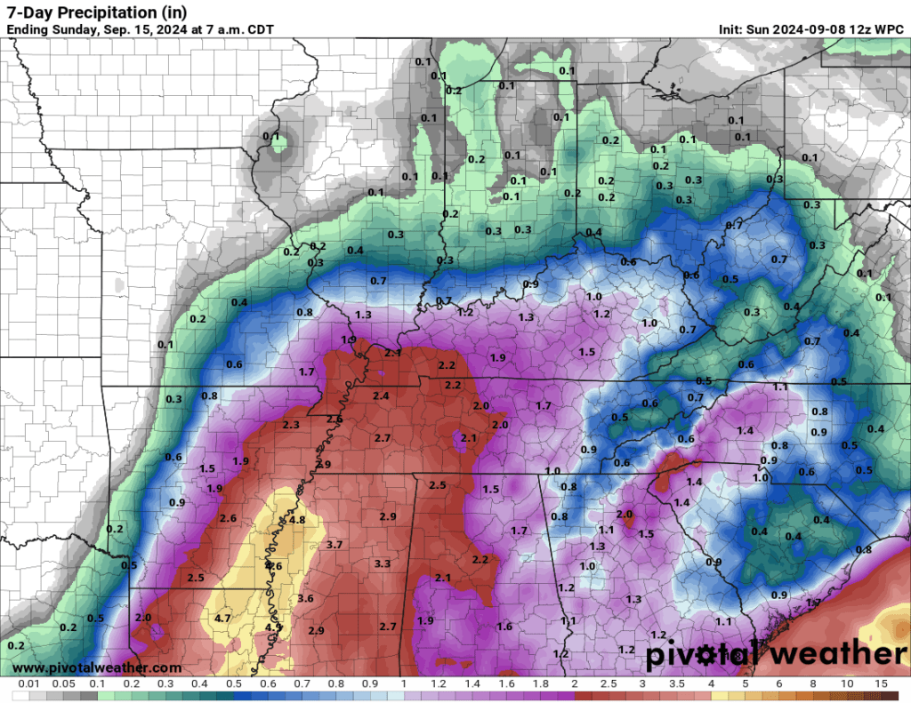
This week’s big weather story will be the possibility of rain. Chances appear to be increasing.
I continue to monitor the tropics. A disturbance in the Gulf of Mexico will move northward over the coming days. We expect it to develop into a tropical depression and/or a named tropical storm/hurricane.
The National Hurricane Center gives this system an 80% chance of developing into at least a tropical depression. The Gulf of Mexico waters are extremely warm. This will feed the system.
As the system moves northward, it may eventually bring our region much needed widespread rainfall. As a matter of fact, the latest WPC/NOAA rainfall outlook brings it into our region this coming week. Late week into the weekend.
The Paducah, Kentucky National Weather Service is now talking about the system, as well.
This is from their area forecast discussion.
A STRONG UPPER LEVEL TROUGH WILL MOVE ONSHORE THE PACIFIC NORTHWEST AMPLIFYING THE UPPER LEVELS.    MODELS ARE CONVERGING ONTO THE POTENTIAL FOR A TROPICAL SYSTEM TO MOVE OUT OF THE WESTERN GOM LATE THIS WEEK. THIS SYSTEM HAS THE POTENTIAL TO BRING SOME TROPICAL MOISTURE AND RAINFALL TO THE REGION LATE THIS WEEK. THE NBM INCREASES POPS THURSDAY INTO FRIDAY MORNING BUT THERE STILL REMAIN SOME UNCERTAINTY WITH THIS
SYSTEM. CERTAINLY SOMETHING TO KEEP AN EYE ON.
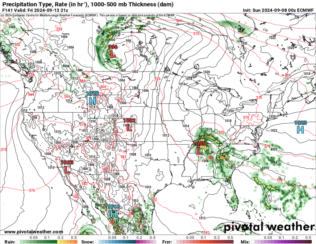
Both the GFS and EC model now bring it into our region. Yesterday, only the GFS model tracked into our region. Let’s keep an eye on it. We need this rain!
GFS model (Friday night). You can see the system moving northward.
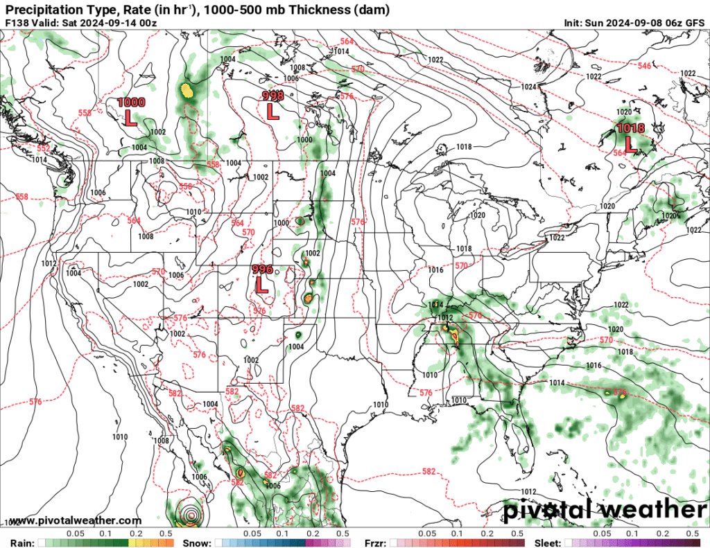
Animation
EC model (Friday afternoon). You can see the system tracking into our region.
Stay tuned.
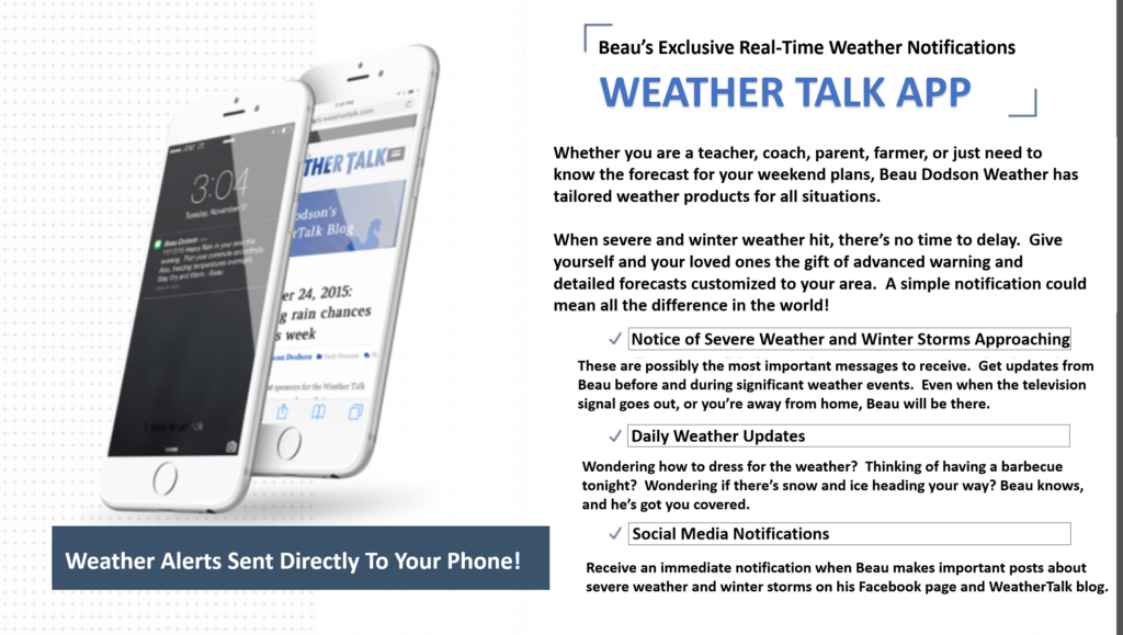
Want to receive more weather information? Straight to your phone!
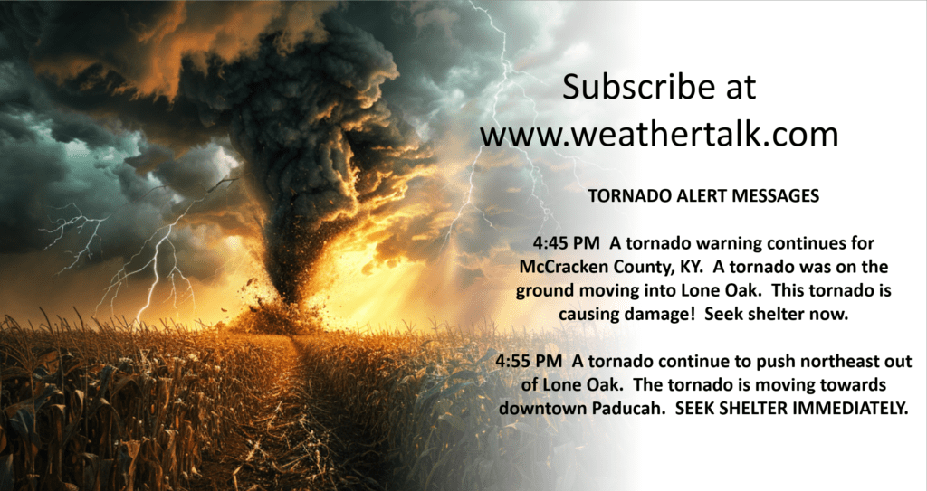
Beau provides a service through www.weathertalk.com
Subscribe at www.weathertalk.com and then download the Beau Dodson Weather app from the app stores!
Apple users: Beau Dodson Weather App
https://wtalk.co/9EZYG8A8
Android users: Beau Dodson Weather App
https://wtalk.co/ZEWYU8ME
Be sure and have three to five ways of receiving your severe weather information.
One of those sources can be www.weathertalk.com
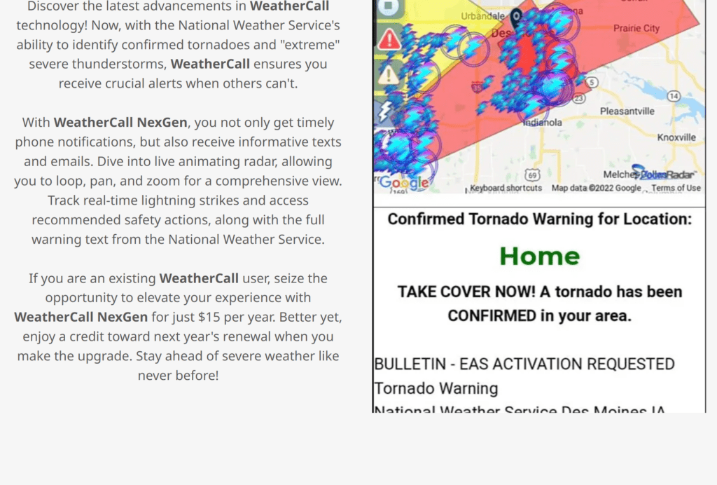
We also have a new service called WeatherCall that will call your cell phone or home phone number IF your home is INSIDE the severe thunderstorm or tornado warning. That service can be found here https://weathercallservices.com/beau-dodson-weather
Check out Beau’s live exclusive interactive weather radars.
Interactive local city-view radars. Clickable watches and warnings.
https://beaudodsonweather.com/weather-radars/