Posted by Meteorologist Beau Dodson
Welcome to autumn!

I am monitoring the Gulf of Mexico for the development of a tropical system.
The chances of a tropical storm forming are high.
The National Hurricane Center has a 70% chance for development over the next few days.
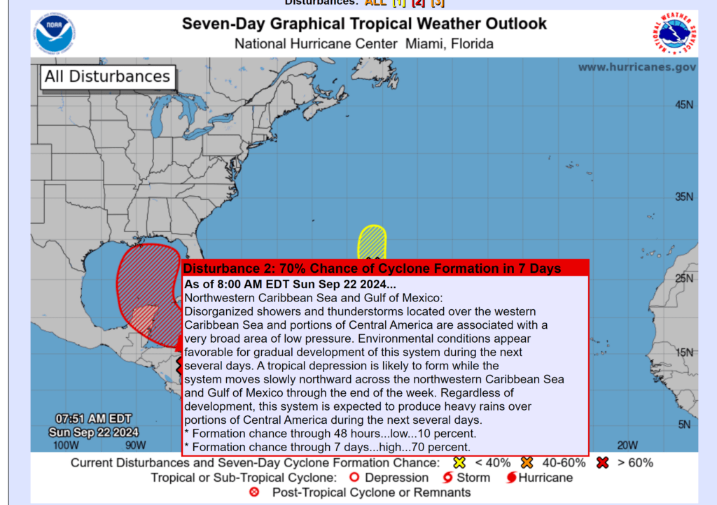
It remains too early to determine the strength and track of this system. Since it hasn’t formed yet, all we have to go by is model guidance.
There are some general themes in the guidance. That theme is to track it towards Alabama and Florida.
This graphic shows you the probability of its eventual track. You will also notice the left curve as the system pulls northward.
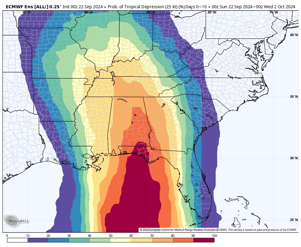
I am watching for the development of an upper-level low-pressure center over our region mid to late week. If that does develop, then it could pull moisture north-northwest into our region. That would enhance rainfall totals.
Stay tuned.
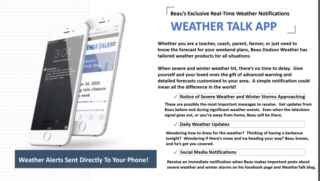
Want to receive more weather information? Straight to your phone!
Beau provides a service through www.weathertalk.com
Subscribe at www.weathertalk.com and then download the Beau Dodson Weather app from the app stores!
Apple users: Beau Dodson Weather App
https://wtalk.co/9EZYG8A8
Android users: Beau Dodson Weather App
https://wtalk.co/ZEWYU8ME
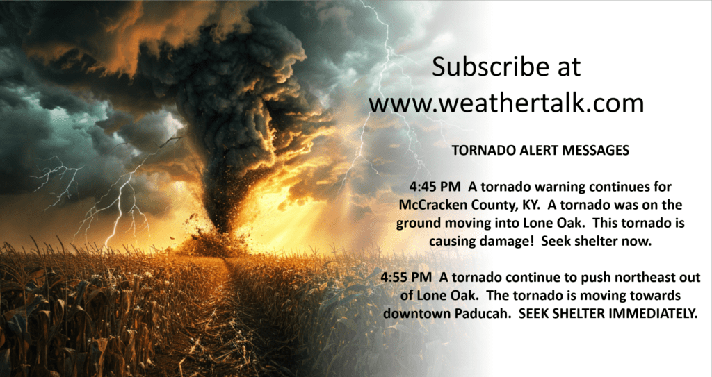
Be sure and have three to five ways of receiving your severe weather information.
One of those sources can be www.weathertalk.com
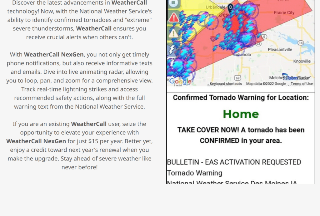
We also have a new service called WeatherCall that will call your cell phone or home phone number IF your home is INSIDE the severe thunderstorm or tornado warning. That service can be found here https://weathercallservices.com/beau-dodson-weather
Check out Beau’s live exclusive interactive weather radars.
Interactive local city-view radars. Clickable watches and warnings.
https://beaudodsonweather.com/weather-radars/