Posted by Meteorologist Beau Dodson
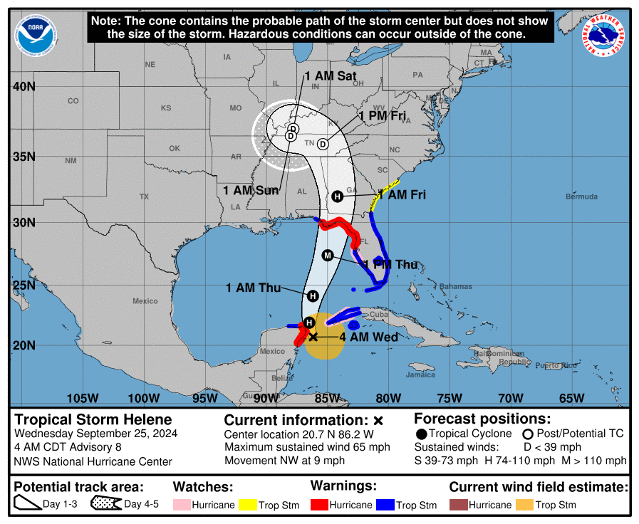
The remnants of Hurricane Helene will move into our region later this week. You can see that on this National Hurricane Center storm track map. The D stands for tropical depression.
A widespread rain event will move into our region Thursday through Saturday. Peak rain chances will be Thursday night into Saturday. If you have outdoor plans, then monitor updated forecasts and radars. You might want to have a plan B, as well.
Scattered showers will continue into Sunday and perhaps Monday.
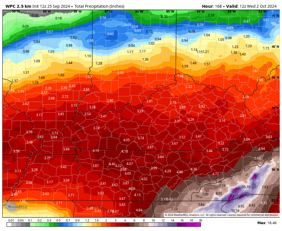
Rainfall totals will range from one to three inches. There will be bands of higher totals, as well. This could lead to flooded roadways in some areas.
The threat of flooding will be higher across areas that received heavy rain over the past week. Some locations picked up two to five inches of rain earlier this week.
Gusty winds will accompany the system. Ranging from 15 to 25 mph. Perhaps some higher gusts, as well. We are not expecting severe weather with this event.
Here is the NWS/WPC rainfall forecast. It won’t be exact but take the general idea from it.
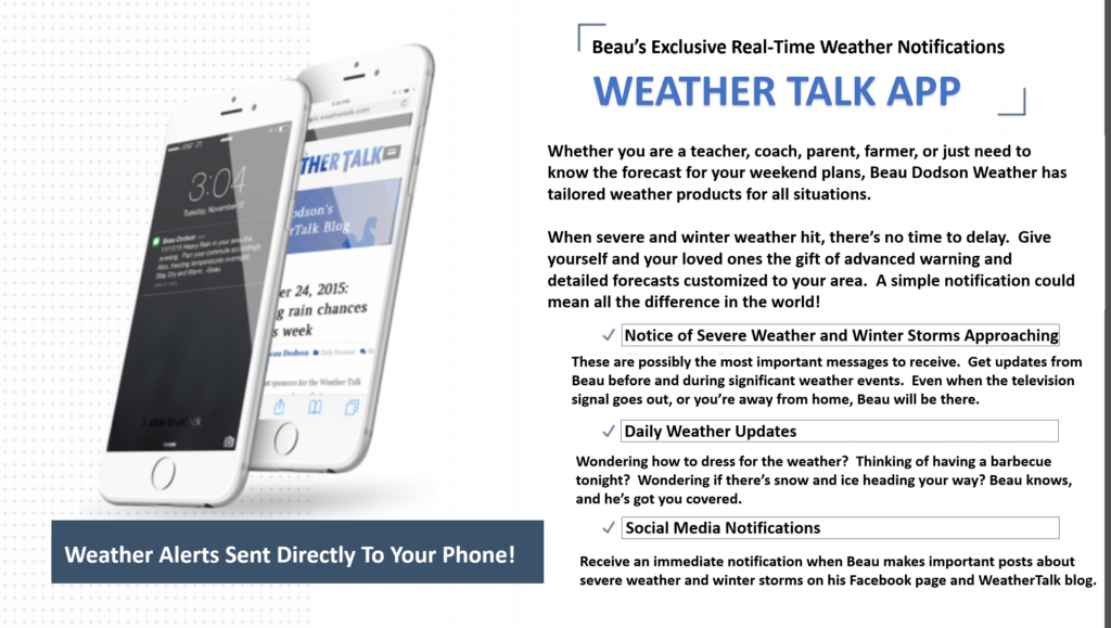
Want to receive more weather information? Straight to your phone!
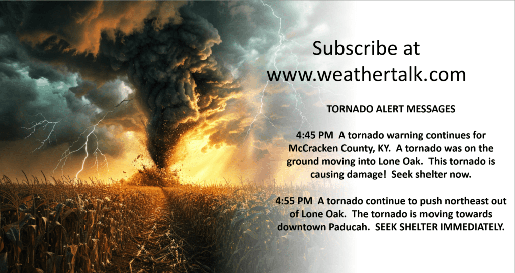
Beau provides a service through www.weathertalk.com
Subscribe at www.weathertalk.com and then download the Beau Dodson Weather app from the app stores!
Apple users: Beau Dodson Weather App
https://wtalk.co/9EZYG8A8
Android users: Beau Dodson Weather App
https://wtalk.co/ZEWYU8ME
Be sure and have three to five ways of receiving your severe weather information.
One of those sources can be www.weathertalk.com
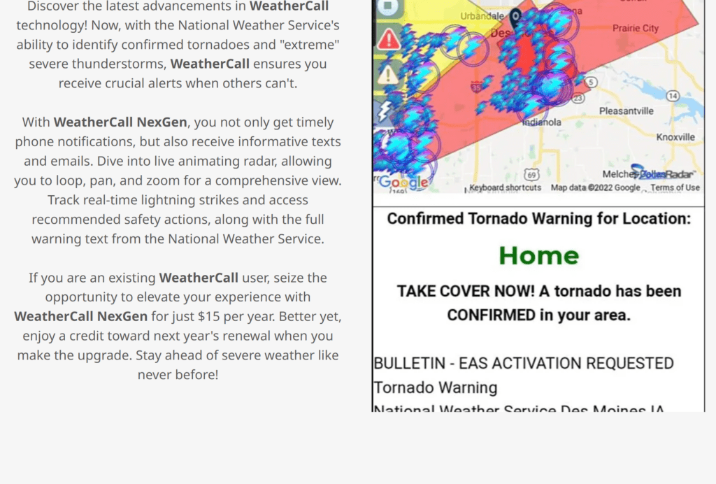
We also have a new service called WeatherCall that will call your cell phone or home phone number IF your home is INSIDE the severe thunderstorm or tornado warning. That service can be found here https://weathercallservices.com/beau-dodson-weather
Check out Beau’s live exclusive interactive weather radars.
Interactive local city-view radars. Clickable watches and warnings.
https://beaudodsonweather.com/weather-radars/