Posted by Meteorologist Beau Dodson
Well, here we go again.
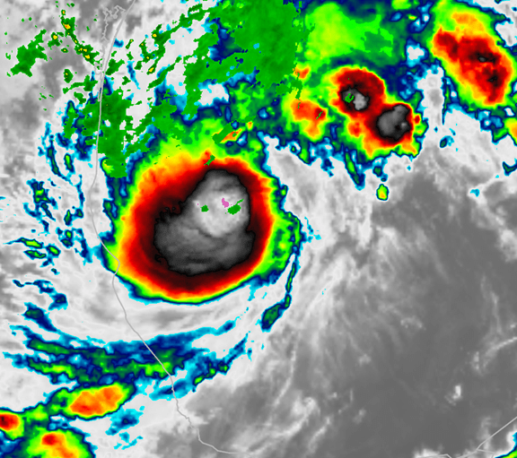
Another hurricane is forming in the Gulf of Mexico. It’s name is Milton. It will rapidly become a hurricane over the next 24 to 48 hours.
The system is forecast to track towards Florida. If you have travel plans to Florida, then monitor updates.
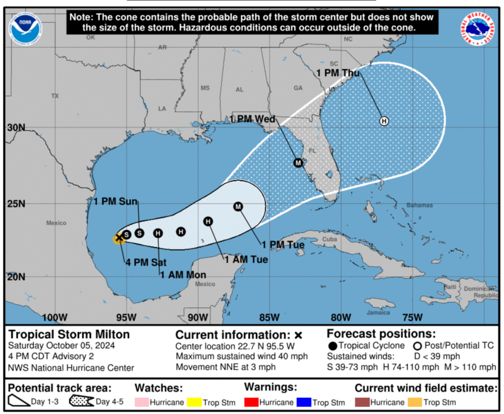
Here is the latest National Hurricane Center cone. The cone is where the eye may pass. There is a large area to monitor. Remember, impacts can occur hundreds of miles away from the eye. Do not focus on the center of the cone.
At this time, it appears that it would move ashore Tuesday or Wednesday. It will likely be a category three or four hurricane. Catastrophic damage is likely with this hurricane.
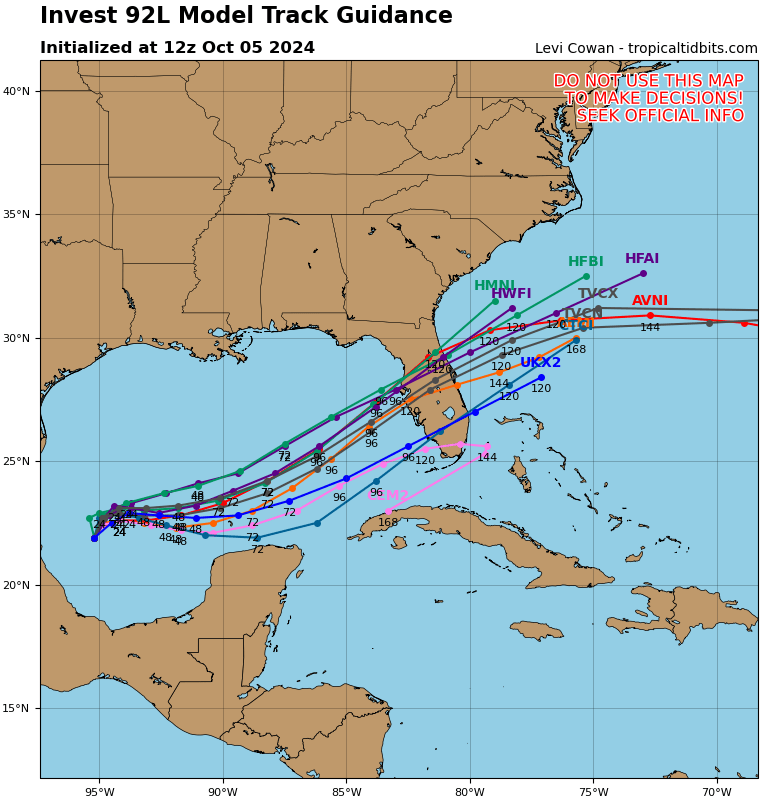
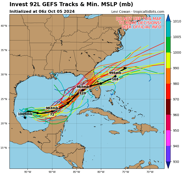
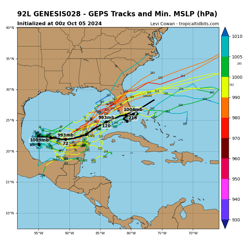
Here are some model plots showing the potential path. These are spaghetti plots. The general idea is that the tighter the clustering the higher the chance of the system coming ashore in that area.
Keep in mind, hurricanes are not a point on a map. They are large and cover many miles. Impacts can occur well away from the center of the storm.
Want to receive more weather information? Straight to your phone!
Beau provides a service through www.weathertalk.com
Subscribe at www.weathertalk.com and then download the Beau Dodson Weather app from the app stores!
Apple users: Beau Dodson Weather App
https://wtalk.co/9EZYG8A8
Android users: Beau Dodson Weather App
https://wtalk.co/ZEWYU8ME
Be sure and have three to five ways of receiving your severe weather information.
One of those sources can be www.weathertalk.com
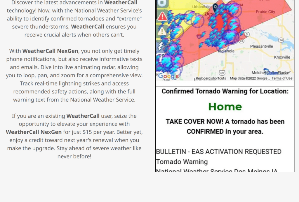
We also have a new service called WeatherCall that will call your cell phone or home phone number IF your home is INSIDE the severe thunderstorm or tornado warning. That service can be found here https://weathercallservices.com/beau-dodson-weather
Check out Beau’s live exclusive interactive weather radars.
Interactive local city-view radars. Clickable watches and warnings.
https://beaudodsonweather.com/weather-radars/