
Good day, everyone.
We are in store for an amazing weather day! Mild.
Be sure and check out my detailed blog over at www.weathertalk.com or on your Beau Dodson Weather app. This is a subscription service. Subscribe and then download the app. If you need any help, then just email me at beaudodson@usawx.com
Let’s talk about rain chances.
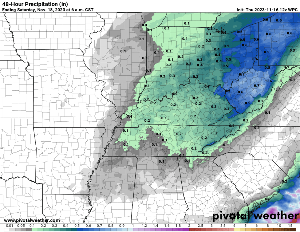
Rain chances ramp up tonight and tomorrow. This is a light rain event. I am forecasting 0.00″ to 0.20″ of rain.
Not much. The lower totals will be across southeast Missouri. Higher totals over Kentucky.
Here is a graphic that shows the potential totals.
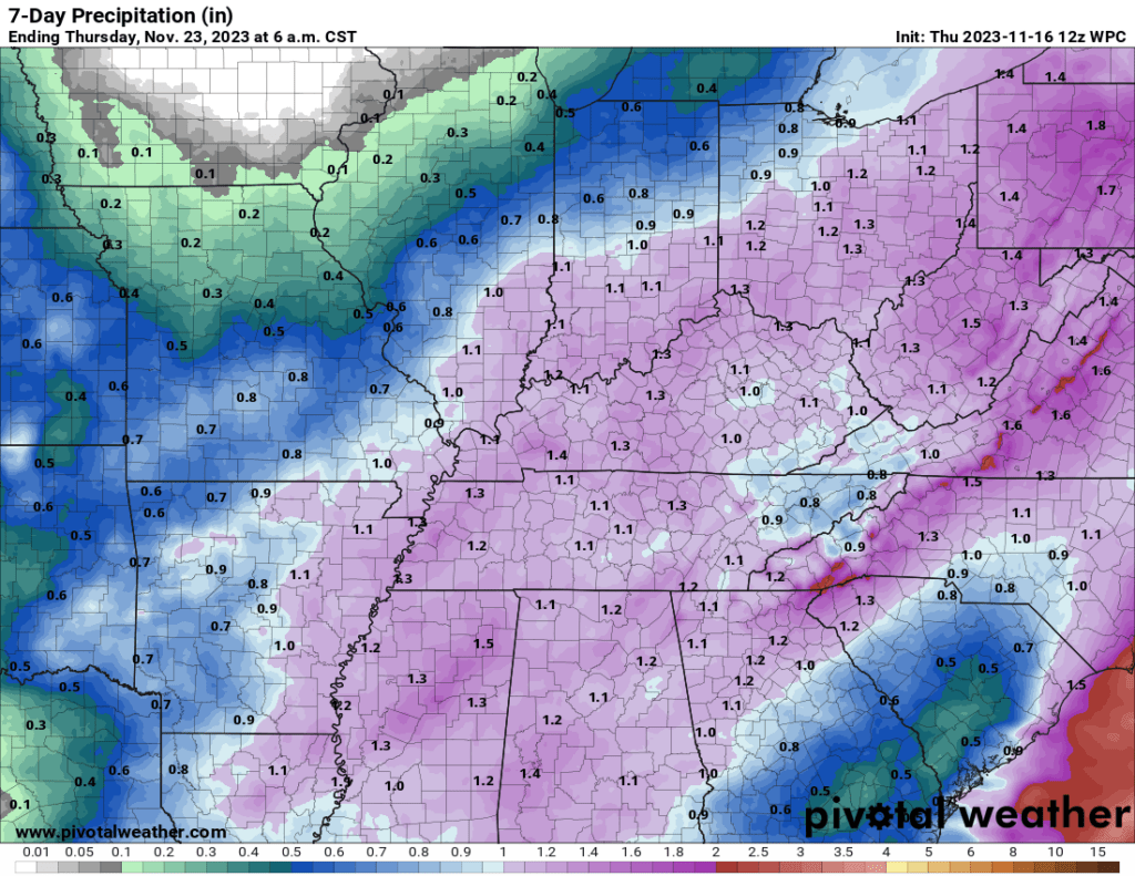
A bigger rain event arrives Sunday night into Tuesday of next week. That is the event that will likely give us 0.50″ to 1.00″ of rain. Locally higher.
Thunderstorms are possible, as well. For now, I do not expect severe storms. That is the good news. Monitor updates.
There remains some disagreement on just how much rain falls in each county.
Here is the latest WPC NOAA rainfall outlook. Most of this will fall Monday and Tuesday.
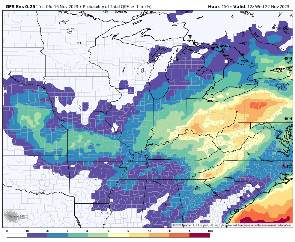
We can also look at the model ensembles.
The EC model is a bit more bullish on some locations receiving one inch or more of rain. Here is the probability of one or more inches of rain.
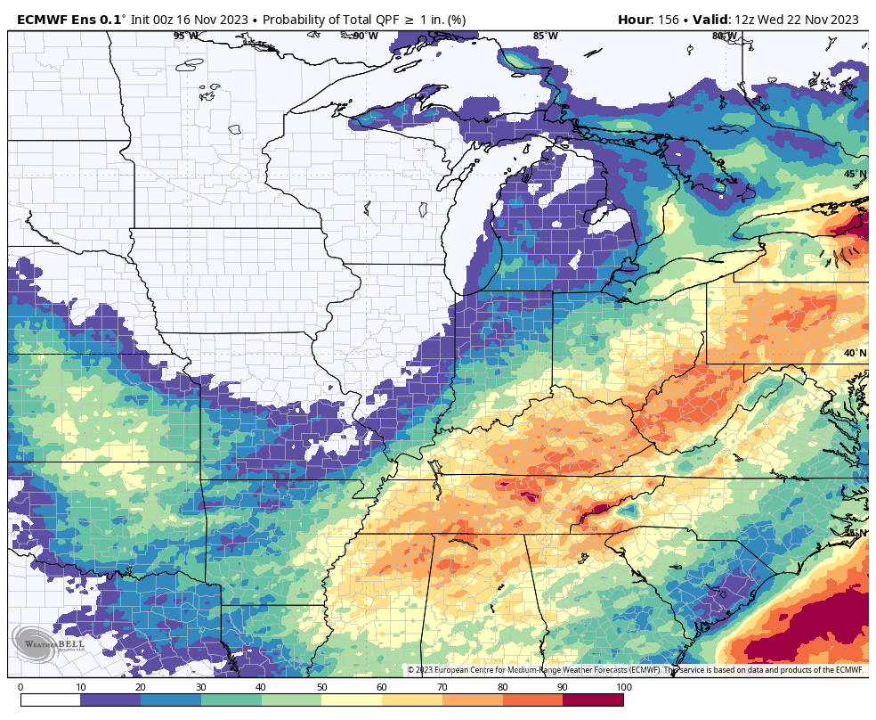
The GFS model, on the other hand, is not quite as bullish. The models have different storm tracks and intensity. This will need to be ironed out over the coming days.
I continue to have next Wednesday and Thanksgiving Day dry and chilly. Highs in the 40s/50s. Lows in the 20s and 30s.
Enjoy today! It is going to be a NICE one.
Subscribe to all of my weather products at www.weathertalk.com
Once you subscribe, go to the app store and download the Beau Dodson Weather app!