
To see all of Beau’s weather products subscribe to www.weathertalk.com

Thanksgiving Forecast!
Posted by Meteorologist Beau Dodson
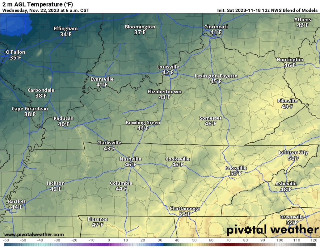
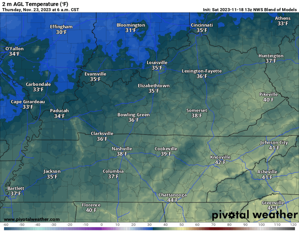
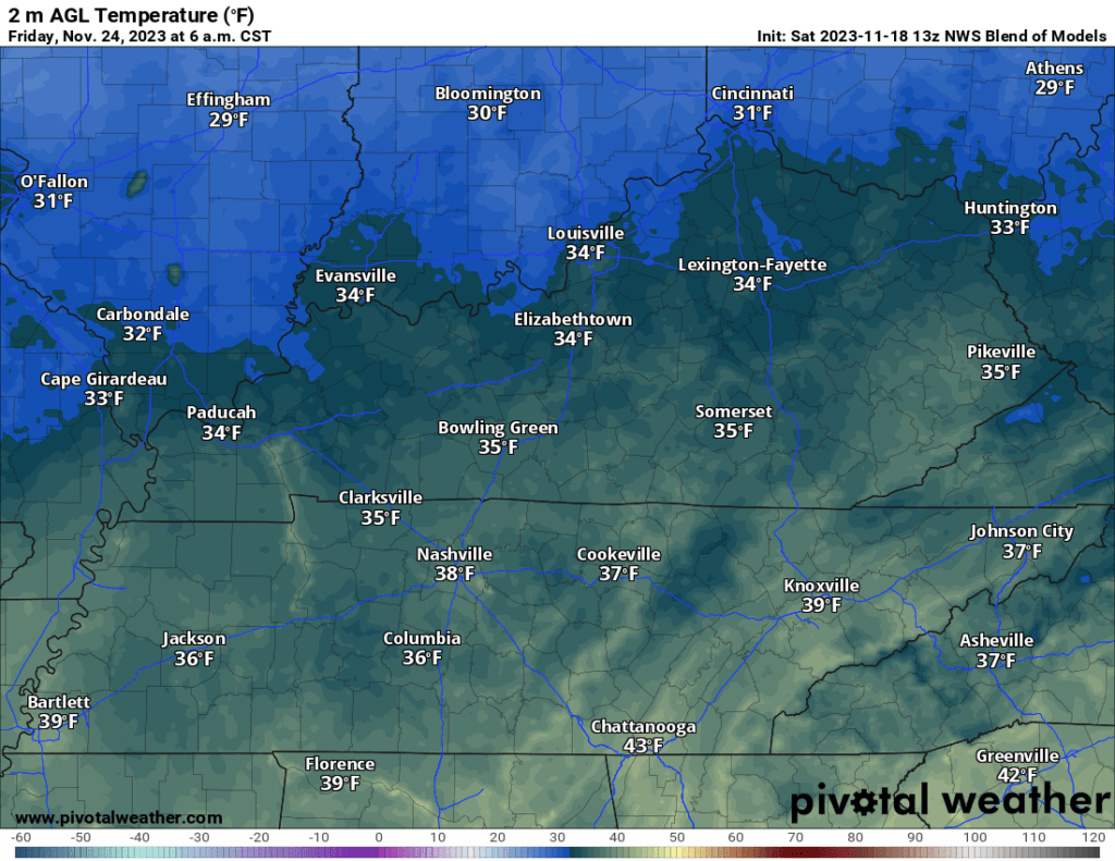
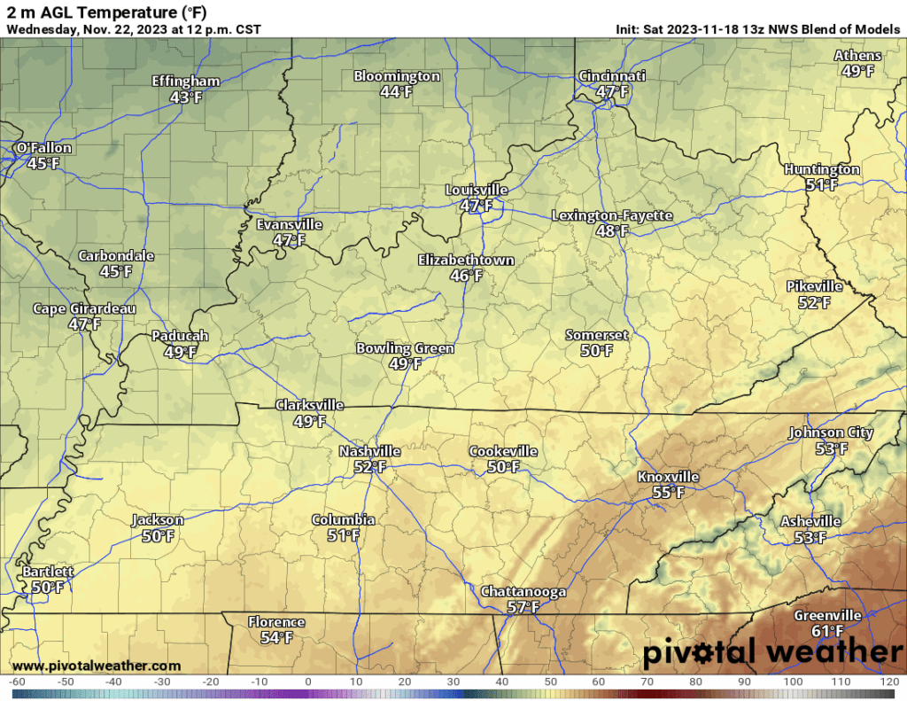
Locally, I am forecasting a dry Wednesday and Thursday. It is going to be chilly both days with high temperatures in the 40s/50s. Lows will dip into the 20s/30s both Wednesday and Thursday morning.
Gusty northerly winds will make it feel a bit colder Wednesday. Winds won’t be as strong Wednesday night into Thursday night.
Wednesday morning lows
Thursday morning lows
Friday morning lows
Wednesday afternoon highs
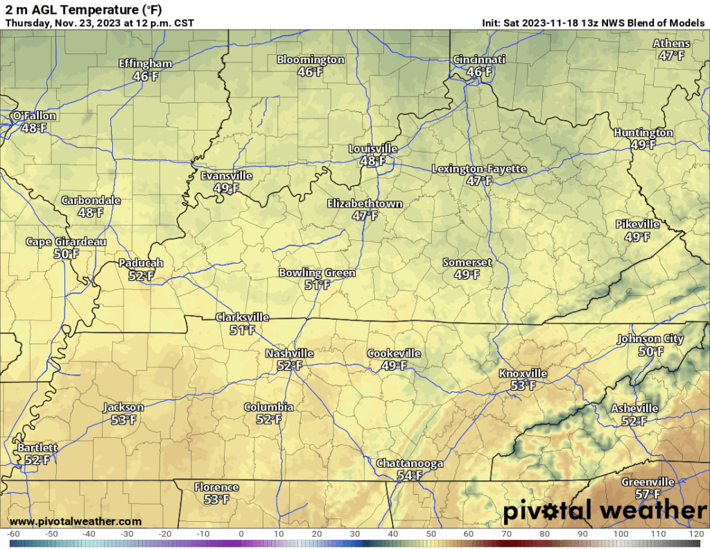
Thursday afternoon highs
This will make for a chilly Thanksgiving!
Thankfully, no snow or ice in the forecast either day.
Those flying into the northeast United States will want to check the latest travel conditions. It is possible that gusty wind, rain, and even snow will impact some locations.
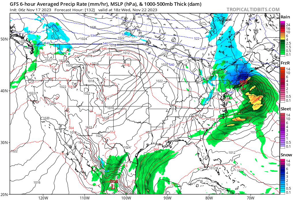
The GFS model is showing rain and snow in the northeast Wednesday afternoon and night. This could impact airports in New York and Boston.
There remains disagreement in the model guidance as to the impacts of the storm system. Make sure you check the latest forecast for your destination.
Wednesday afternoon weather map. GFS model guidance. Blue is snow. Green is rain.
I continue to monitor next Friday, Saturday, and Sunday for another storm system that could bring precipitation back to the region.
For now, confidence in that happening remains low. It will be a few more days until I have a handle on that portion of the extended forecast.
Keep checking back!
Have a GREAT weekend!