
Posted Meteorologist Beau Dodson
Weather discussion below.
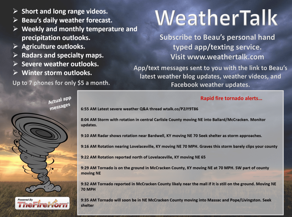
Want to receive more weather information? I provide a service through www.weathertalk.com
You can receive daily weather forecasts, blog updates, special weather statements, severe weather alerts, tornado alerts, ice storm warnings, winter storm alerts, videos, long range videos, long range outlooks, and more!
Subscribe at www.weathertalk.com
Samples of what you will receive. Once you subscribe, download the Beau Dodson Weather App in the app store. Need help? Email me at beaudodson@usawx.com
Happy Saturday, everyone. I hope you had a nice week. We are about to enter the week before Christmas.
Snoopy will enjoy snow today. We will have to settle for rain.

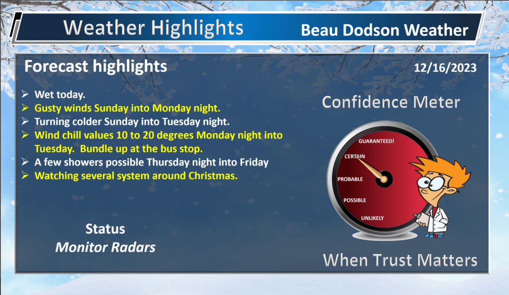
Our forecast for the past six+ weeks has been to watch Christmas for one or more storm systems. The forecast was for the last two weeks of December to be a bit more active than previous weeks.
We are now watching several storm systems the week of Christmas and the week after. The forecast is on track. But. we still need to work out the details.
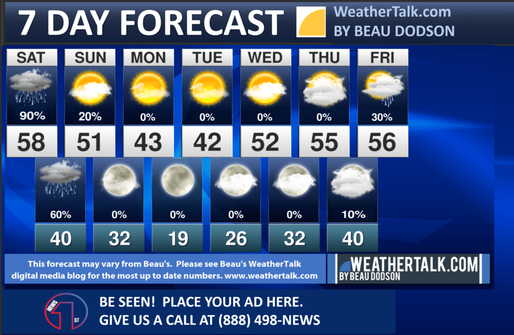
Frist, we have to get through some rain. If you are headed out to parades or other activities today, then bring a jacket and an umbrella.
Showers already dot radar. This rain will continue into tonight.
The good news is that we do not have thunderstorms in the forecast today. No severe weather. No tornadoes. No snow. No ice.
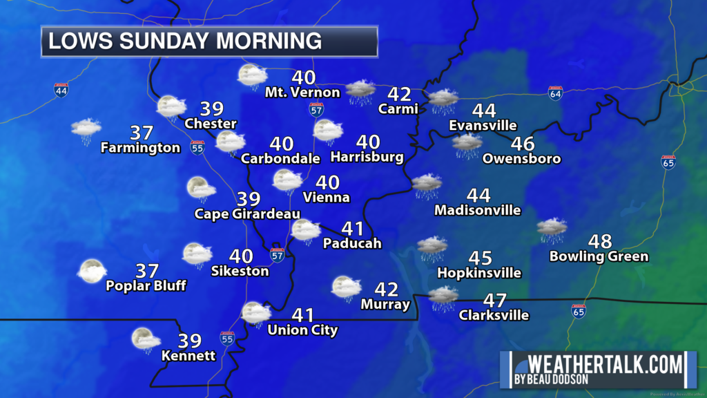
A few showers will linger into Sunday morning across western Kentucky and northwest Tennessee. Especially as you move eastward in the region. With time, the rain will end west to east. There could even be some clearing over portions of southeast Missouri and southwest Illinois.
Here was the 8 AM live radar snapshot. See the live radars for the most up to date data.
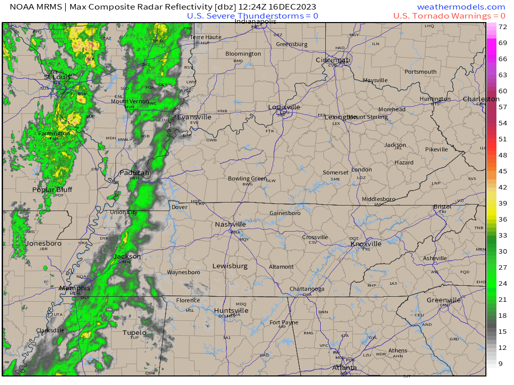
Live radars.
Beau Dodson Radars and Lightning Data
Interactive local city-view radars. Clickable watches and warnings.
https://wtalk.co/B3XHASFZ
Backup radar site in case the above one is not working.
https://weathertalk.com/morani
Regional Radar
https://imagery.weathertalk.com/prx/RadarLoop.mp4
*NEW* Zoom interactive radar (with storm chaser streams)
https://wtalk.co/AVWG7GM7
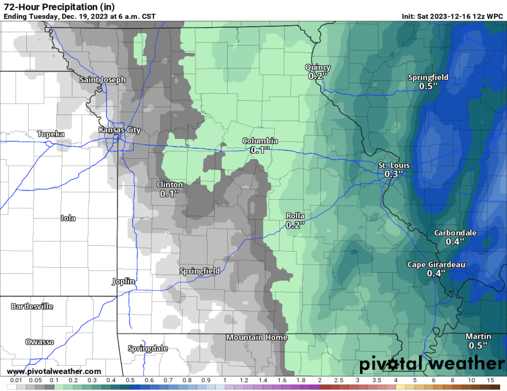
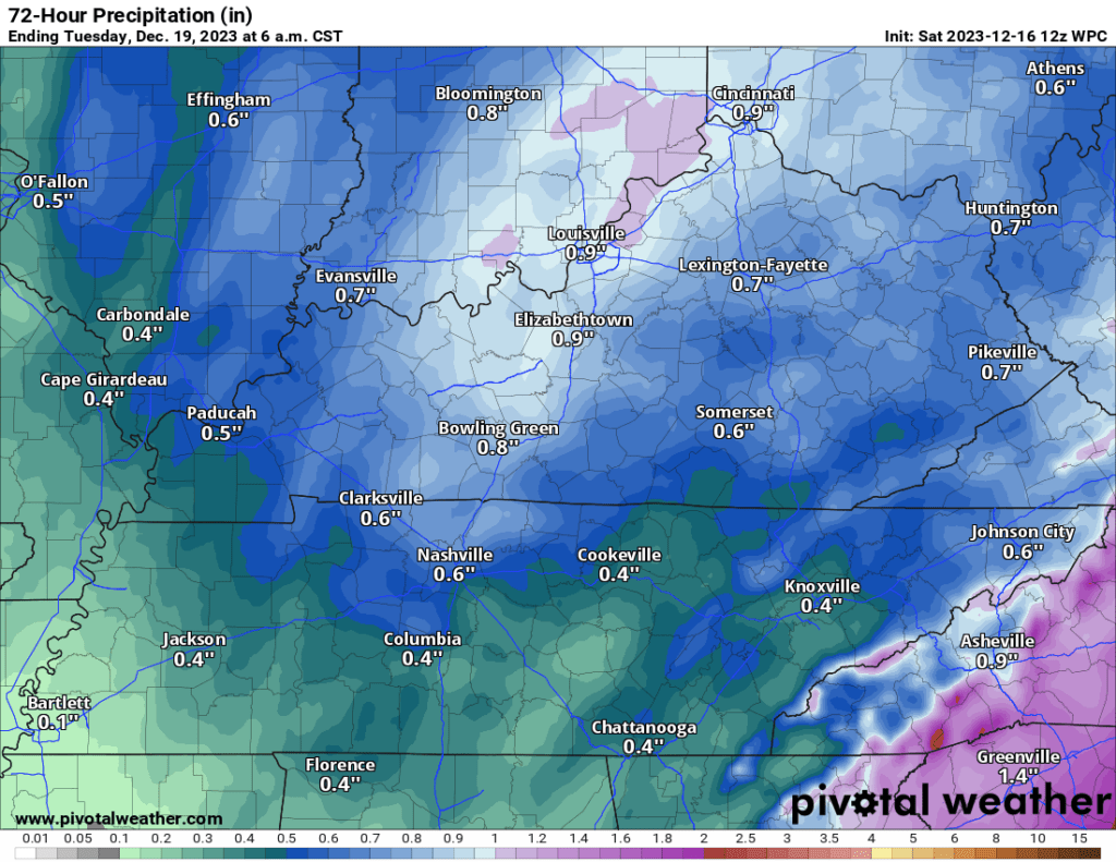
Rain totals will range from 0.10″ to 0.30″ across our western counties and 0.35″ to 0.70″ over our eastern counties. Perhaps a bit more over northwest Kentucky.
Here is the latest WPC NOAA forecast for rain totals.
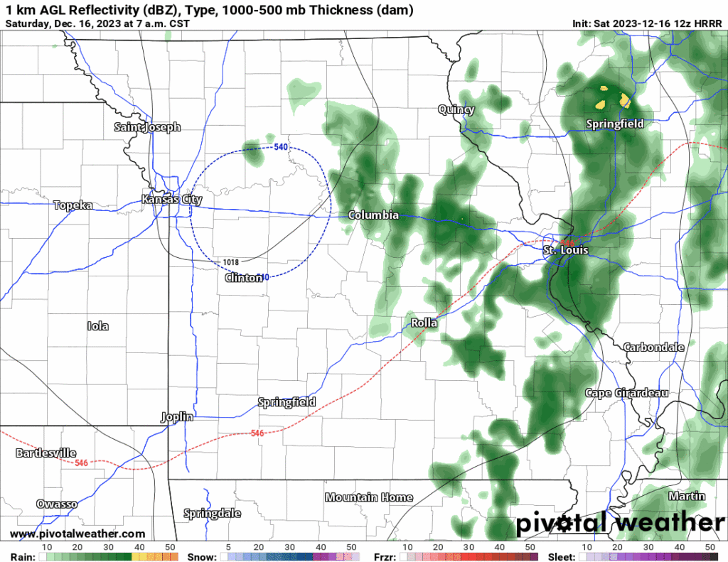
Let’s look at the HRRR future-cast radar. What radar might look like over the next 24 hours. Keep in mind, this is a model. Model’s aren’t exact. Take the general idea from this.
Timestamp upper left.

The next weather story will be gusty winds and cold temperatures Sunday into Tuesday. It will feel like winter, briefly.
This will occur as a large storm system moves up the East Coast.
That system is currently located in the Gulf of Mexico. You can see it on satellite.
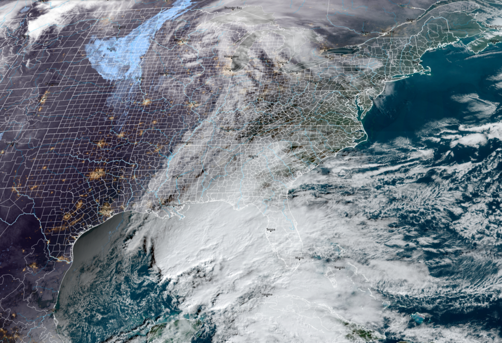
You can also see the system on the weather map below, as well. This is the Sunday night weather map.
See the big red L? That is the area of low pressure. Low pressure rotates counterclockwise. Thus, we are on the cold side of this system.
This is the big system that will bring heavy rain, snow, and severe weather from Florida to Canada. The only impact in our region will be the gusty wind and colder temperatures.
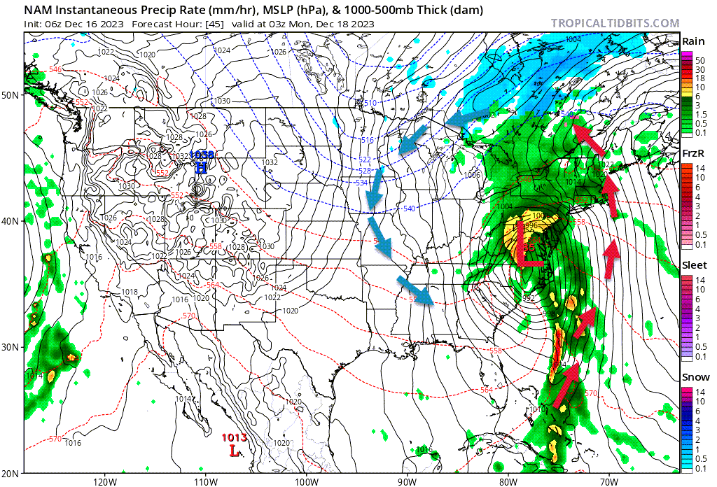
Winds will gust above 30 mph Sunday into Monday night. Tapering late Monday night.
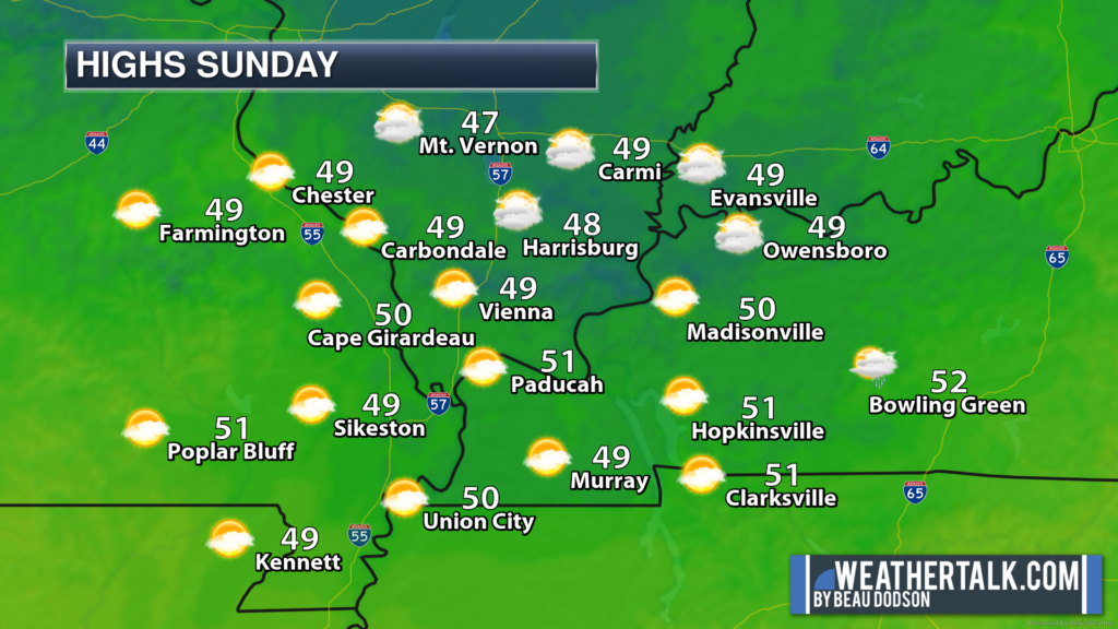
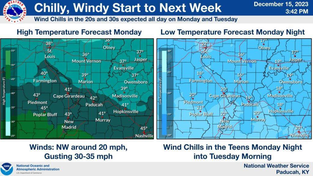
High Sunday, Monday, and Tuesday will only rise into the 40s. Combine those temperatures with gusty winds and the coldest wind chill values will drop to 10 to 20 degrees Monday night and Tuesday morning.
A bit chilly! This will be the coldest air since last winter.
School kids will want to bundle up Monday and Tuesday morning. If they have to stand at the bus stop then gloves might be a good idea

Dry conditions are likely Monday through Thursday afternoon. I am watching a system Thursday night into next weekend. Perhaps some light showers.
A bigger system is possible around Christmas, and I am watching another system or two right after Christmas.