Posted by Meteorologist Beau Dodson
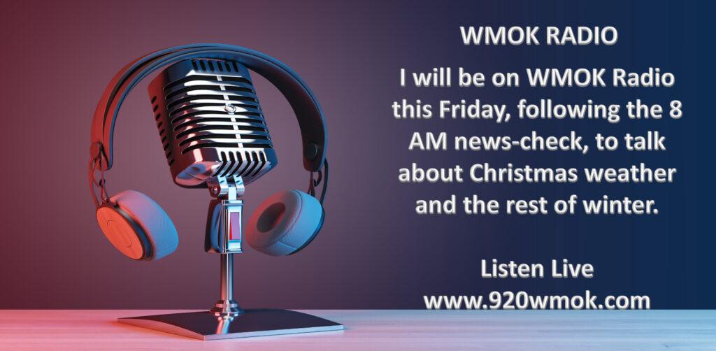
I will be on WMOK this Friday morning. Be sure and listen in as we will be talking about the rest of winter into spring.
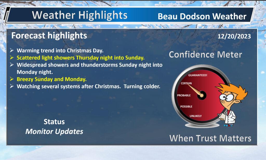
A warming trend will begin today and take us right on into Christmas. As a matter of fact, I can’t rule out some locations hitting the 60 degree mark this weekend and on Christmas Day.
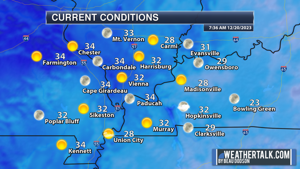
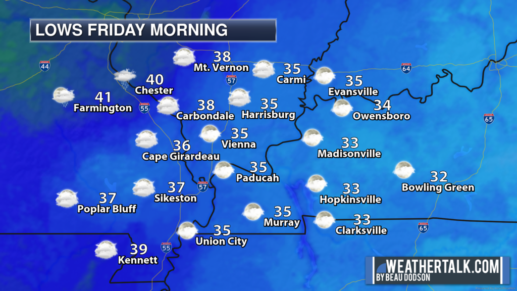
First off, temperatures this morning are in the 30s. Not as cold as yesterday. Still, it is a chilly start to the day.
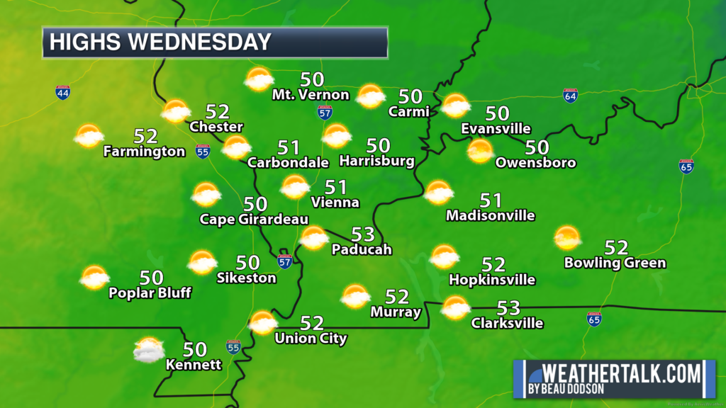
A decent forecast today and tomorrow. Dry conditions. Increasing clouds.
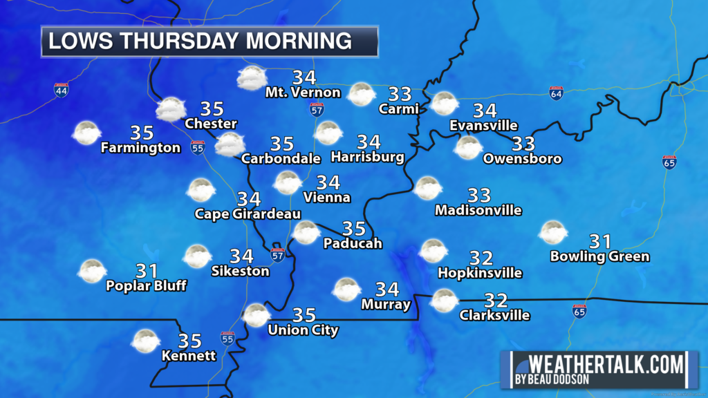
A few showers will enter the picture Thursday night into Friday night, but this won’t amount to much. Trace amounts to perhaps 0.20″.
Rain chances will be lower Saturday during the day. Likely in the 0% to 20% range. Mostly dry day.
Here is the latest WPC NOAA rainfall forecast through Saturday morning.
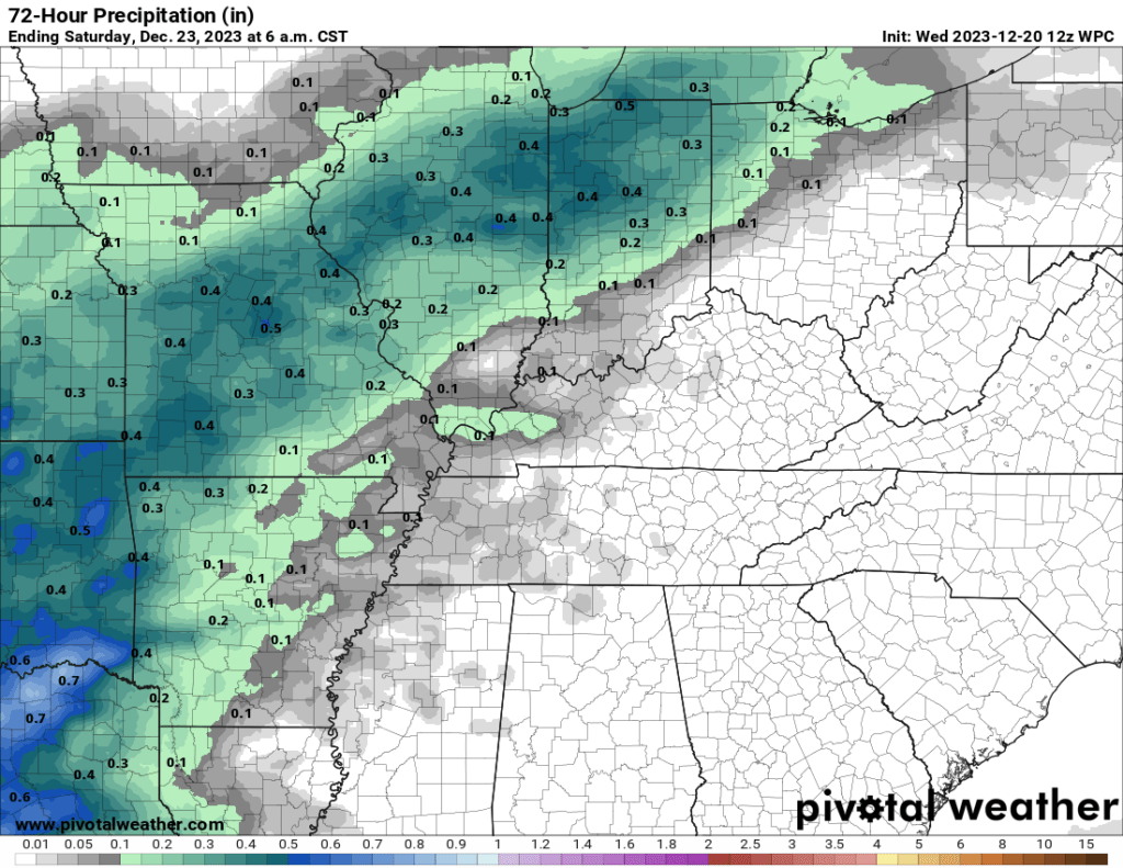
Again, this initial round of showers will be light. No severe weather concerns through Saturday night.
A stronger/wetter system will approach the region Saturday night into Monday night.
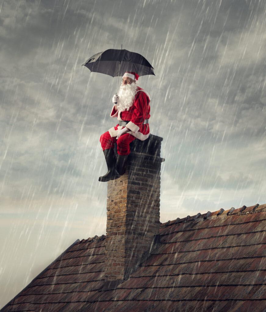
Peak rain chances will arrive Sunday night into Monday night. Santa is going to need an umbrella and a rain jacket!
I have rain chances in the 60% to 70% range Sunday night into Monday night.
A few thunderstorms will be possible, as well. At this time, it appears there won’t be severe weather. I will continue to monitor trends. Keep checking back.
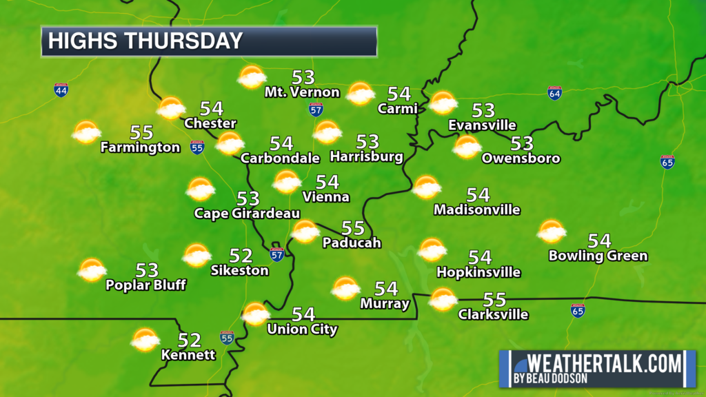
It will be mild Sunday and Monday with highs in the 50s and perhaps lower 60s. Well above seasonal averages.
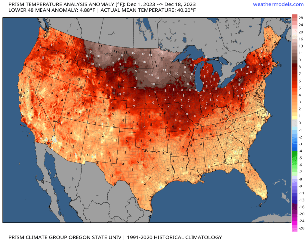
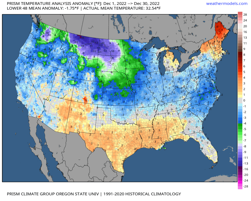
We did forecast a mild December. Here are the temperature anomalies, thus far. Anomalies are how many degrees temperatures are above or below average.
Let’s compare that to last year! What a difference a year makes. We were shivering last December. Remember those -30-degree wind chills? Ice and snow, as well.
This was the December 2022 temperature anomaly map.
If you have outdoor events Sunday or Monday, then you will want to check the Beau Dodson Weather Radars.
Beau Dodson Radars and Lightning Data
Interactive local city-view radars. Clickable watches and warnings.
Beau’s Exclusive Weather Radars
Backup radar site in case the above one is not working.
https://weathertalk.com/morani
Regional Radar
https://imagery.weathertalk.com/prx/RadarLoop.mp4
*NEW* Zoom interactive radar (with storm chaser streams)
https://wtalk.co/AVWG7GM7
Real time lightning tracker system two. https://map.blitzortung.org/#5.02/37.95/-86.99
Lightning Data (zoom in and out of your local area)
https://wtalk.co/WJ3SN5UZ
I continue to monitor several systems between December 26th and January 7th. Whether one of these will produce snow or ice is still a question.
There will be some colder air to work with, but whether we have precipitation during that timeframe is something I will need to work out.
Models do show some snow and wintry precipitation, from time to time, after Christmas into the first week of January. The atmospheric players are there, but the storm tracks will have to line up just right to produce snow in our local area. Confidence remains low. For now, at least.
Stay tuned snow fans.
———————————–
Want to receive more weather information? I provide a service through www.weathertalk.com
Subscribe at www.weathertalk.com and then download the Beau Dodson Weather app from the app stores!
Apple users: Beau Dodson Weather App
https://wtalk.co/9EZYG8A8
Android users: Beau Dodson Weather App
https://wtalk.co/ZEWYU8ME
Need help? Email me at beaudodson@usawx.com
* Daily weather forecasts
* My personal weather blog with all sorts of weather information!
* Special weather statements sent to the Beau Dodson Weather app.
* Rapid fire tornado alerts.
* Severe weather alerts and forecasts.
* Severe weather updates throughout the day (when severe weather is occurring)
* Ice storm alerts and forecasts.
* Winter storm alerts and forecasts.
* Winter storm updates throughout the event.
* Regional weather videos.
* Long range weather videos.
* A daily forecast that I hand type for your county. Sent out every afternoon.
* Long range outlooks. Including week one, two, three, four, and monthly outlooks. Seasonal outlooks.
* App messages to alert you when I have updated the weather blogs and Facebook.
* And more!
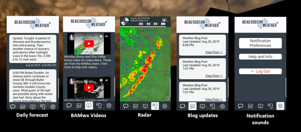
Here are some examples of what people receive when they subscribe to www.weathertalk.com
What you receive on the Beau Dodson Weather App