Posted by Meteorologist Beau Dodson
First, I want to wish you and your family a healthy and happy new year ahead!

Good day, everyone. I hope you are having a great week. The weather has been a bit gloomy.
We will have rain and snow showers today into Friday evening.
Special Weather Statement
Confidence in the overall forecast? Medium.
What? Scattered showers and snow showers. Sleet may also mix in.
When? Today through Friday evening. Peak precipitation coverage will be late tonight into Friday.
Where? Area-wide.
Snow totals? Many areas will receive no snow accumulation. Depending on the intensity and timing of the snow band late tonight and tomorrow morning, some locations could pick up a solid dusting to an inch or two of snow.
Impacts? Minimal impacts are anticipated from this event. I encourage you to monitor air temperatures late at night and during the morning hours. If they dip below freezing then be careful on bridges, overpasses, decks, and porches. Elevated surfaces could briefly freeze. Road temperatures are fairly warm. This will help prevent impacts. The road department, in some areas, will be salting, as well.
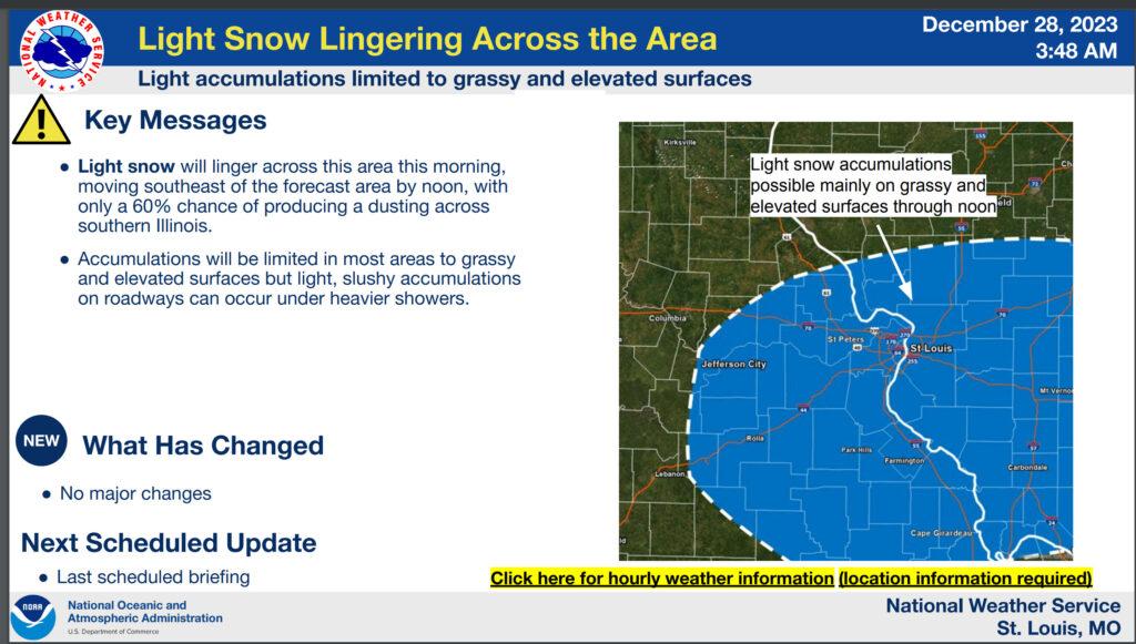
The St Louis, Missouri, NWS posted this graphic for their area (this does include portions of my forecast area)
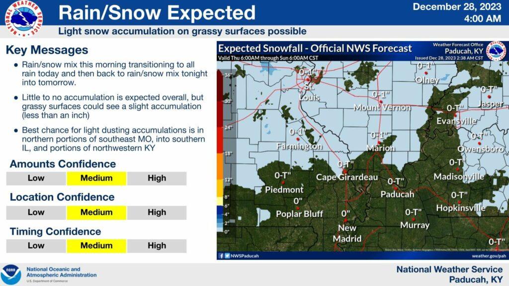
And the Paducah, Kentucky, NWS posted this graphic.
BEAU’S EXCLUSIVE LIVE WINTER LOCAL CITY-VIEW RADARS
Interactive local city-view radars. Clickable watches and warnings.
Click the winterize button on the local city-view radars to see precipitation type.
https://beaudodsonweather.com/weather-radars/
Backup radar site in case the above one is not working.
https://weathertalk.com/morani
Regional Radar
https://imagery.weathertalk.com/prx/RadarLoop.mp4
Today’s rain and snow shower activity will be fairly limited and mainly this morning. Don’t expect much.
Another round of rain and snow showers will arrive tonight and tomorrow. This one may have a bit more precipitation with it (coverage wise).
Rain totals of a trace to 0.25″ will be the going forecast. Heaviest totals over Illinois and northwest Kentucky.
I can’t rule out some light snow accumulation late tonight into Friday morning. Let’s keep an eye on temperatures. Snow accumulations of a trace to an inch will be possible.
The highest probability of that happening will be across southern Illinois and northwest Kentucky.
Remember, bridges and overpasses freeze before everything else. Elevated surfaces freeze first.
At this time, dry and cool conditions are anticipated Saturday into Tuesday.
I am watching a southern system Sunday night and Monday. If it were to push slightly farther north, then I would need to add rain and snow showers to the forecast (Sunday night/Monday). For now, I am watching trends.
Here is the NAM 3K future-cast radar. What radar might look like as we move through today into tomorrow. Green is rain. Blue is snow. Timestamp is Zulu. 12z=6 am. 18z=12 pm 00z=7 pm. 06z=12 am.
Want to receive more weather information? I provide a service through www.weathertalk.com
Subscribe at www.weathertalk.com and then download the Beau Dodson Weather app from the app stores!
Apple users: Beau Dodson Weather App
https://wtalk.co/9EZYG8A8
Android users: Beau Dodson Weather App
https://wtalk.co/ZEWYU8ME
Need help? Email me at beaudodson@usawx.com
* Daily weather forecasts
* My personal weather blog with all sorts of weather information!
* Special weather statements sent to the Beau Dodson Weather app.
* Rapid fire tornado alerts.
* Severe weather alerts and forecasts.
* Severe weather updates throughout the day (when severe weather is occurring)
* Ice storm alerts and forecasts.
* Winter storm alerts and forecasts.
* Winter storm updates throughout the event.
* Regional weather videos.
* Long range weather videos.
* A daily forecast that I hand type for your county. Sent out every afternoon.
* Long range outlooks. Including week one, two, three, four, and monthly outlooks. Seasonal outlooks.
* App messages to alert you when I have updated the weather blogs and Facebook.
* And more!
Here are some examples of what people receive when they subscribe to www.weathertalk.com