Posted by Meteorologist Beau Dodson
Want to receive more weather information? I provide a service through www.weathertalk.com
Subscribe at www.weathertalk.com and then download the Beau Dodson Weather app from the app stores!
Apple users: Beau Dodson Weather App
https://wtalk.co/9EZYG8A8
Android users: Beau Dodson Weather App
https://wtalk.co/ZEWYU8ME
Need help? Email me at beaudodson@usawx.com
The primary weather focus continues to be on the cold air and not the snow. I have been saying all week that there was a chance this system trends so far south and east that we miss out on accumulating snow.
That continues to be a possibility.
Confidence in the cold air is 100%. Confidence in the snow is lower.
With each passing day the guidance has trended farther and farther south with the accumulating snow.
Typically, an accurate snow forecast isn’t made until 24 to 48 hours in advance. We will be within 48 hours tonight (Friday night). Thus, I will know more tonight and tomorrow.
Models are all over the place with snow potential. Sometimes models lose the snow in the day 3 to 5 range. We are within that range and some models have lost the snow. Showing no snow locally.
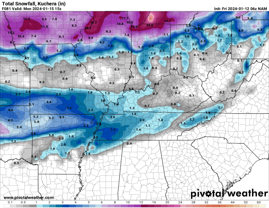
The NAM is the first high resolution model to pull within range of the system. But, we are still more than 48 hours out.
Here is what it is showing for snow totals Sunday night into Monday. Take this with a grain of salt. Other models show no snow. Some show double this amount!
I am also watching Thursday for additional snow chances.
The bottom line is we don’t know, yet. Monitor updates.
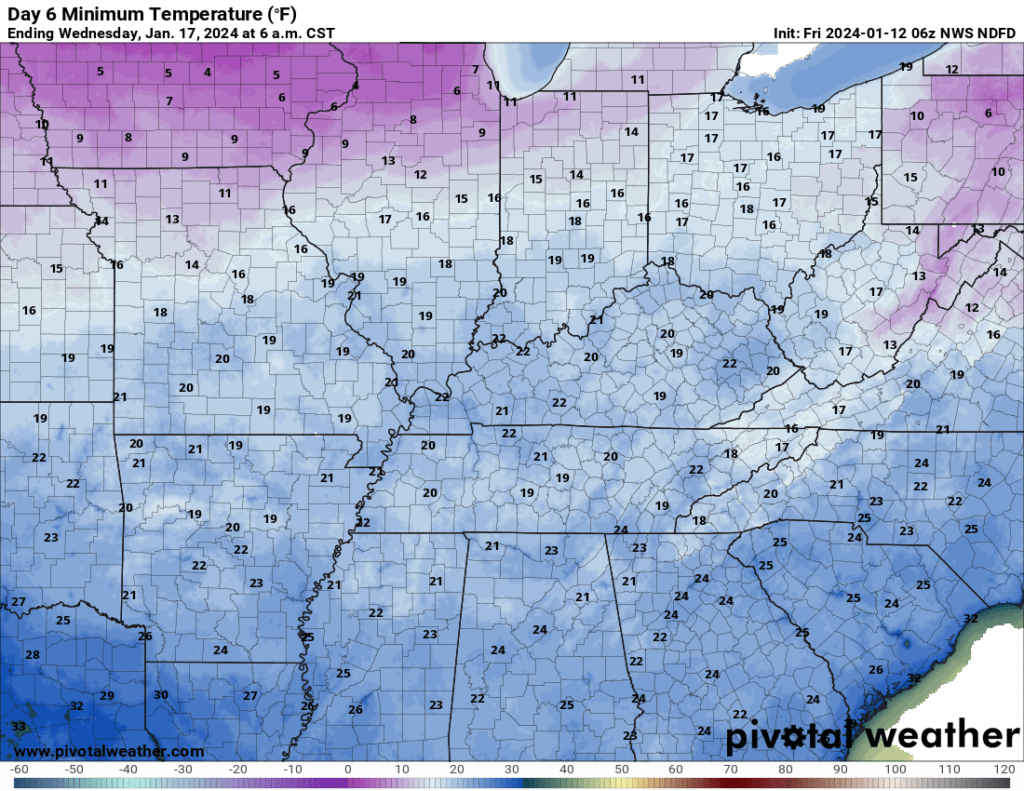
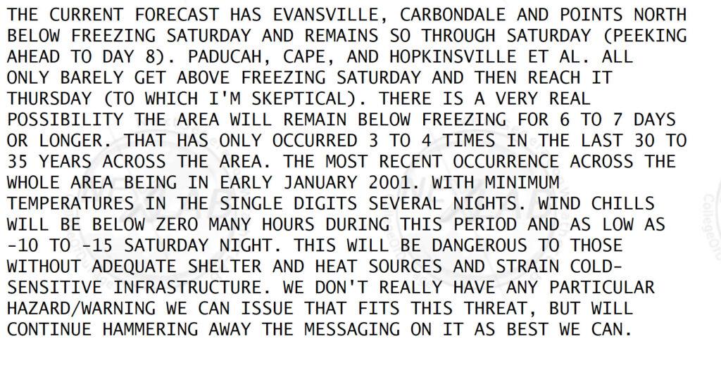
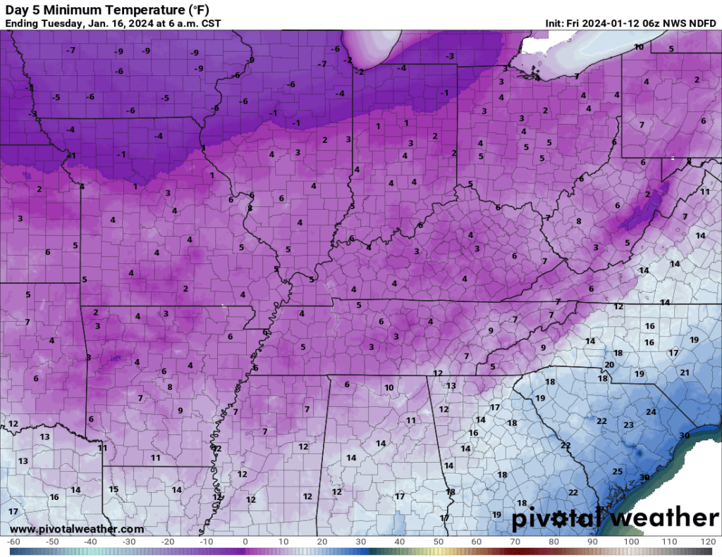
What is certain is the bitterly cold air. The Paducah, Kentucky, National Weather Service spoke to just how unusual this cold snap is going to be. Here is what they said.
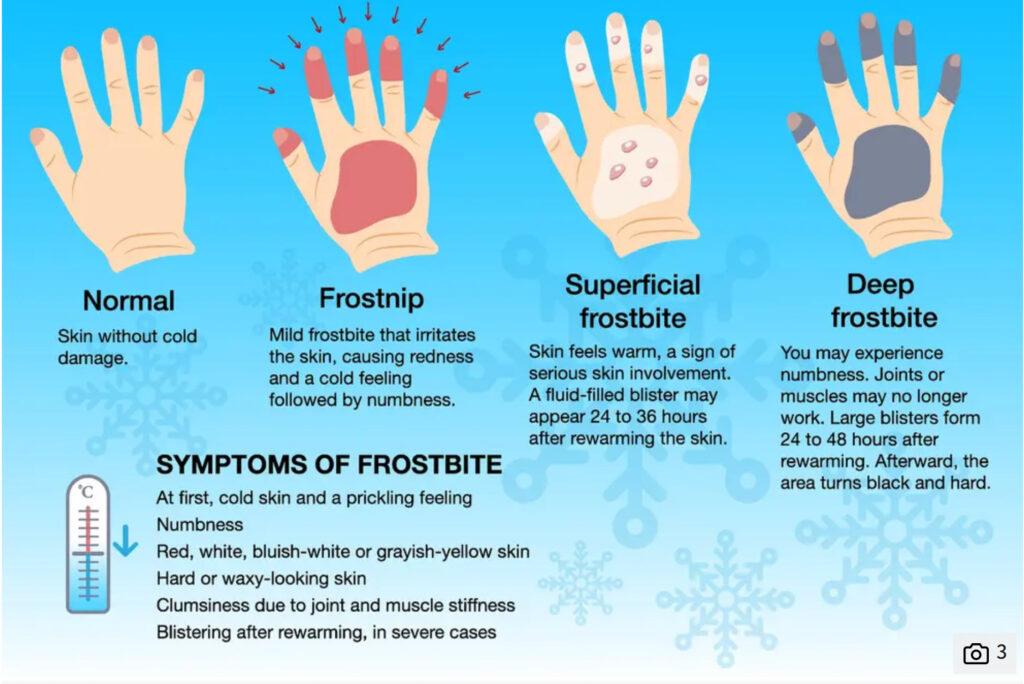
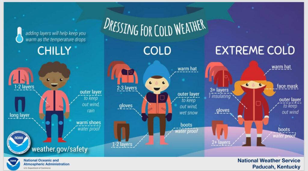
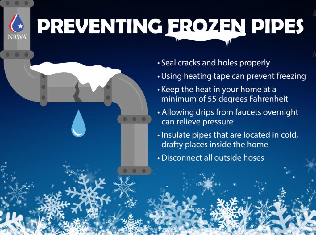
I have posted quite a bit of safety information over the past few days. Let’s stay safe during this cold blast. Check on the elderly. Use care with kids outside. Frost bite is a real concern.

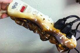
Avoid using extension cords with space heaters. This can lead to house fires.
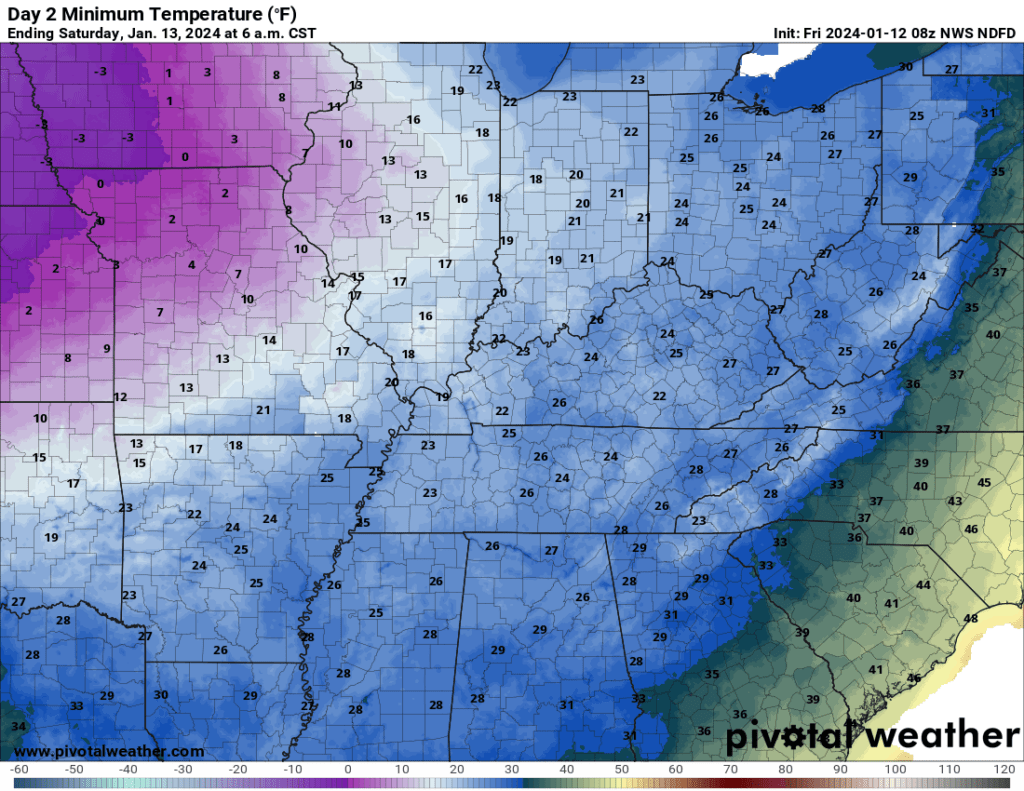
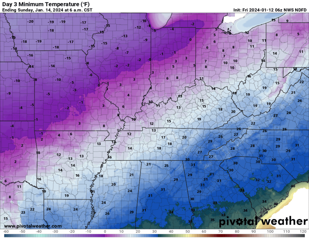
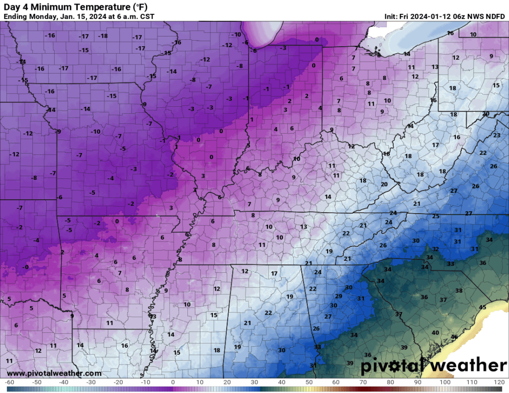
The coldest nights will be Saturday through Tuesday night.
Saturday morning lows
Sunday morning lows
Monday morning lows
Tuesday morning lows
Wednesday morning lows