Posted by Meteorologist Beau Dodson
Want to receive more weather information? I provide a service through www.weathertalk.com
Subscribe at www.weathertalk.com and then download the Beau Dodson Weather app from the app stores!
Apple users: Beau Dodson Weather App
https://wtalk.co/9EZYG8A8
Android users: Beau Dodson Weather App
https://wtalk.co/ZEWYU8ME
Need help? Email me at beaudodson@usawx.com
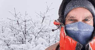
I hope everyone prepared for the cold weather. It has arrived.
I sent out the subscriber weather blog, to the Beau Dodson Weather app, earlier this morning.
I have posted updates over on the Beau Dodson Weather Facebook page, as well.
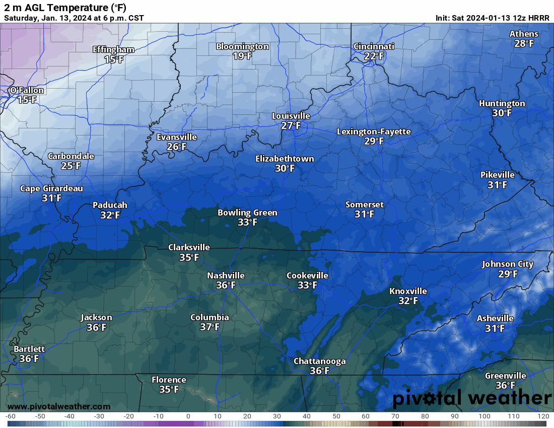
Before I forget, I wanted to mention that I do have snow showers and snow flurries in the forecast today and tonight.
Arctic air is efficient in squeezing moisture out of the atmosphere.
A dusting to an inch or so of snow can’t be ruled out along the front later today and tonight. This could lead to slick spots.
I know there are a lot of moving parts to the overall forecast, but I wanted to mention that.
No promises on accumulation later today and tonight. It is something that I am watching.
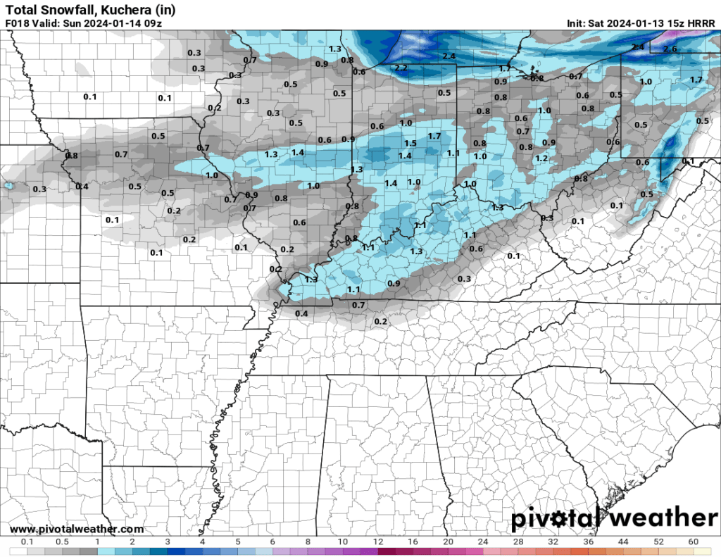
The Hrrr model does pick up on that general idea. Again, just a model. This graphic is just for today and tonight.
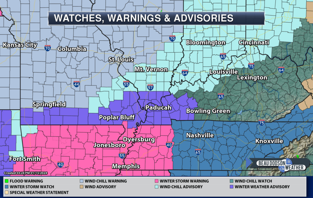
Here are the latest winter weather advisories. Click here for an updated map.
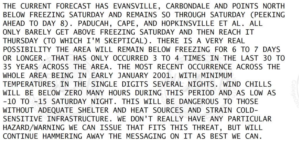
It is winter. It is cold. Why is this such a big deal?
The long duration of this cold event is unusual. This is why it will be so damaging, for some. This will be an $expensive$ weather event for a large chunk of the nation.
Over the last 35 years this has only happened a handful of times.
Here are some comments from the National Weather Service. I posted this the other day, as well.
Bitterly cold arctic air continues to filter into the United States from Canada.
Just look at these insane temperatures. These are not wind chill values. These are actual air temperatures. Brrr. Double brrrrrr.
Yes, those are some -50 readings north of the border. Needless to say, this is dangerous weather for those who must be outside.
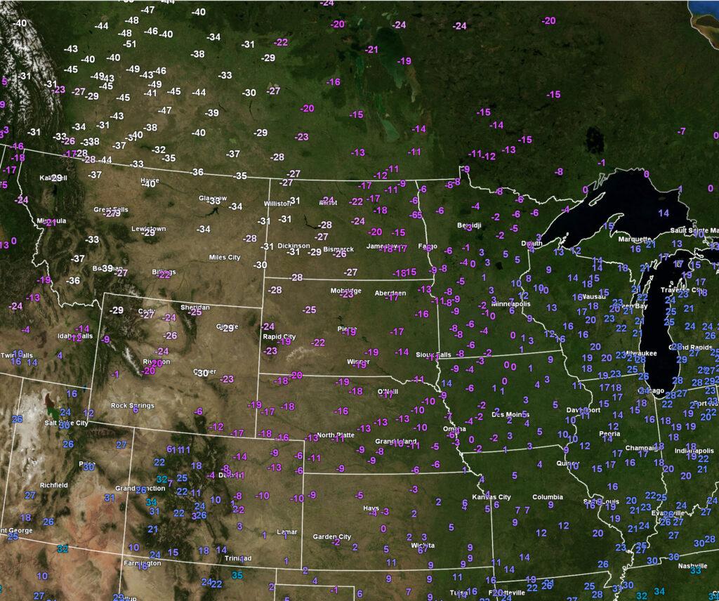
The cold air will continue to filter into our region today and tonight. The arctic front is knocking on our door.
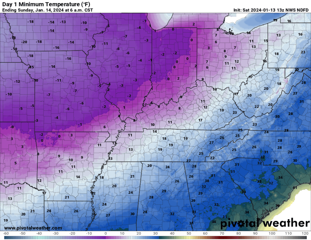
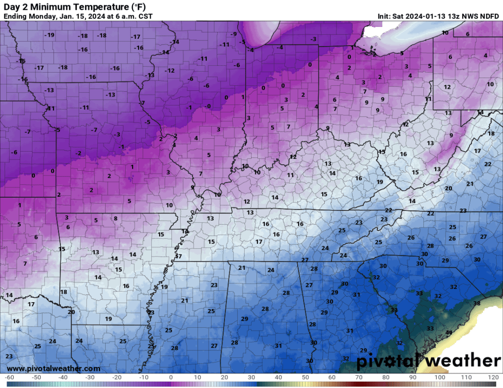
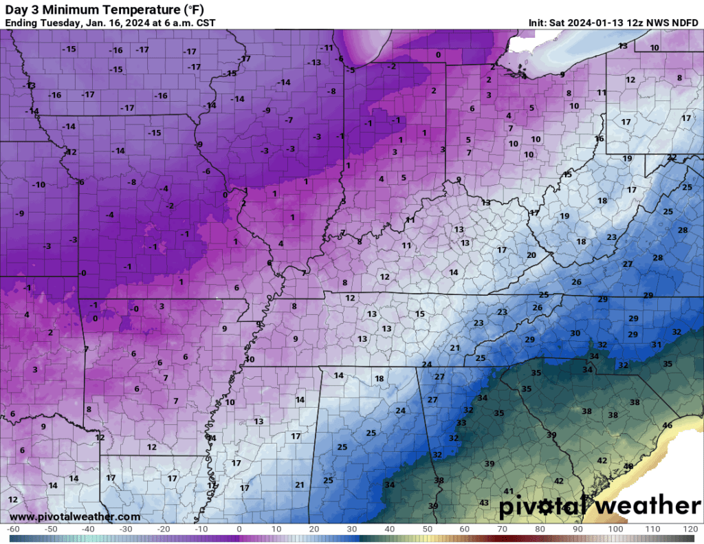
Let’s look at the 24-hour temperature animation. You get the general idea. Cold cold cold.
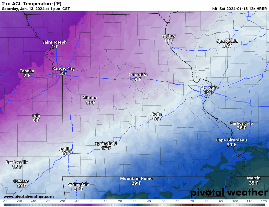
Check out these low temperature numbers.
If we have a snowpack, then these numbers could be even lower.
Tonight
Sunday night
Monday night
Tuesday night
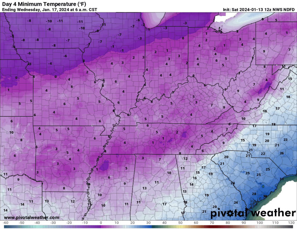
Wind chill values will be even colder. Ranging from -5 to -20 degrees.
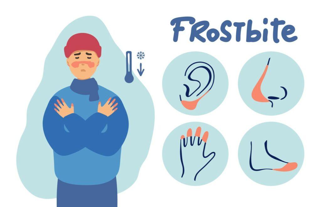
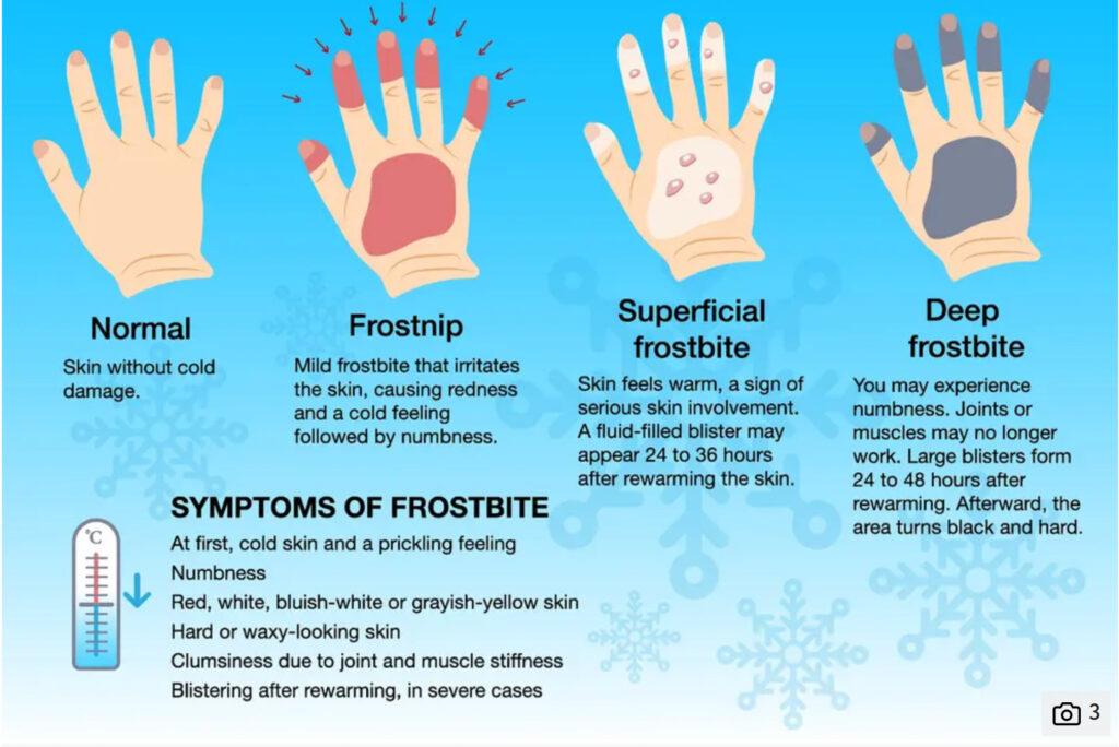
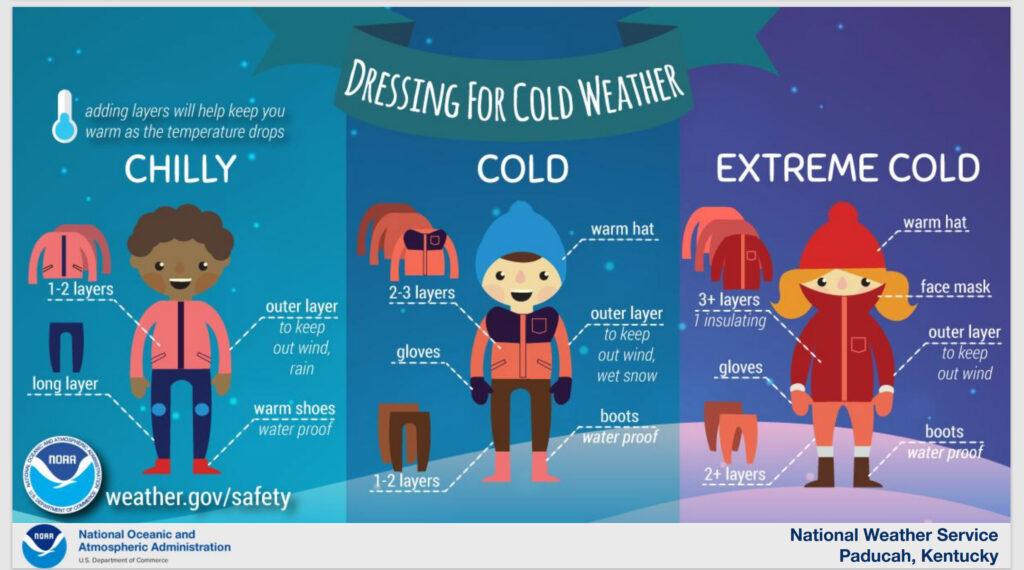
If we have snow, then the kids may want to play outside. You are going to want to keep their exposed skin covered. Common sense winter clothing.
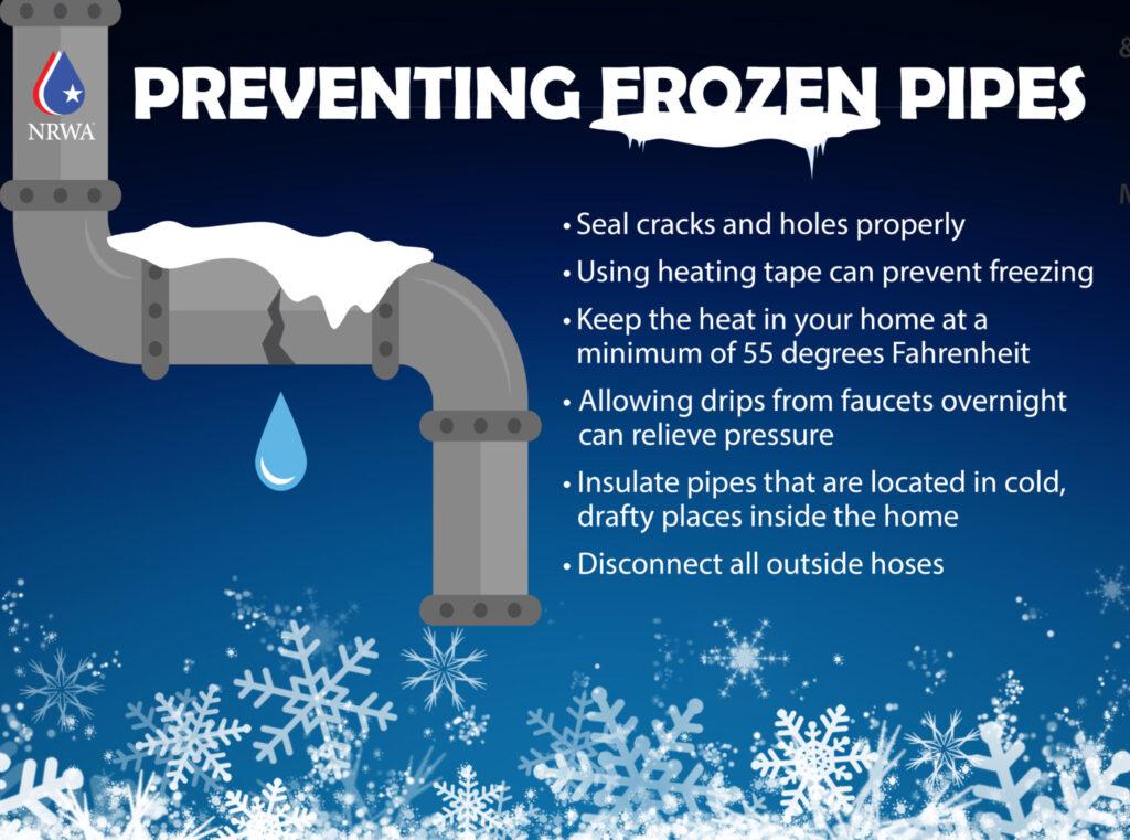
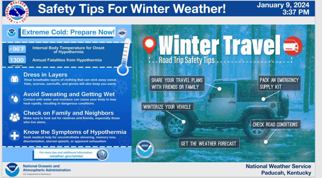
Frozen pipes continue to be a big concern. We have been talking about that over the last few days.
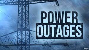
I can’t rule out some power grid issues, as well. Some rolling blackouts are a possibility. Same as 2022.
There were already some power outages last night and earlier this morning. I suspect because of the high winds.
Make sure you have protected your water pipes. If you need some helpful tips, then Google it. There is plenty of information online.
The next big question is snow!
As always, the snow portion of the forecast is more difficult than the temperature forecast. It seems our region is always on the edge of these systems.
I am forecasting a general one to three inches of snow. This will lead to icy roadways. The cold temperatures will make it dangerous to be out on the roadways. For you and first responders.
Snow totals will vary. They always do. Even within one county you can have a wide range of totals.
Focus on impacts and not totals. The impact will be icy roadways.
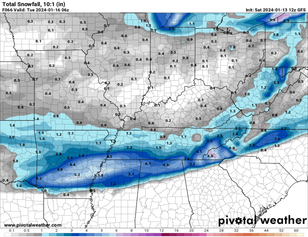
Models are basically useless with this event. They have been all over the place during the past week.
Let me show you some examples.
Here is the GFS snowfall forecast. That is one model.
And here is the NAM model
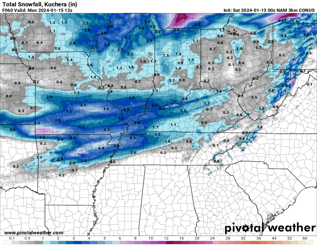
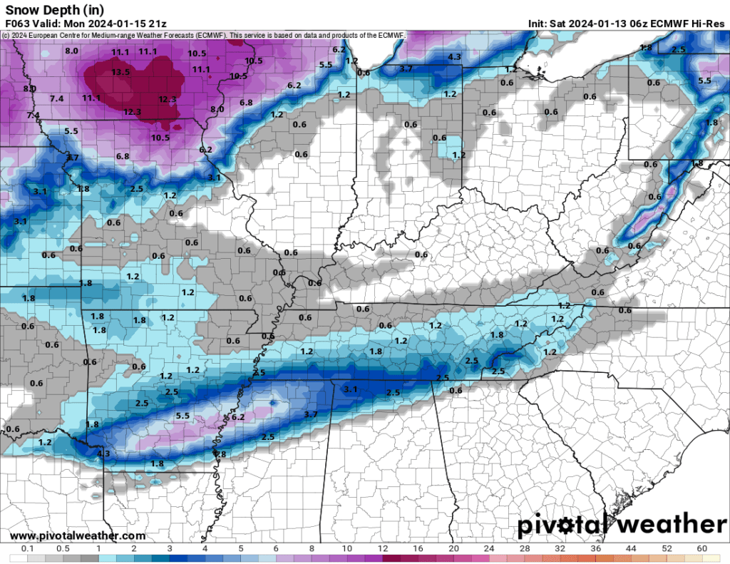
Here is the EC model. It is way way south with the snow! So far south that it misses us.
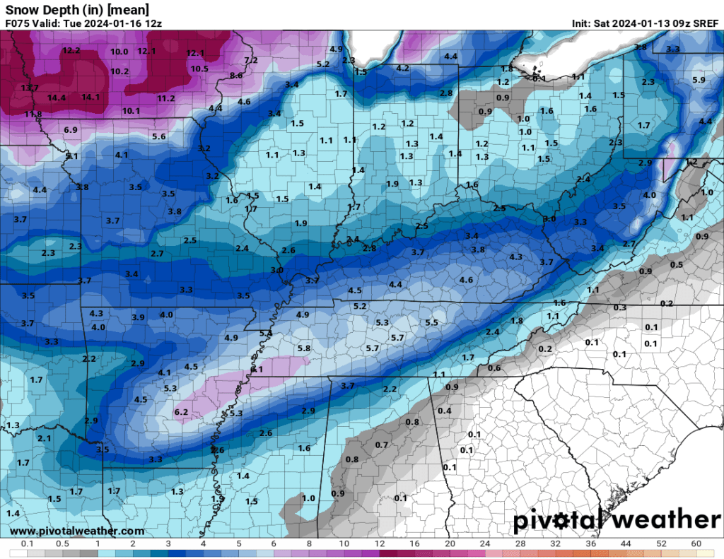
And then there is the SREF model. Model mania! And you wonder why meteorologists are stressed when forecasting winter weather!
Got to love weather models! This is one reason I tell you to ignore maps that people post when it comes to snow totals. They just aren’t accurate.
They are a tool and to be used for guidance.
For planning purposes (area-wide) let’s plan on one to three inches of snow. If the system trends farther north, then increase that by an inch or two.
With that said, I have been forecasting the highest chance of accumulating snow (the higher totals) to be from northern and central Arkansas into the Missouri Bootheel and then east along the Kentucky/Tennessee border southward.
Other forecasts, that I have viewed online, have come around to the same general idea.
For the past five days that has been my forecast and that remains my forecast.
I can’t rule out totals exceeding three inches across our southern counties. What does fall from the sky will stick. It will obviously be plenty cold.
This will be a dry fluffy snow.
Could the snow not materialize? I think that is unlikely. The only question is how much and how far north. Let’s see how it goes. There are always surprises in these events.
These are the Saturday morning graphics, and they are certainly subject to change as we draw closer to the event.
The snow arrives Sunday afternoon and night. Snow showers will continue into at least Monday afternoon and perhaps even into Tuesday.
Another shot at snow next Thursday into Friday. Another shot of cold air next weekend! Ack!
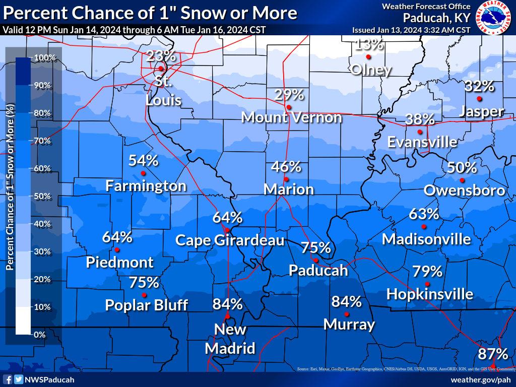
What is the chance of one inch or more of snow?
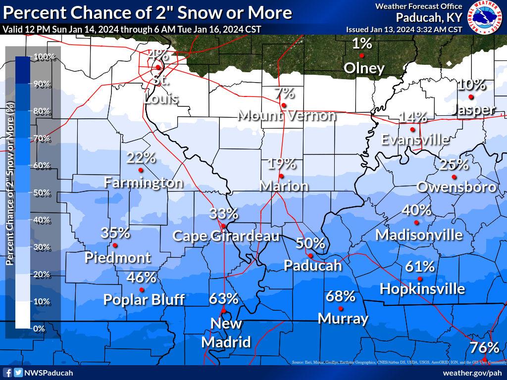
What is the chance of two or more inches of snow?
Okay, everyone! Let’s stay warm. Stay safe. This too shall pass.
Want to receive more weather information? I provide a service through www.weathertalk.com
Subscribe at www.weathertalk.com and then download the Beau Dodson Weather app from the app stores!
Apple users: Beau Dodson Weather App
https://wtalk.co/9EZYG8A8
Android users: Beau Dodson Weather App
https://wtalk.co/ZEWYU8ME
Need help? Email me at beaudodson@usawx.com
* Daily weather forecasts
* My personal weather blog with all sorts of weather information!
* Special weather statements sent to the Beau Dodson Weather app.
* Rapid fire tornado alerts.
* Severe weather alerts and forecasts.
* Severe weather updates throughout the day (when severe weather is occurring)
* Ice storm alerts and forecasts.
* Winter storm alerts and forecasts.
* Winter storm updates throughout the event.
* Regional weather videos.
* Long range weather videos.
* A daily forecast that I hand type for your county. Sent out every afternoon.
* Long range outlooks. Including week one, two, three, four, and monthly outlooks. Seasonal outlooks.
* App messages to alert you when I have updated the weather blogs and Facebook.
* And more!
Here are some examples of what people receive when they subscribe to www.weathertalk.com