Posted by Meteorologist Beau Dodson
Want to receive more weather information? I provide a service through www.weathertalk.com
Subscribe at www.weathertalk.com and then download the Beau Dodson Weather app from the app stores!
Click the winterize button on the local city view radars to see precipitation type.
Interactive local city-view radars. Clickable watches and warnings.
https://beaudodsonweather.com/weather-radars/
I have Facebook Q&A threads ongoing. Here is the link to my weather page. CLICK HERE.
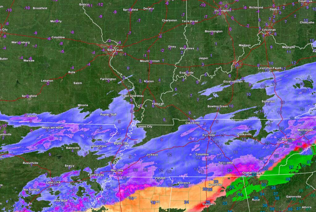
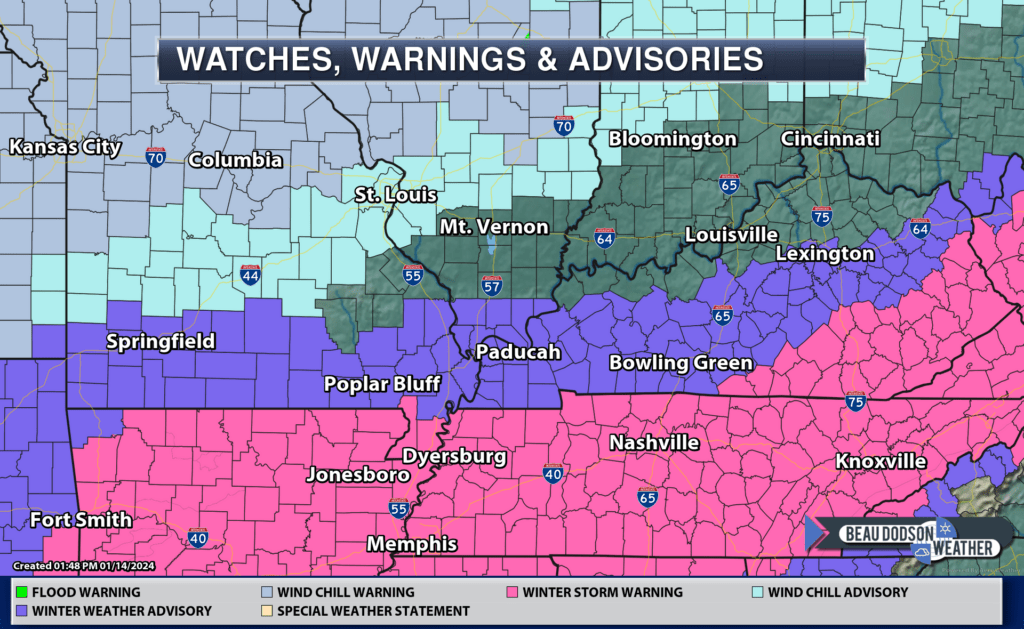
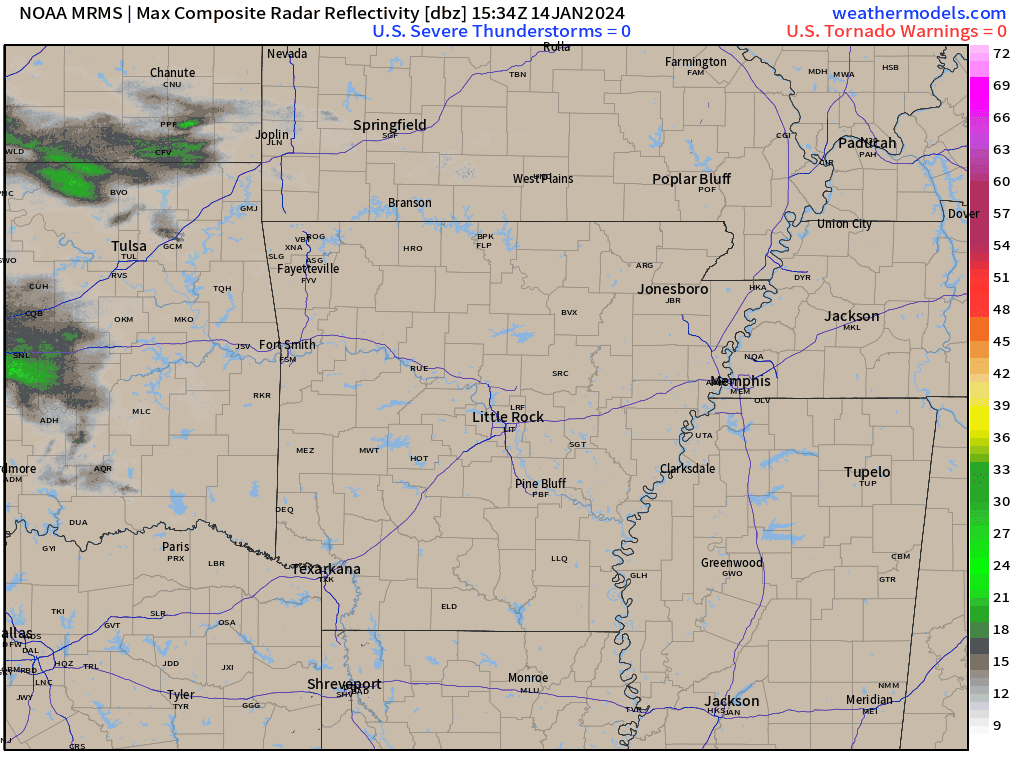
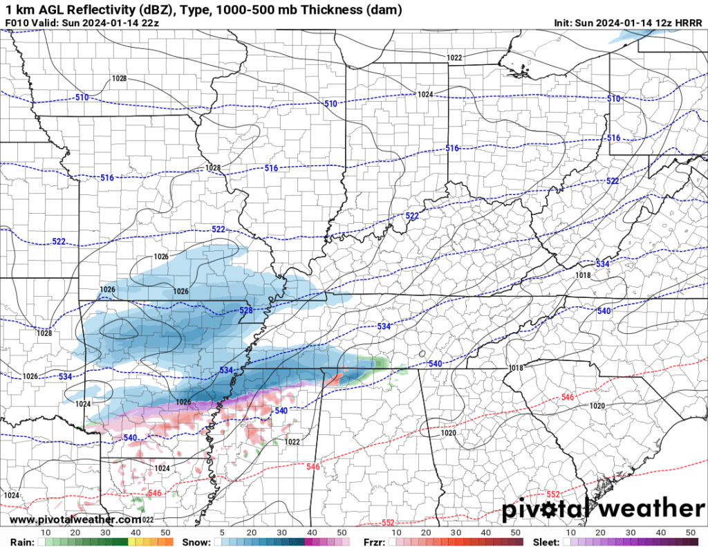
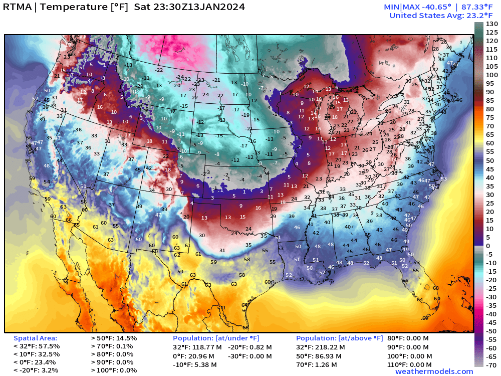
4 PM Monday
Snow showers will exit the area as we move through the overnight hours. Any additional accumulation will be light.
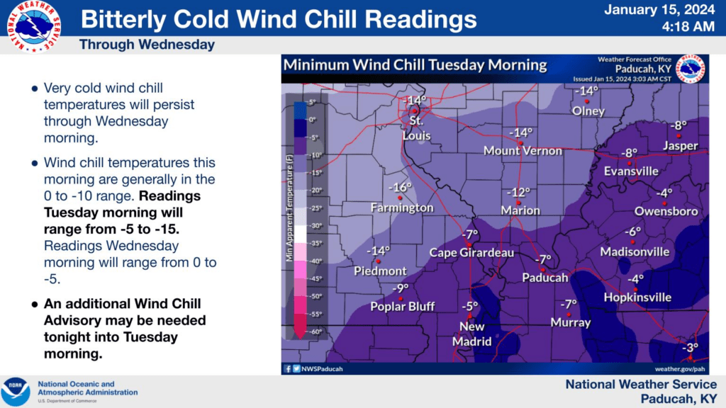
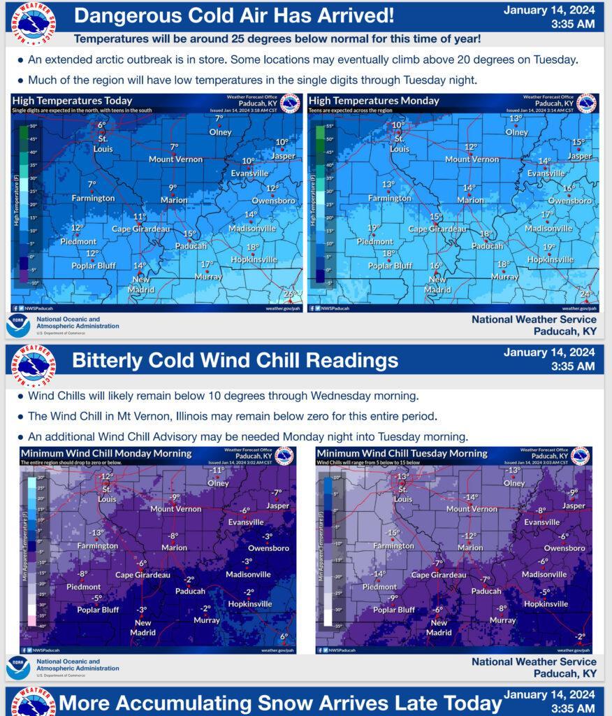
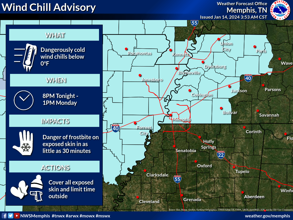
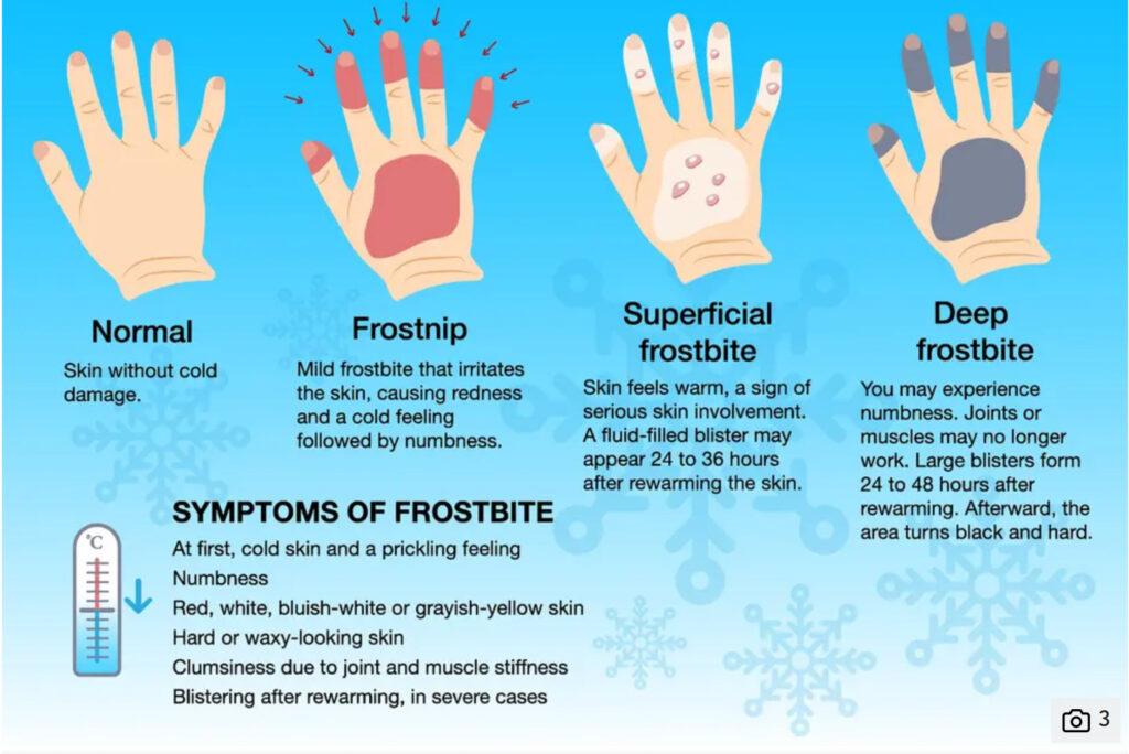
Bitterly cold wind chill values tonight. Dangerous cold, again. Pipe busting cold will linger into the weekend.
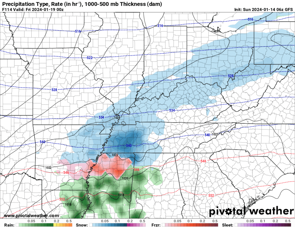
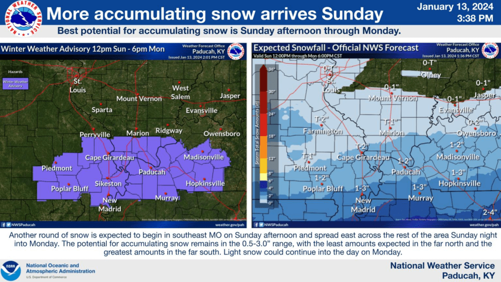
Additional snow and a wintry mix return to the forecast Thursday into Thursday night. It is still too soon to talk totals.
9:45 AM Monday
Snow continues to move northeast.
8 AM Monday
Light snow is moving northeast into the area. Another trace to one inch possible from this round.
7 AM Monday
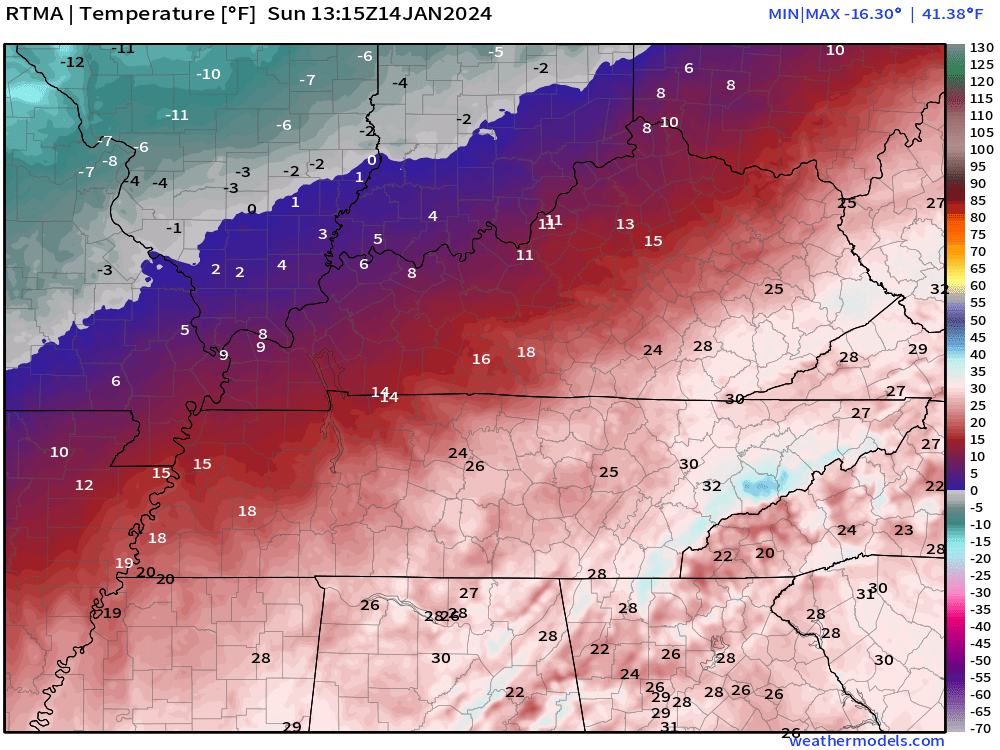
Four degrees here at The Weather Observatory in Massac County, Illinois. Brrr. Tundra.

5 AM Monday
Wind chill values today into tomorrow will be frigid. Bundle up.
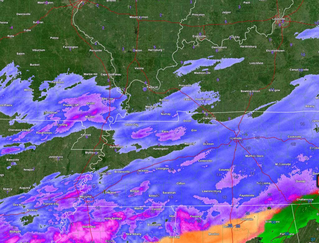
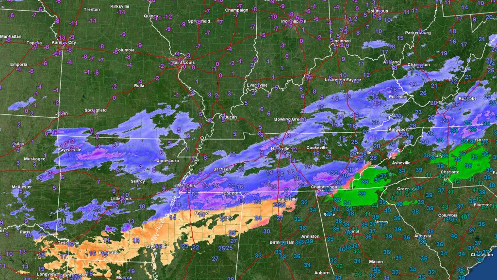
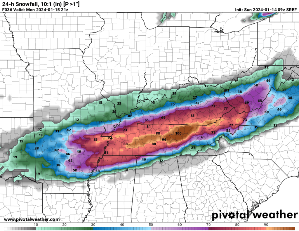
The bulk of our snow has pushed off to the east. A widespread 0.00″ to 2.00″ of snow fell across the region. Isolated 2″ to 3″ totals were reported. About what was expected. A light but impactful snow event.
Some snow showers are possible today. Accumulation of 0.00″ to 0.50″ will be possible. If a persistent band develops, then perhaps up to an inch of snow. Flurries are possible into tonight.
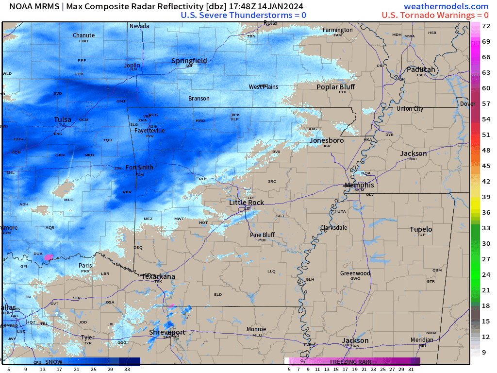
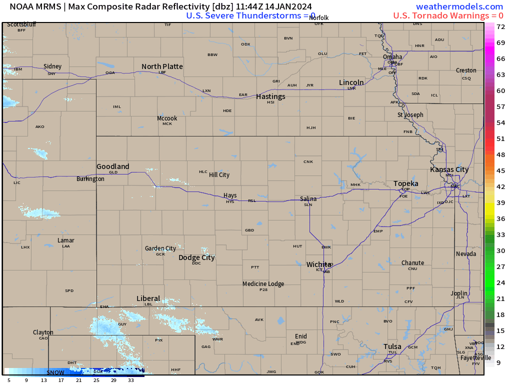
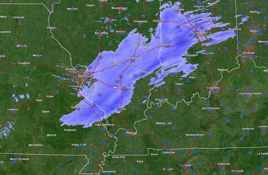
Radar, at 5 AM showed snow showers over Missouri and Arkansas. This is moving east. It is light.
Data shows snow showers over our northern counties today and tonight, as well. Again, a dusting to 0.5″ possible. What falls will stick. It only took a dusting of snow last night to cause slick roadways.
I am monitoring Thursday for snow showers. Accumulation, at this time, appears to be light.
6:30 PM Sunday
No major adjustments to the going forecast from the past six days.
The system is about 15 miles farther north in southern Illinois that I had forecast. I will be off by 1/2 to 1″ of snow in those areas.
The system is about one county farther north in northwest Kentucky than expected. So, they will have a bit more snow than I had in the forecast.
Otherwise, the forecast is on track. The system is behaving as anticipated.
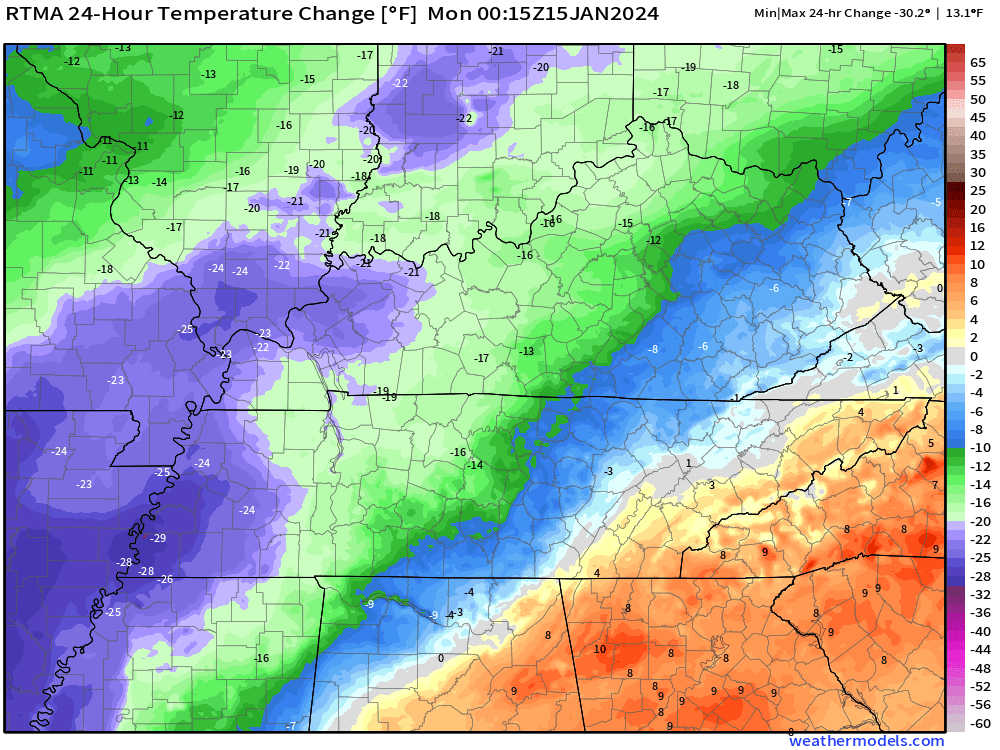
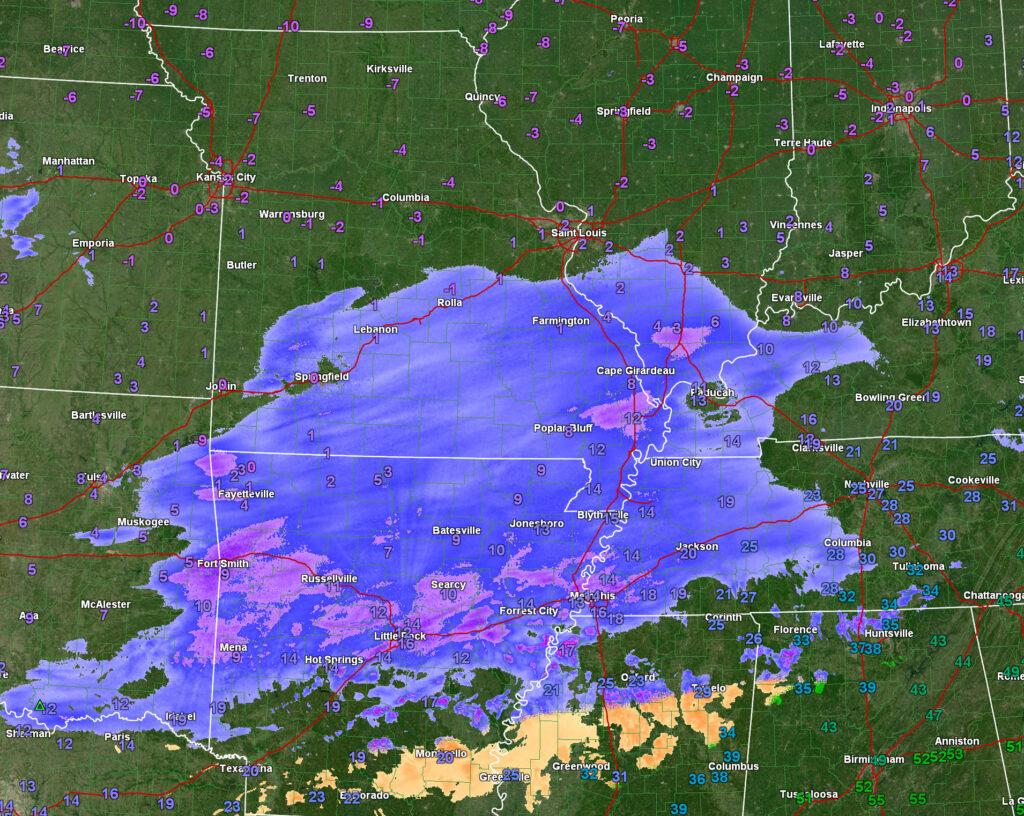
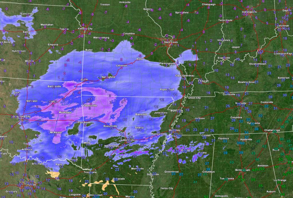
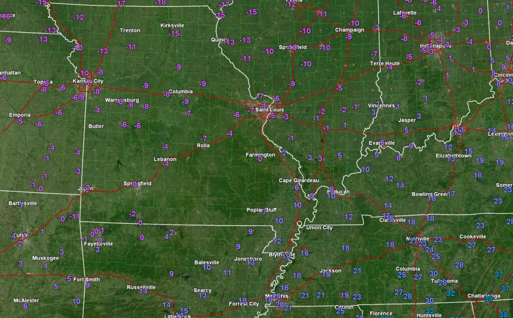
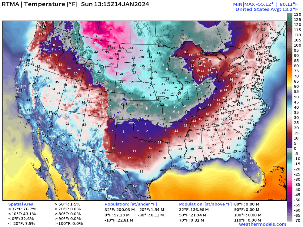
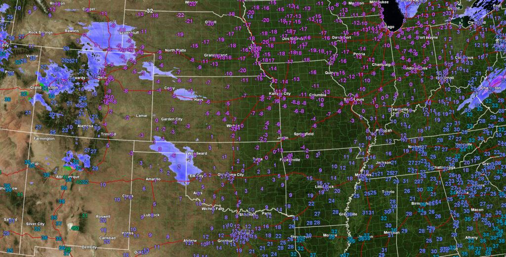
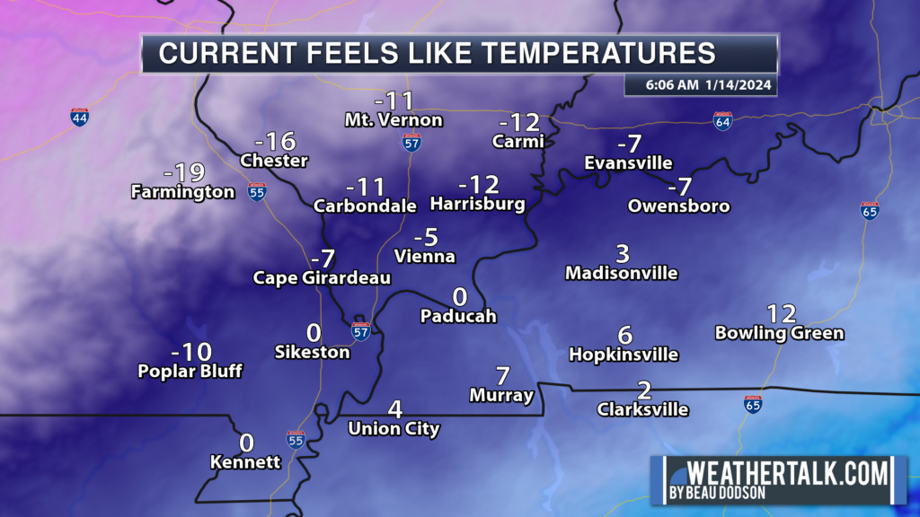
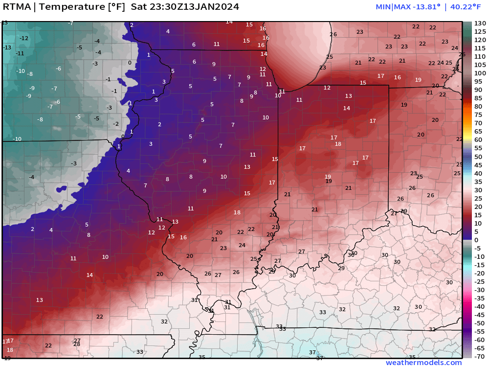
Check out the current temperatures. Brrr.
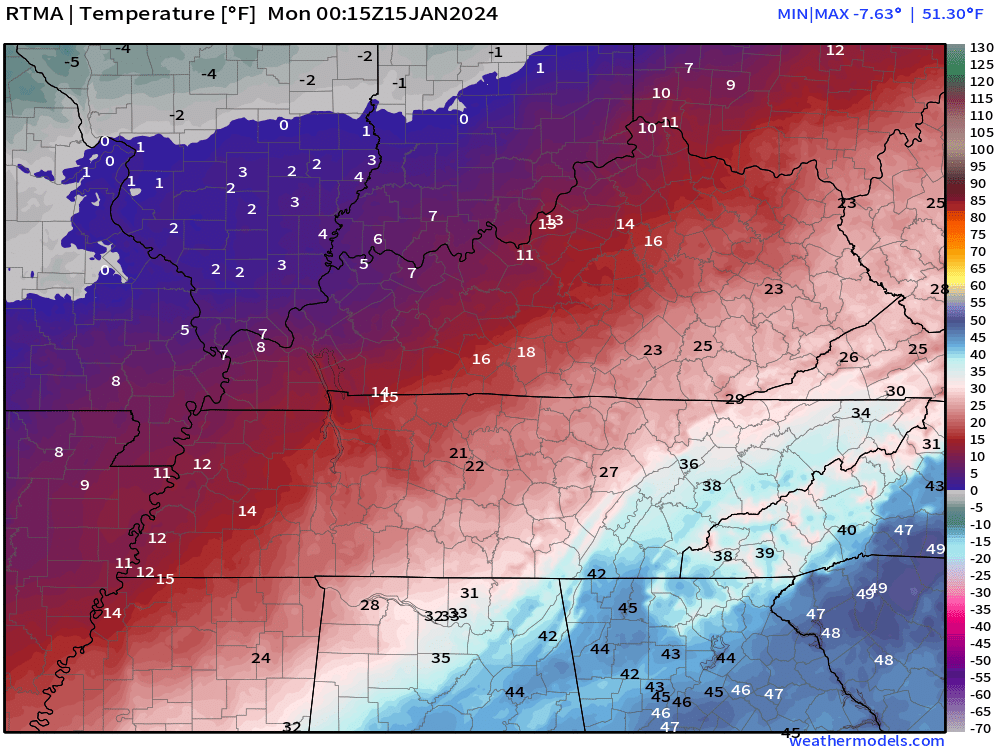
24 hour temperature change
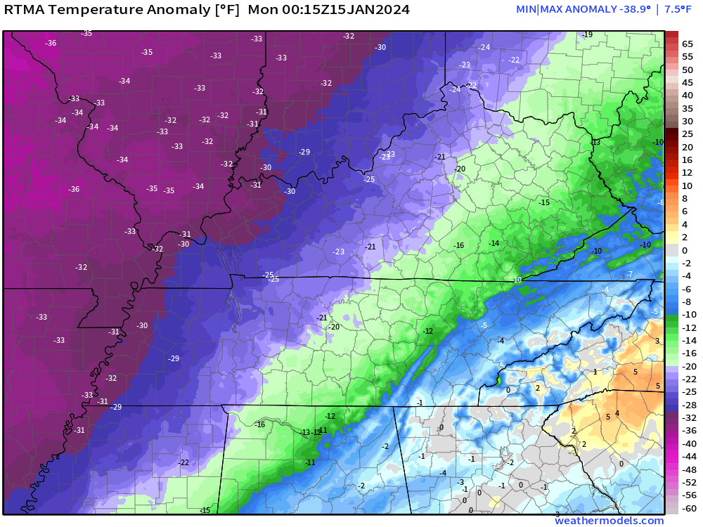
Temperature anomaly. How many degrees below average are temps? Well below average!
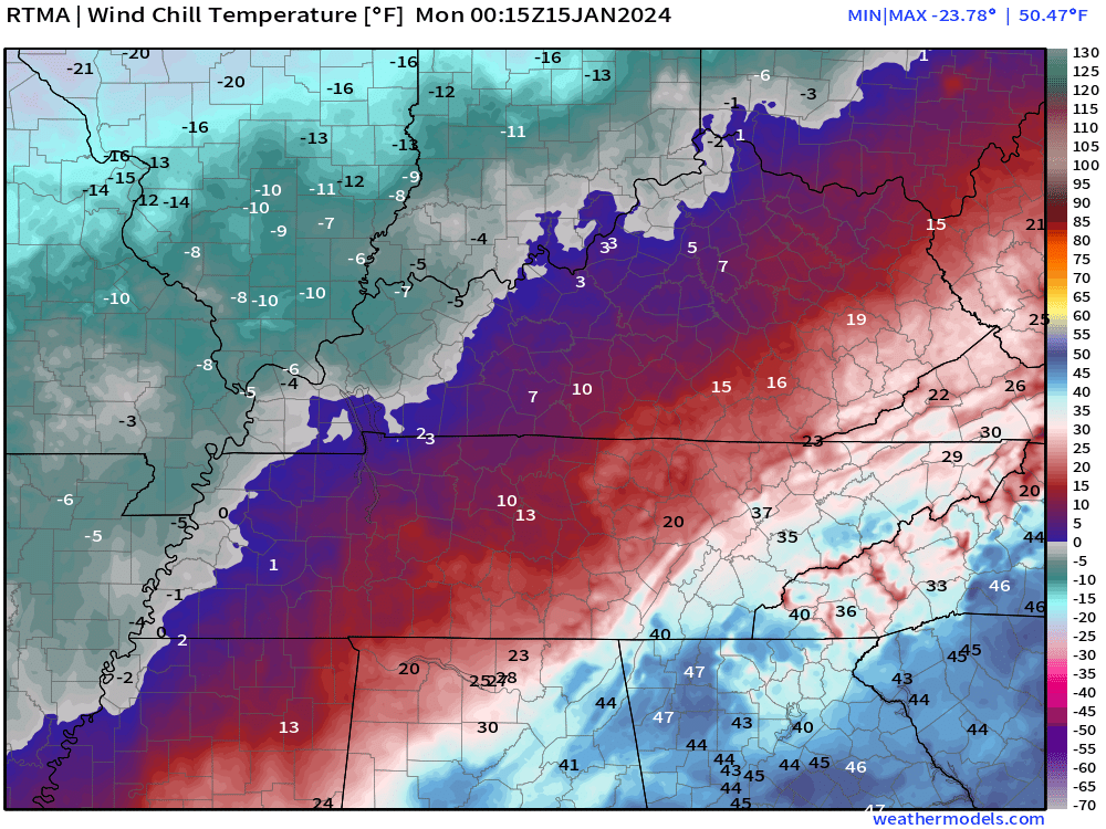
Current wind chill values.
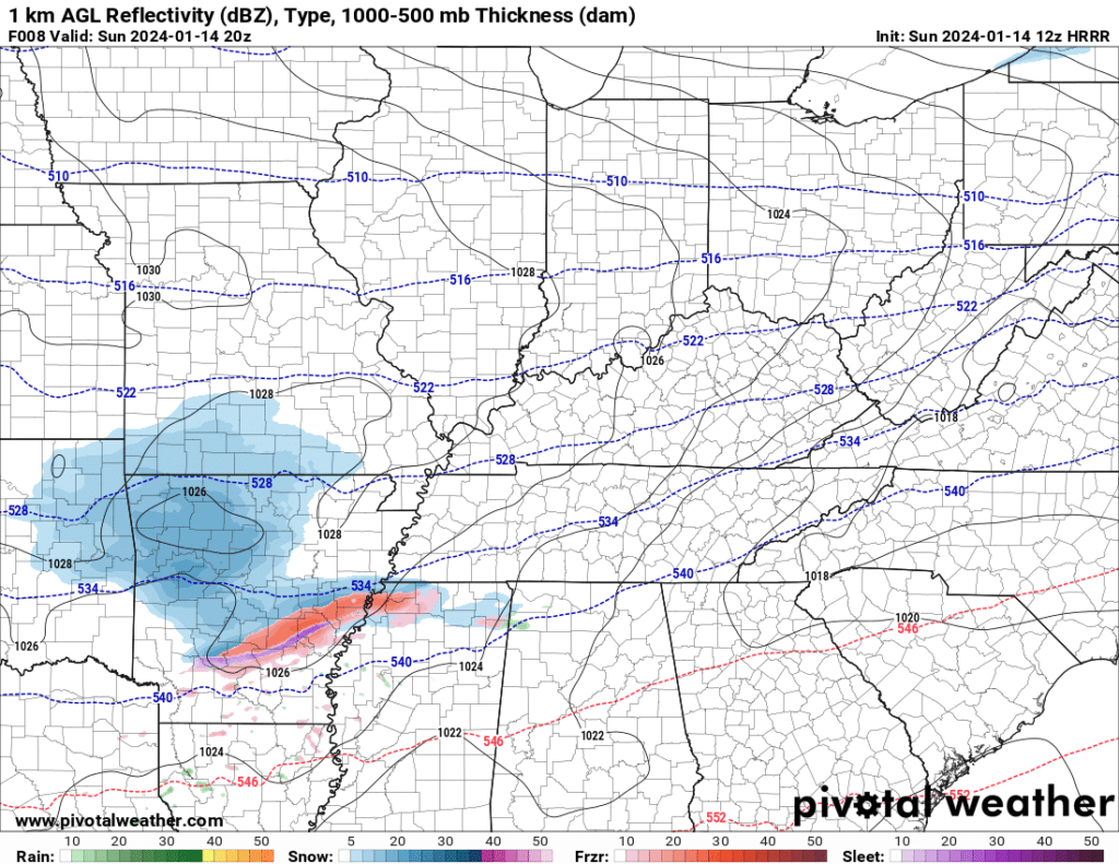
Snow will continue into the night. Overall, this is a light snow event for the region. Use care on the snow-covered roadways.
Bitterly cold temperatures tonight. Some locations will go below zero. Wind chill values into Tuesday night will continue to be very cold. At times, well below zero.
4:15 PM Sunday
Massac County, Illinois.
3:50 PM Sunday
Numerous reports of snow across the area. Already reports of slick roads in southeast Missouri. It won’t take long for other areas to have issues.
Snow will continue to spread eastward over the coming hours.
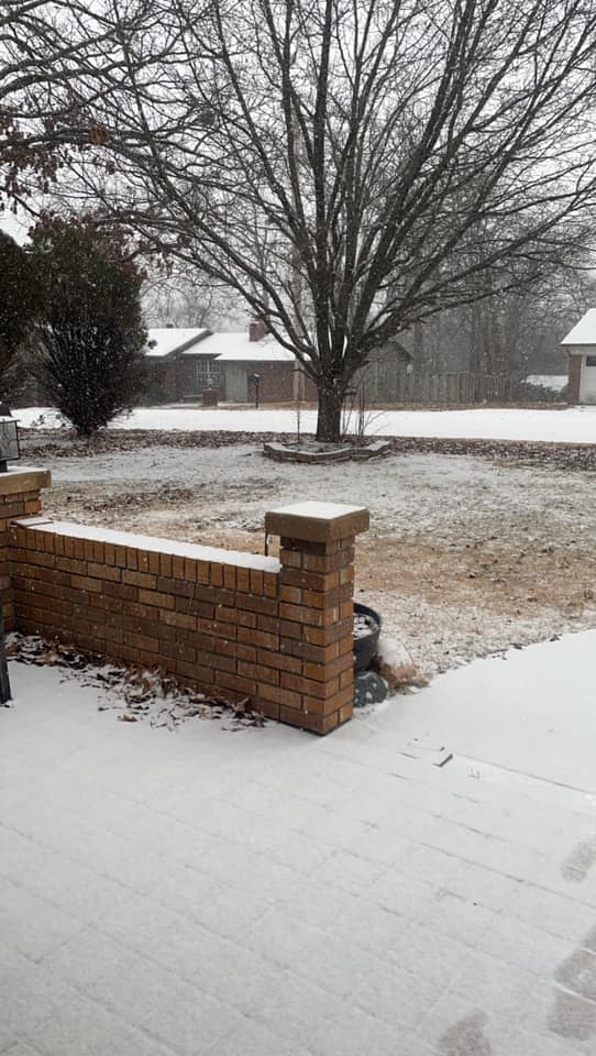
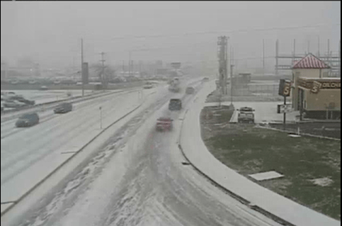
Angie Hefner sent in this photo from Poplar Bluff, Missouri.
2 PM Sunday
A couple of counties were added to the winter weather advisory (in west KY). Otherwise, no changes.
1:15 PM Sunday
Snow continues to expand and move eastward towards the area. There is a small layer of dry air aloft that is causing some of this to be virga.
Virga is precipitation that is falling but doesn’t reach the ground because it evaporates. That is normal. Usually, the leading and northern end is virga.
No changes to the going forecast.
12:25 PM Sunday
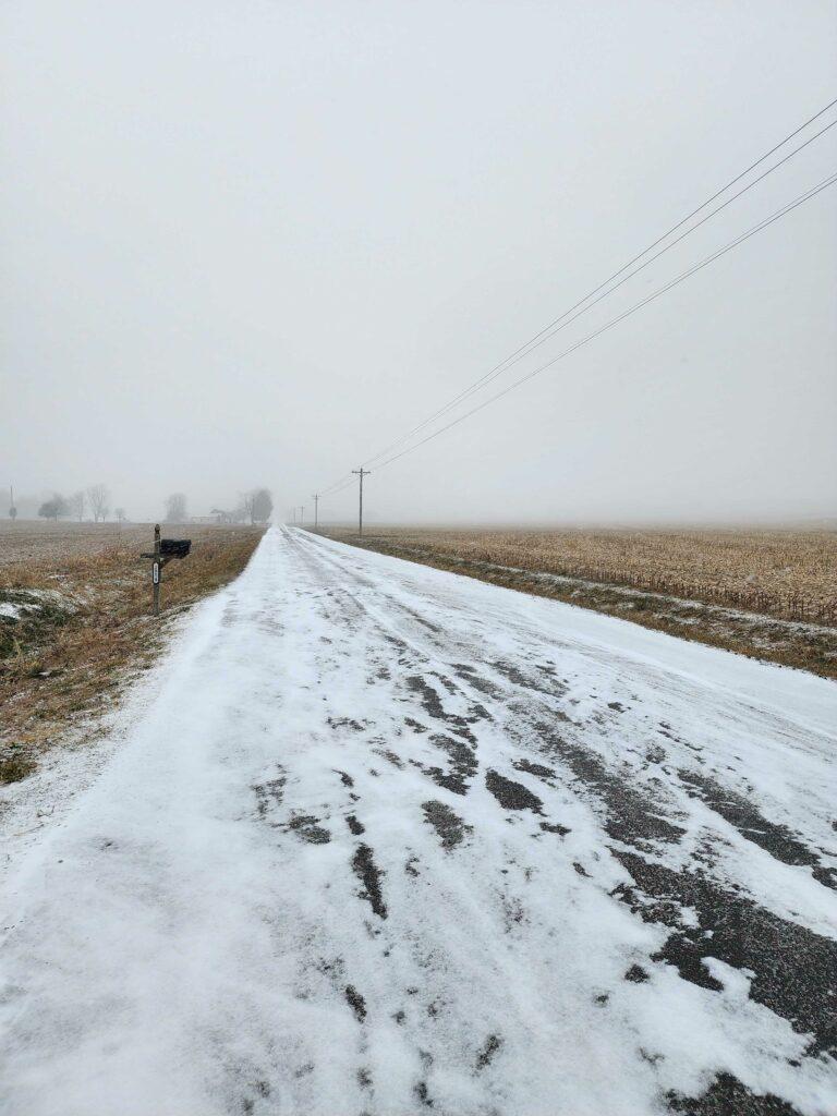
Joplin, Missouri. Just a little snow, but it is sticking.
11:02 AM Sunday
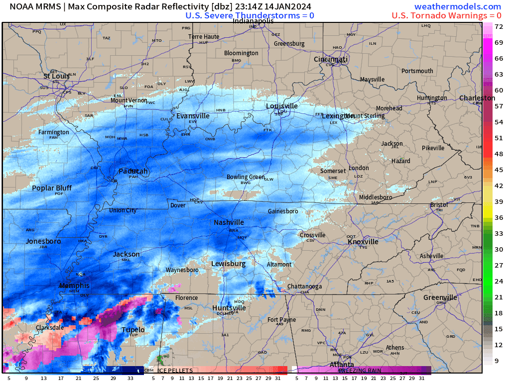
Latest radar.
11 AM Sunday
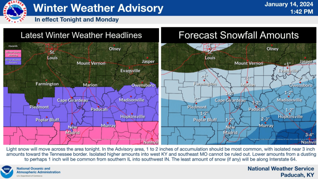
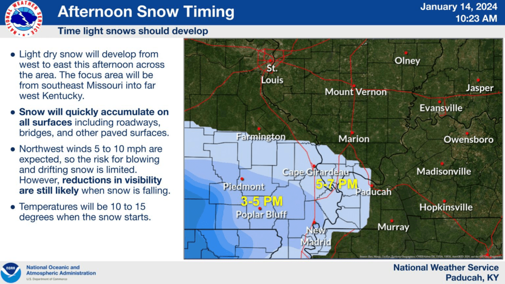
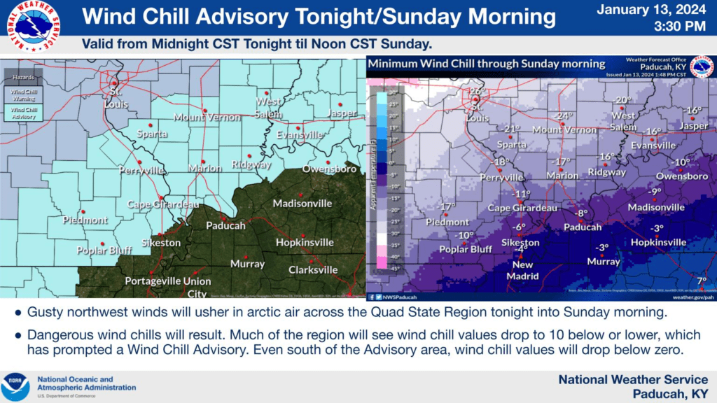
Sometimes these events move in a little faster. Here is a new graphic from the Paducah, KY NWS.
9:00 AM Sunday
9 AM temperatures. Brrr. Wind chill values are lower.
I am watching another system Thursday and Thursday night. A bit early to know if it will bring accumulating snow to the area. That would prolong our cold snap.
The GFS model shows some precipitation in our region Thursday. Other models show the chance, as well.
8:55 AM Sunday
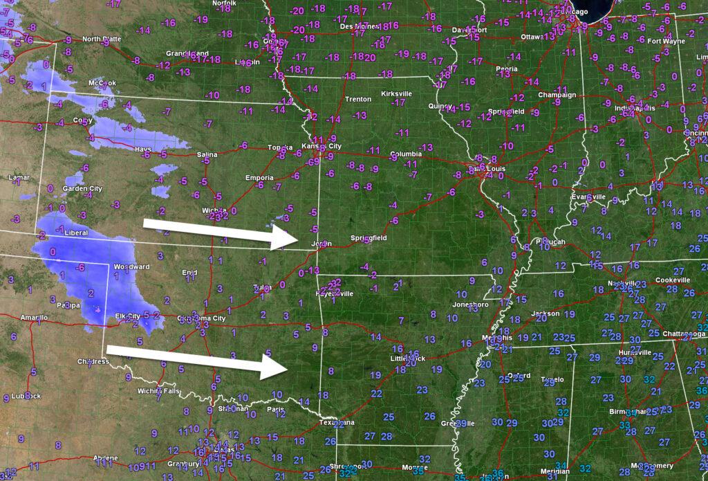
NWS Springfield, Missouri radar. Yellow zone is southwest Missouri. That is the snow developing in Kansas and Oklahoma.
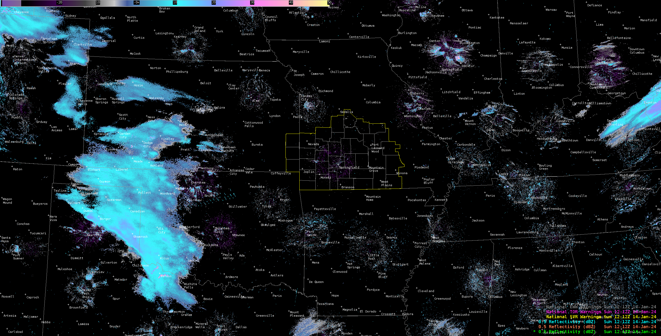
Light snow will push into southeast Missouri by early to midafternoon. It will then move eastward.
There will be a fairly sharp cutoff to the north where little or no snow will occur.
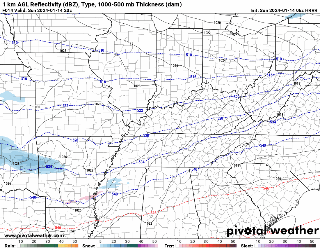
Future-cast radar. 2 PM radar. What radar might look like.
4 PM future-cast radar. What radar might look like.
Want to receive more weather information? I provide a service through www.weathertalk.com
Subscribe at www.weathertalk.com and then download the Beau Dodson Weather app from the app stores!
Apple users: Beau Dodson Weather App
https://wtalk.co/9EZYG8A8
Android users: Beau Dodson Weather App
https://wtalk.co/ZEWYU8ME
Some new data rolling in.
The latest SREF model. What is the probability of one inch or more of snow? Notice the sharp cutoff to the north.
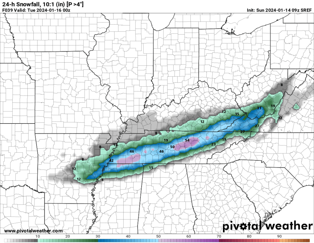
What is the probability of four inches or more of snow?
Snow continues to expand over Kansas and Oklahoma. This is the system that will bring some snow to our region.
7:30 AM Sunday
Snow is expanding across Oklahoma and Kansas. It is moving east southeast.
Brrr. Temperatures continue to fall. It is now four degrees here at my location in Massac County, Illinois.
6:25 AM Sunday
Good morning, and welcome to the North Pole! It is six degrees here at the Weather Observatory in Massac County, Illinois. Or northern and central counties are below zero and in the single digits. Our southern counties are in the single digits and teens. It is a bitterly cold morning. Wind chill values are even colder.
The big weather story continues to be the bitterly cold air. It will be with us for several days. By now, everyone should be prepared for it. We have been talking about it all week.
Snow chances will increase this afternoon into Monday night. Keep in mind, this light snow event will be on and off. It may snow. Stop snowing. Then, snow again.
Here is the Hrrr model Future-cast radar. What radar might look like later today into tonight.
I have made little changes to the forecast. I have zero to a dusting over our northern counties. I have a dusting to two inches in our middle counties. I have one to three inches in our southern counties.
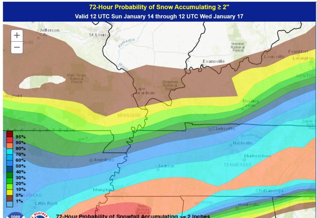
Over the past six days, that has been the forecast. Little has changed. The odds of snow are highest from central and northern Arkansas into the Missouri Bootheel and then into and along the Kentucky/Tennessee border southward. The odds of snow are lower as you travel farther and farther north.
Here is the probability of two or more inches of snow. No chance north. Higher chances south.
This will be a dry snow. A fluffy snow. We will have to see how easy it is to clean off the roads. Plan on some icy roads where one to three inches falls.
The system is beginning to take shape well to our west this morning. Here is the temperature and radar map.
You can see the snow expanding across Kansas and Oklahoma.
Winter weather radars are up and running. The local city-view radars have a WINTERIZE button. Click it to see the snow.
Backup radar site in case the above one is not working.
https://weathertalk.com/morani
Regional Radar
https://imagery.weathertalk.com/prx/RadarLoop.mp4
*NEW* Zoom interactive radar (with storm chaser streams)
https://wtalk.co/AVWG7GM7
6:20 AM Sunday
I agree with the graphics from the NWS. Little or no snow north. Highest snow totals south. no changes to the previous forecast.
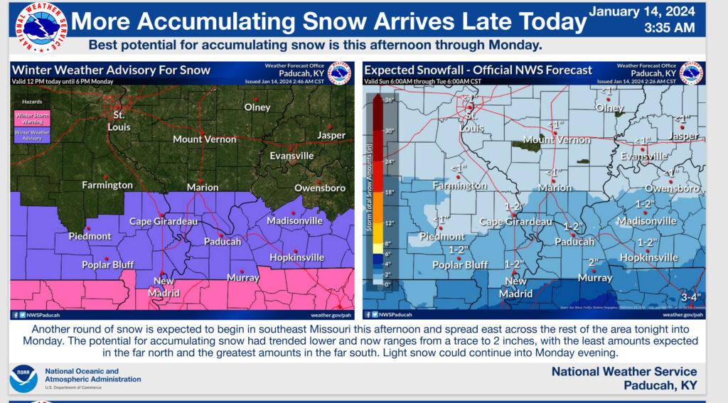
The Paducah, Kentucky NWS posted these graphics.
6:15 AM Sunday
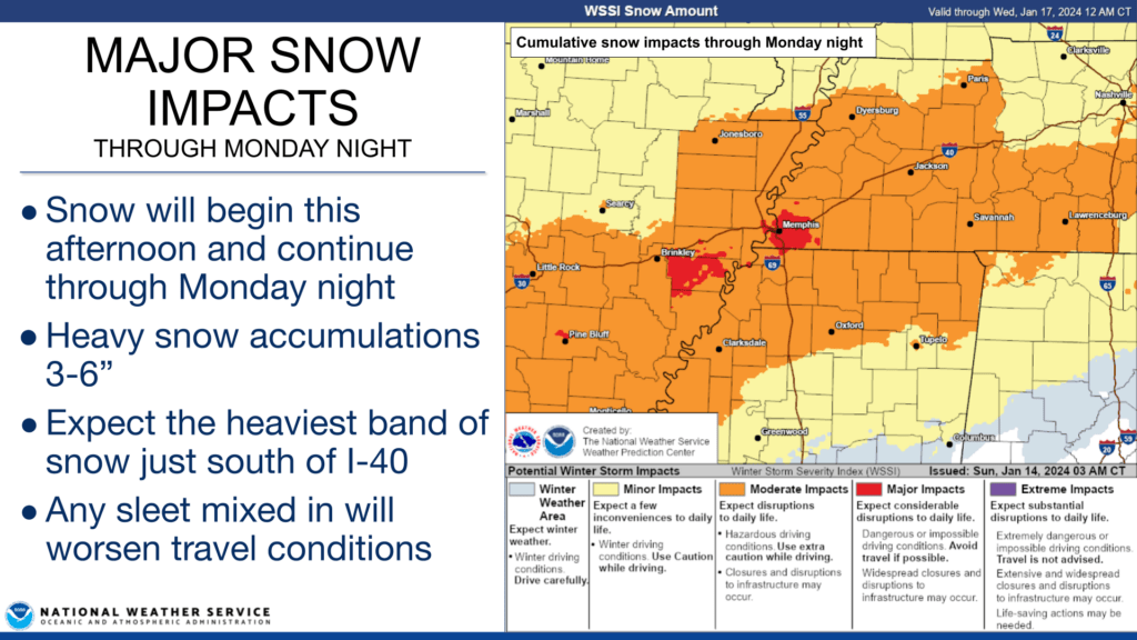
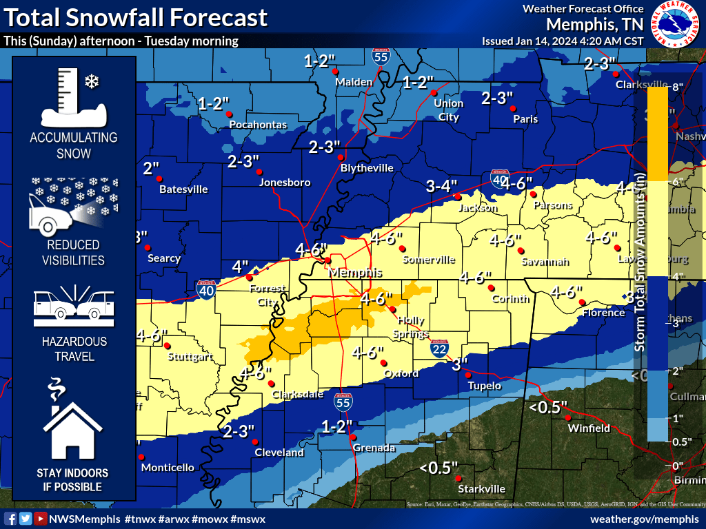
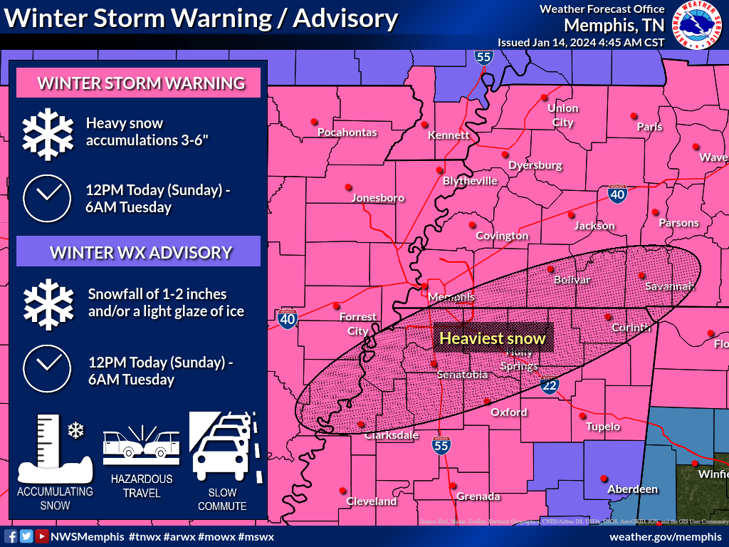
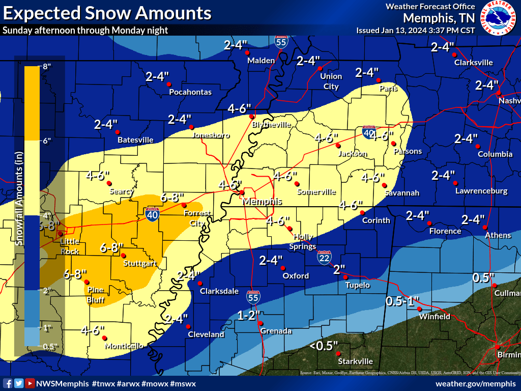
The Memphis NWS posted this information for the Bootheel and western Tennessee.
Bottom Line: Winter Storm Warnings are now in effect for heavy snow accumulations totaling 3-6″ through tomorrow night. Wind Chill Advisories are also in effect (and will continue to be needed all week) for sub-zero wind chills. Moderate to major infrastructure and/or travel impacts are likely.
Today, Sun 1/14:
- Snow will start to move in this afternoon, continuing through tomorrow night
- Hazardous travel conditions with reduced visibilities expected tonight
- A band of heavy snow is expected to set up just south of the I-40 corridor tonight
- Areas south of I-22 may see a mix of snow/sleet/freezing rain tonight
- Wind chills will drop below zero tonight along and north of I-40
Tomorrow, Mon 1/15:
- Bitter cold early morning sub-zero wind chills
- Snow will continue all day, finally ending by midnight
- Travel conditions will worsen throughout the day
- Another round of mixed precip (snow/sleet/freezing rain) may impact the same areas of north MS in the afternoon
- Total snowfall accumulations through midnight are widespread 3-6″, but there may be pockets along the heaviest snow band (see total snowfall graphic) of up to 8″
- Any sleet mixing into the snow will worsen travel conditions even further
Rest of this week:
- Bitter cold wind chills daily
- Tuesday morning will be the coldest with widespread wind chills between 0°F and -10°F
- Temperatures will not rise above freezing at all until Thursday afternoon
- This will keep snow/ice on the roads frozen all week. Hazardous travel conditions will likely last for several days
Confidence: High (4/5) for forecast snowfall amounts and winter precip impacts today/tomorrow, High (5/5) for extreme cold
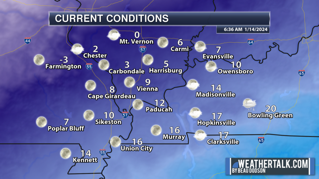
6 AM Sunday
Brrr. We are waking up to bitterly cold temperatures and wind chill values.
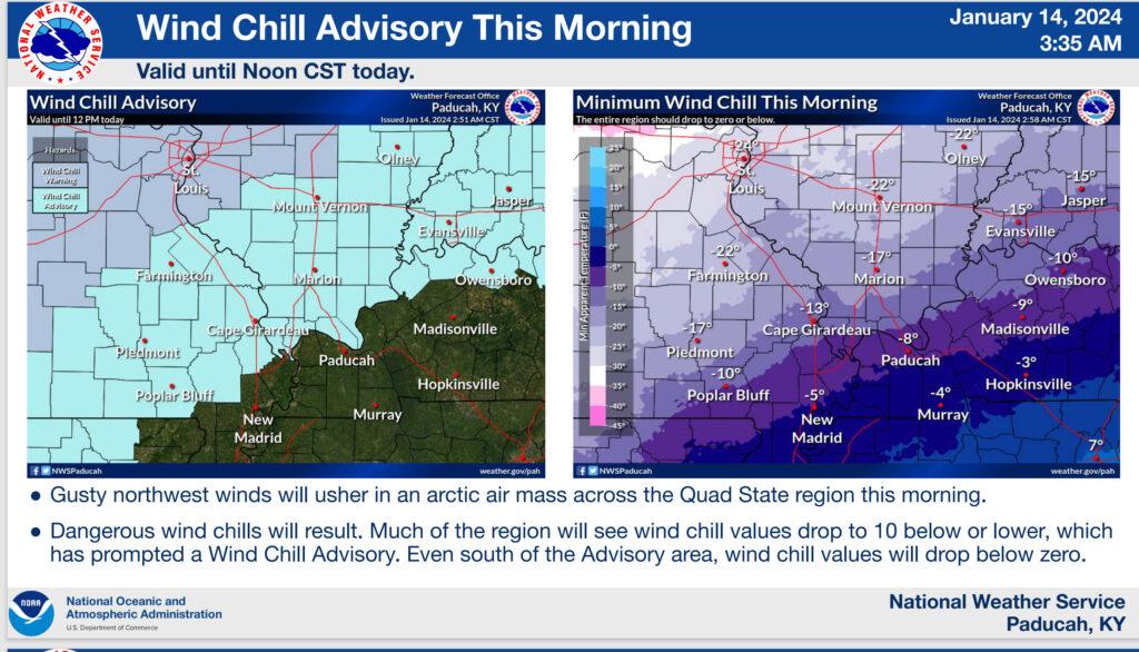
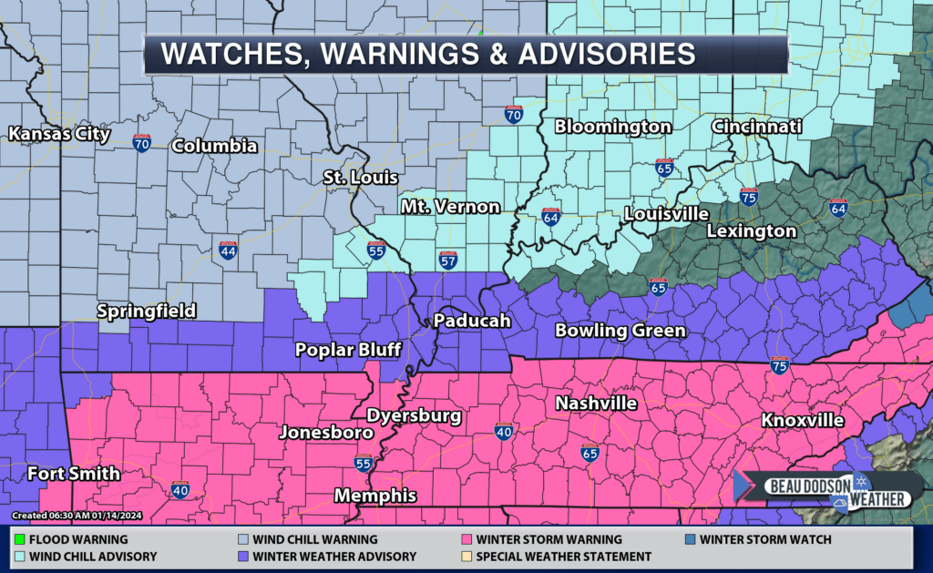
Winter weather advisories and winter storm warnings remain in effect for portions of the region. Wind chill advisories, as well.
A light snow event will take shape later today into Monday afternoon. Some areas will pick up a dusting to three inches of snow. Highest totals south and very little north.
7 PM UPDATE
Light snow is moving into the area from the west. It is moving east southeast. This is the arctic cold front.
Winter weather radars are up and running. The local city-view radars have a WINTERIZE button. Click it to see the snow.
Backup radar site in case the above one is not working.
https://weathertalk.com/morani
Regional Radar
https://imagery.weathertalk.com/prx/RadarLoop.mp4
*NEW* Zoom interactive radar (with storm chaser streams)
https://wtalk.co/AVWG7GM7
The Paducah, Kentucky NWS has issued a winter weather advisory for portions of the region. Here is their thinking. This lines up well with my forecast from the past week. No significant adjustments, thus far.
A wind chill advisory has also been issued. The Bootheel and northwest Tennessee has been added to this, as well.
Just because your county is not in the advisory doesn’t mean it won’t be bitterly cold. It will be bitterly cold area-wide!
Winter storm warnings have been issued for the Missouri Bootheel into western Tennessee. I am forecasting 2 to 4 inches of snow for the Bootheel into northwest Tennessee. Pink zone is the winter storm warning.
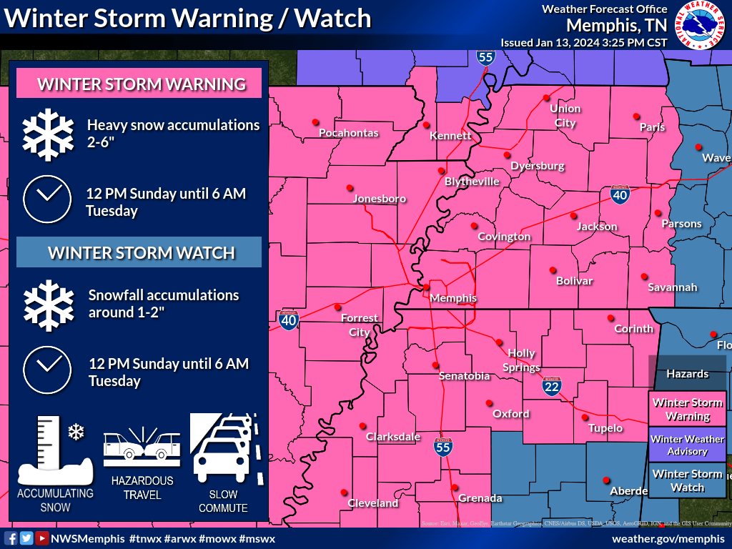
I agree with the Memphis, TN National Weather Service on their snow totals forecast. Let’s see how it goes. There are usually surprises with these events.
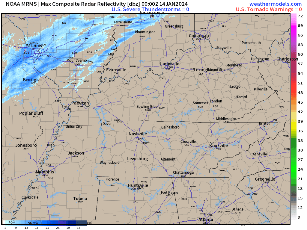
Check out current temperatures! The arctic front is moving into the region from the northwest. Some light snow showers are accompanying it.
Radar shows that light snow moving east southeast.
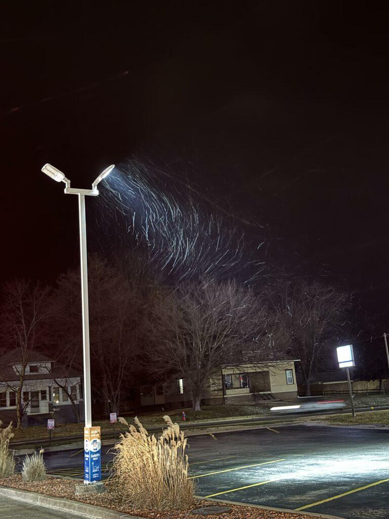
Cody Simmerman posted this photo from Marion, Illinois. Light snow falling.
Check out the temperatures at 7 PM. Rapidly falling temperatures behind the arctic front.
Want to receive more weather information? I provide a service through www.weathertalk.com
Subscribe at www.weathertalk.com and then download the Beau Dodson Weather app from the app stores!
Apple users: Beau Dodson Weather App
https://wtalk.co/9EZYG8A8
Android users: Beau Dodson Weather App
https://wtalk.co/ZEWYU8ME
Need help? Email me at beaudodson@usawx.com
* Daily weather forecasts
* My personal weather blog with all sorts of weather information!
* Special weather statements sent to the Beau Dodson Weather app.
* Rapid fire tornado alerts.
* Severe weather alerts and forecasts.
* Severe weather updates throughout the day (when severe weather is occurring)
* Ice storm alerts and forecasts.
* Winter storm alerts and forecasts.
* Winter storm updates throughout the event.
* Regional weather videos.
* Long range weather videos.
* A daily forecast that I hand type for your county. Sent out every afternoon.
* Long range outlooks. Including week one, two, three, four, and monthly outlooks. Seasonal outlooks.
* App messages to alert you when I have updated the weather blogs and Facebook.
* And more!
Here are some examples of what people receive when they subscribe to www.weathertalk.com