Posted by Meteorologist Beau Dodson
Want to receive more weather information? I provide a service through www.weathertalk.com
Subscribe at www.weathertalk.com and then download the Beau Dodson Weather app from the app stores!
Apple users: Beau Dodson Weather App
https://wtalk.co/9EZYG8A8
Android users: Beau Dodson Weather App
https://wtalk.co/ZEWYU8ME
Need help? Email me at beaudodson@usawx.com
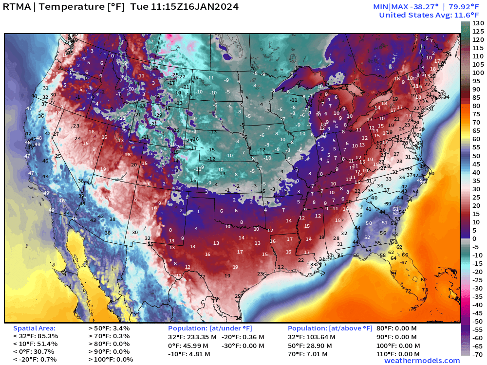
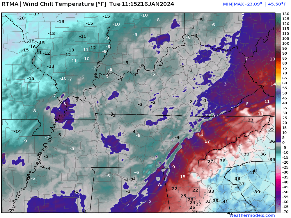
Good morning, everyone. We are waking up to bone chill temperatures. Some of our counties have dipped below zero. Wind chill values are below -10 in some areas, well.
The nation as a whole is shivering.
This is dangerous for kids at the bus stop. Bundle up.
Here is the 6 AM wind chill map. Brrr!
Here are the 6:30 AM temperatures. Again, bitterly cold.
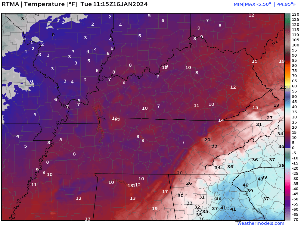
Cold cold cold.
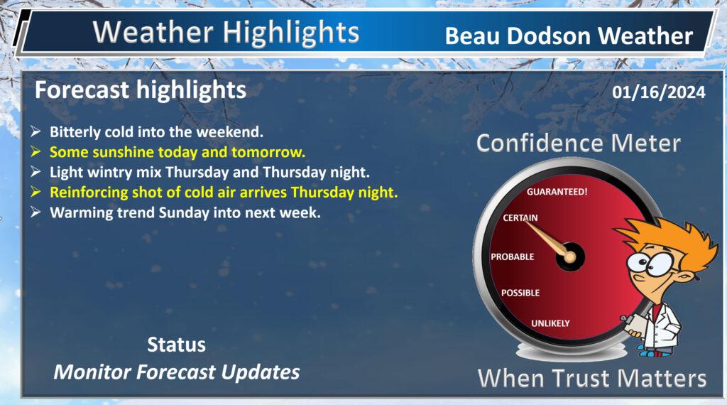
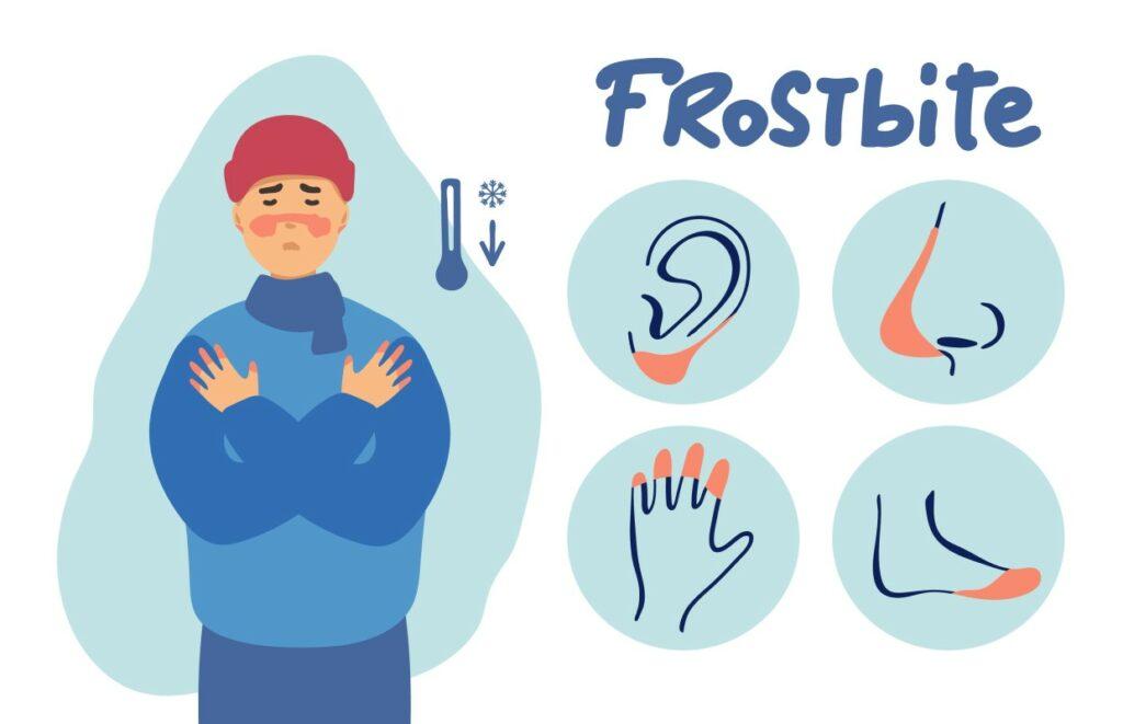
Today will remain bitterly cold. Protect yourself from frostnip and frostbite.
Our next chance of precipitation will arrive Thursday and Thursday night. This winter weather event will be light.
Temperatures will likely support a wintry mix this time around. That would be freezing rain, sleet, and snow. This raises increasing concerns about icy roadways redeveloping.
Focus on impacts and not totals. A light event but high impact, because of icy road conditions. Even a light amount of freezing rain, sleet, and snow will cause issues. Same as this last event.
The chance of precipitation will be higher over the Missouri Bootheel into extreme southern Illinois, western Kentucky, and northwest Tennessee.
The chance of precipitation will be lower over northern portions of southeast Missouri and northern portions of southern Illinois. At least during the day Thursday.
Another arctic front will push across the region Thursday night. This will increase the chance of snow showers area-wide but especially over our northern counties.
Snow totals would likely be light (less than an inch or two). Perhaps enough to coat the roadways. Focus on impacts and not totals. Icy roadways would be the end result.
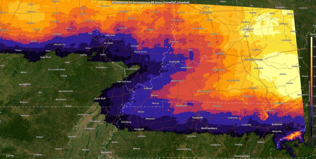
Here is the probability of 1/2″ of snow or more Thursday into Friday.
Bitterly cold temperatures Thursday night into Saturday night.
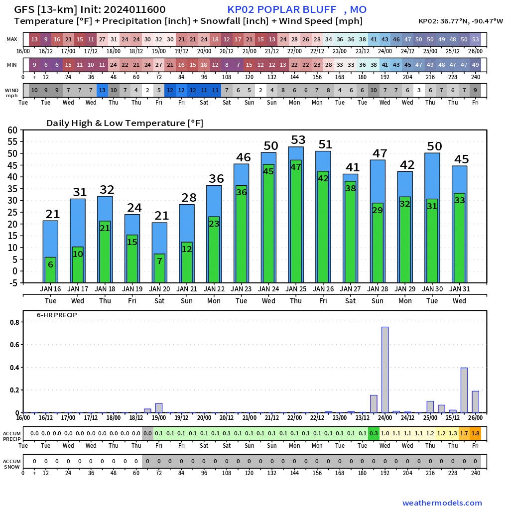
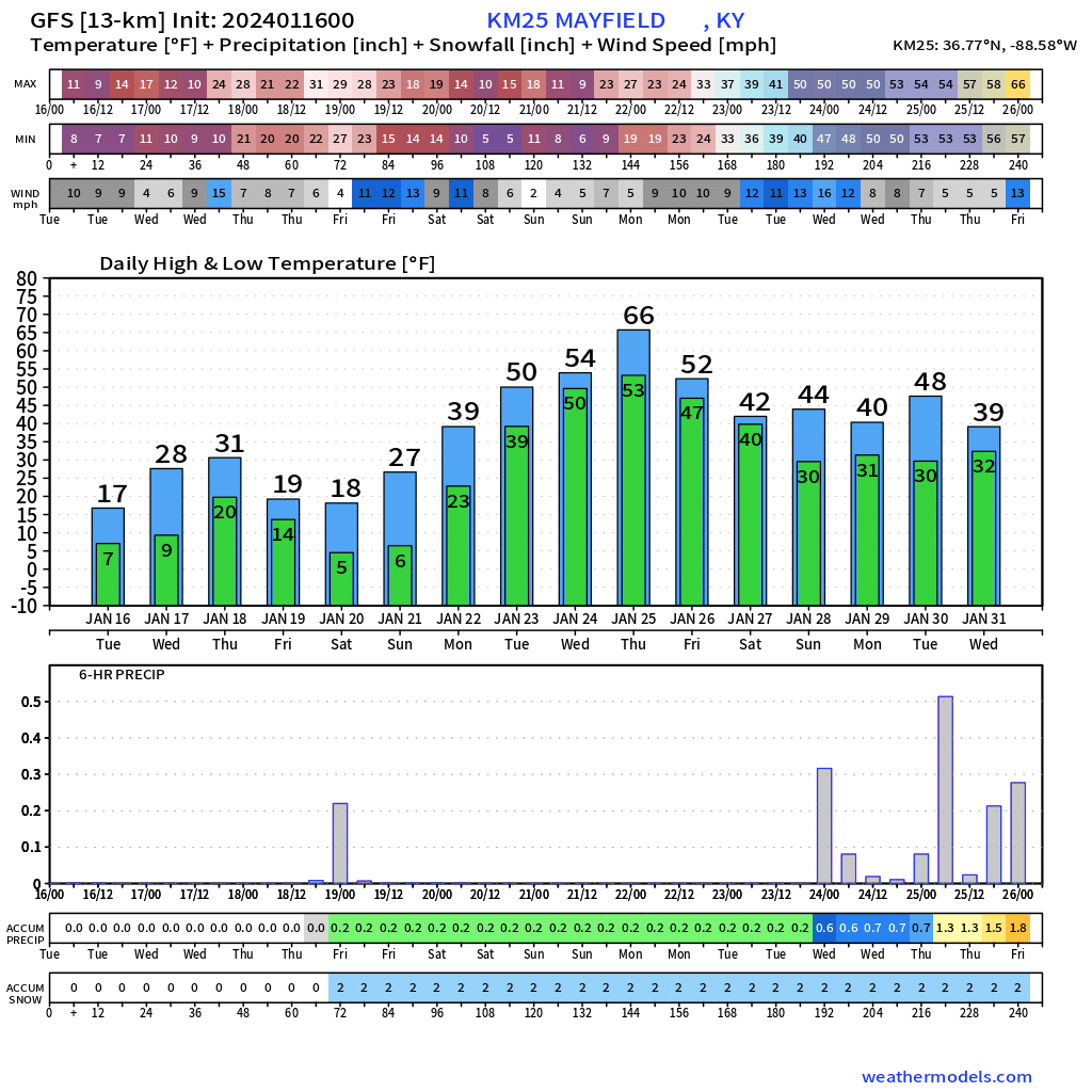
Some good news. A warming trend begins Sunday. I chose a handful of local cities/towns to show you the warming trend as we pull into next week. This is great news.
Poplar Bluff, Missouri.
Mayfield, Kentucky
Carbondale, Illinois
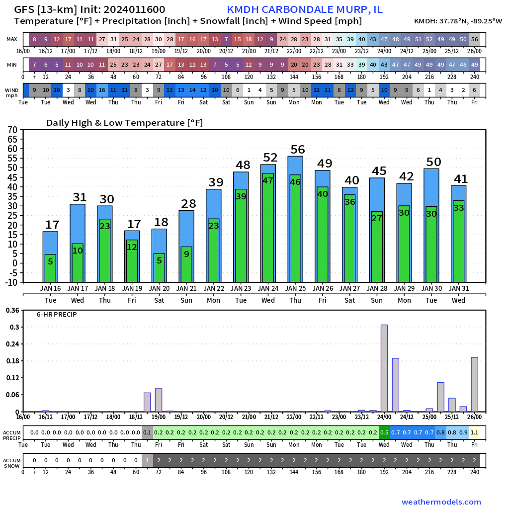
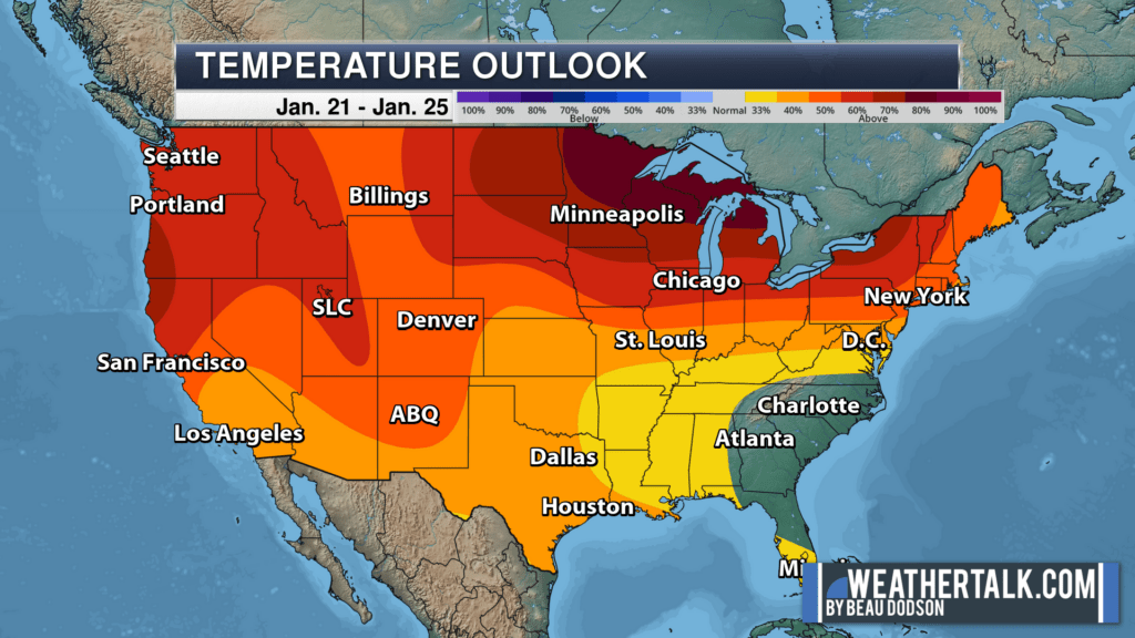
Next week’s temperature outlook favors near normal to above normal temperatures. A wetter pattern, as well.
Want to receive more weather information? I provide a service through www.weathertalk.com
Subscribe at www.weathertalk.com and then download the Beau Dodson Weather app from the app stores!
Apple users: Beau Dodson Weather App
https://wtalk.co/9EZYG8A8
Android users: Beau Dodson Weather App
https://wtalk.co/ZEWYU8ME
Need help? Email me at beaudodson@usawx.com
* Daily weather forecasts
* My personal weather blog with all sorts of weather information!
* Special weather statements sent to the Beau Dodson Weather app.
* Rapid fire tornado alerts.
* Severe weather alerts and forecasts.
* Severe weather updates throughout the day (when severe weather is occurring)
* Ice storm alerts and forecasts.
* Winter storm alerts and forecasts.
* Winter storm updates throughout the event.
* Regional weather videos.
* Long range weather videos.
* A daily forecast that I hand type for your county. Sent out every afternoon.
* Long range outlooks. Including week one, two, three, four, and monthly outlooks. Seasonal outlooks.
* App messages to alert you when I have updated the weather blogs and Facebook.
* And more!
Here are some examples of what people receive when they subscribe to www.weathertalk.com