Posted by Meteorologist Beau Dodson
Want to receive more weather information? I provide a service through www.weathertalk.com
Subscribe at www.weathertalk.com and then download the Beau Dodson Weather app from the app stores!
Good day, everyone. Well, our long battle with bitterly cold air is about over. Yes, we still have a cold night ahead of us, but nothing like recent days.
This has been an expensive weather disaster for the nation as a whole. I would not be surprised if it was a billion-dollar disaster. From the ice storms out west to the pipe busting cold across many states.
We have a wet week ahead of us. Milder temperatures, as well.
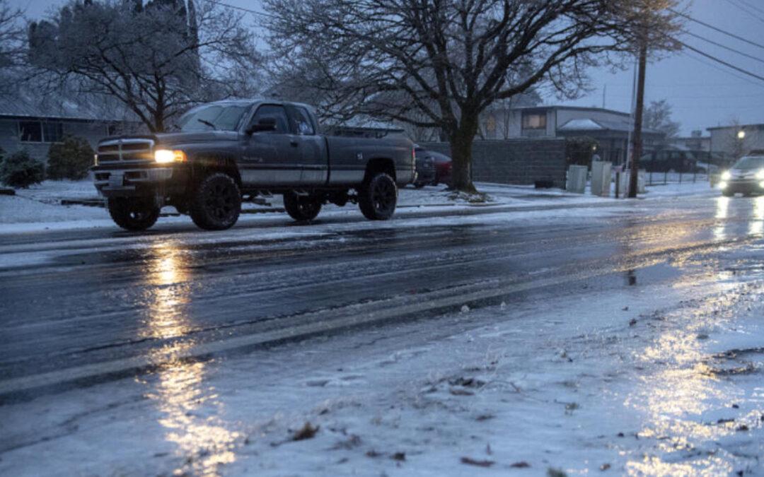
First, we have to get through a brief period of freezing rain for portions of southeast Missouri and southern Illinois.
A winter weather advisory has been issued for portions of the region.
For the most up to date watches, advisories, and warnings click here or visit our exclusive interactive local city-view radars here.
On the local city-view radars you can click the watch warning button. Then, click on your county for the information.
As of this typing (1:30 PM) there was a winter weather advisory for freezing rain across portions of Missouri and Illinois. This will run from late tonight into tomorrow afternoon.
Again, check the links above for the most up to date information/graphics.
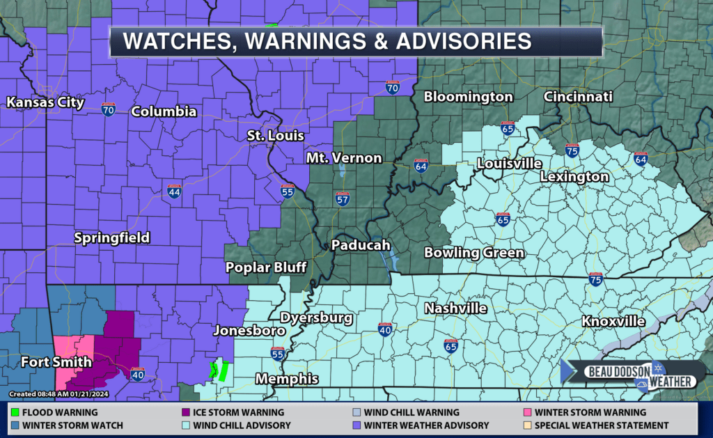
I am monitoring this area in blue, as well. We will see if the NWS adds a few more counties to the winter weather advisory. They will decide that shortly.
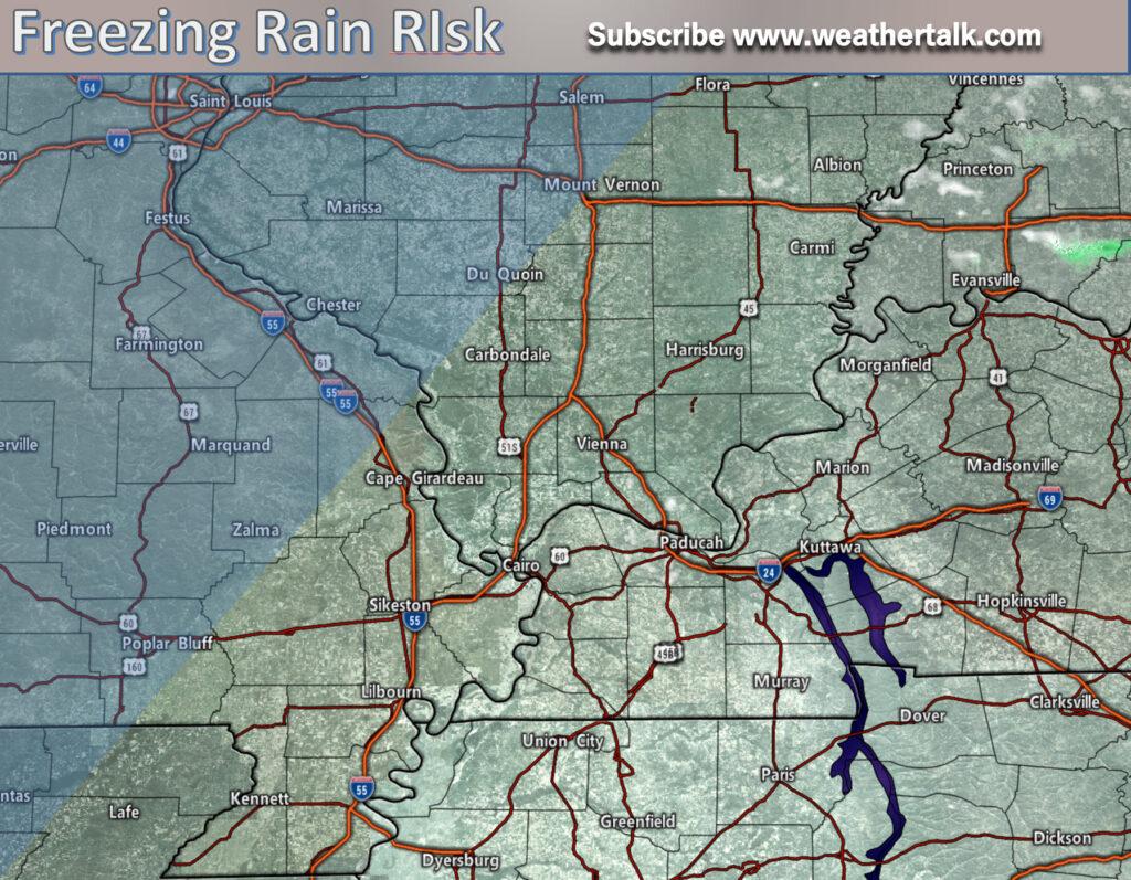
Use care while driving. Watch your first step. What looks wet could be ice.
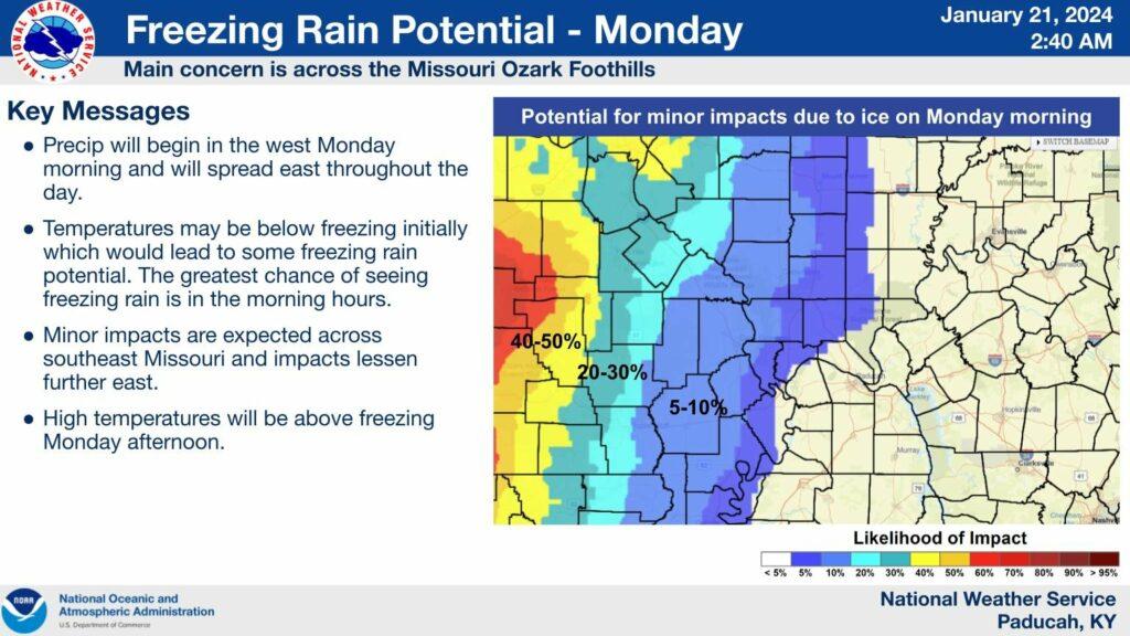
The Paducah, Kentucky NWS put out this graphic. Again, we are closely monitoring the exact track of the system. Adjustments to the forecast are possible near the current winter weather advisory.
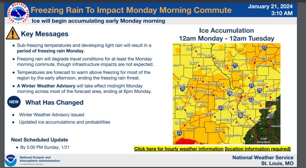
The St Louis, Missouri NWS posted this graphic.
The GREAT news is that a warming trend will begin late tonight and continue into Thursday. As a matter of fact, some locations could hit SIXTY degrees Wednesday and Thursday.
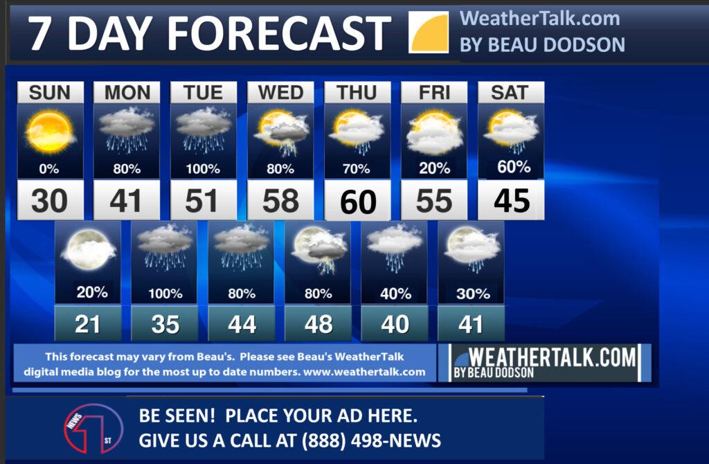
Widespread rain will impact the region tomorrow into the weekend. I am forecasting a widespread one to three inches of rain. The totals have gone up a bit. The system is farther west northwest than earlier projected.
This amount of rain could lead to some standing water, low land flooding, and nuisance flooding. Areas that commonly flood could have issues. Avoid flooded roadways, as always.
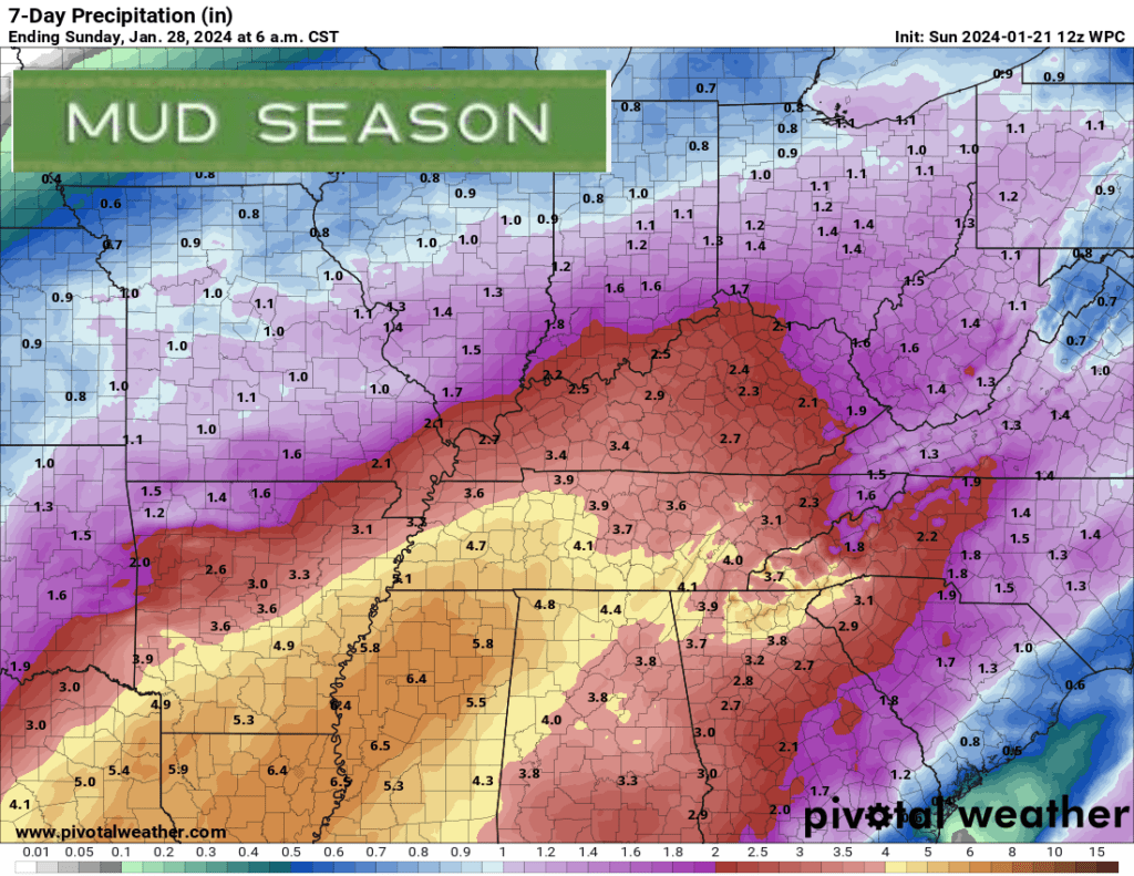
Here is the latest rainfall outlook. This is the seven-day rainfall outlook. Mud season has arrived. At this time, we do not expect severe thunderstorms.
Want to receive more weather information? I provide a service through www.weathertalk.com
Subscribe at www.weathertalk.com and then download the Beau Dodson Weather app from the app stores!
Apple users: Beau Dodson Weather App
https://wtalk.co/9EZYG8A8
Android users: Beau Dodson Weather App
https://wtalk.co/ZEWYU8ME
Need help? Email me at beaudodson@usawx.com
* Daily weather forecasts
* My personal weather blog with all sorts of weather information!
* Special weather statements sent to the Beau Dodson Weather app.
* Rapid fire tornado alerts.
* Severe weather alerts and forecasts.
* Severe weather updates throughout the day (when severe weather is occurring)
* Ice storm alerts and forecasts.
* Winter storm alerts and forecasts.
* Winter storm updates throughout the event.
* Regional weather videos.
* Long range weather videos.
* A daily forecast that I hand type for your county. Sent out every afternoon.
* Long range outlooks. Including week one, two, three, four, and monthly outlooks. Seasonal outlooks.
* App messages to alert you when I have updated the weather blogs and Facebook.
* And more!
Here are some examples of what people receive when they subscribe to www.weathertalk.com