Posted by Meteorologist Beau Dodson
Want to receive an app notification when I post a new Facebook thread, update the weather blog, post rapid-fire tornado alerts, severe weather alerts, ice storm alerts, winter storm alerts, the daily forecast, and more?
Subscribe to www.weathertalk.com
Then, download the Beau Dodson Weather app
Apple users: Beau Dodson Weather App
https://wtalk.co/9EZYG8A8
Android users: Beau Dodson Weather App
https://wtalk.co/ZEWYU8ME

FORECAST UPDATE
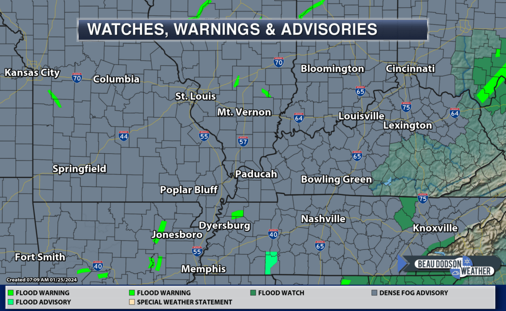
A dense fog advisory continues through the morning hours. Link to advisories.
Well, it has been quite the week of rain. We have had daily chances. Quite unusual. It has been a while since we had this many days with rain in the forecast.
Drought continues to be an issue over a large area of the United States. We need this rain.
This is the latest drought monitor.
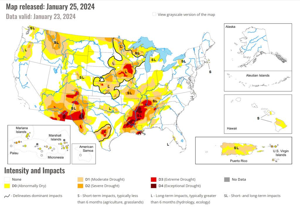
No complaints. Imagine had this been a series of ice and snow events! We would be digging out for weeks!
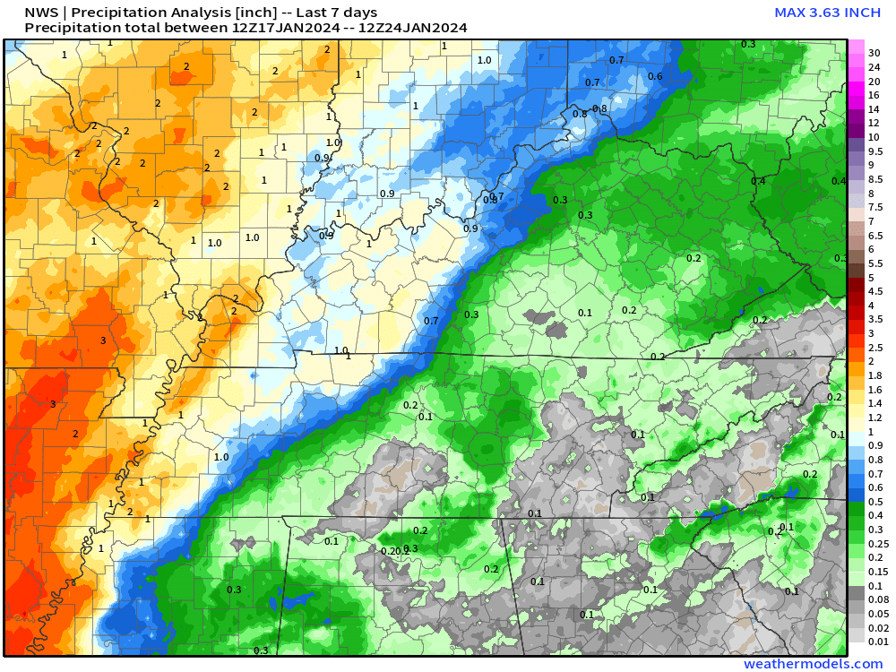
Here is a graphic that shows the radar indicated rainfall totals from the past week. The rain has been spread out over several days. That has kept flooding issues at a minimum.
We do have more rain in the forecast. Perhaps even a rumble of thunder.
Let’s look at the Hrrr model. This is the future-cast radar. What radar might look like today and tonight.
The time is in Zulu. 12z=6 AM. 18z=12 PM. 00z=6 PM. 06z=12 AM.
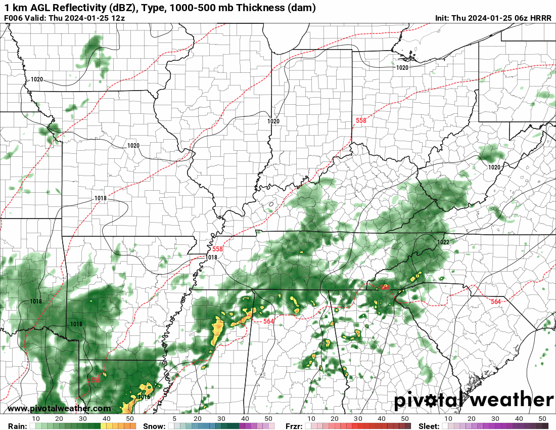
Another wave of precipitation arrives today and this evening. Ending tonight. That rain will help mix out the fog this afternoon. More fog is possible tonight. Use care if you drive into dense fog.
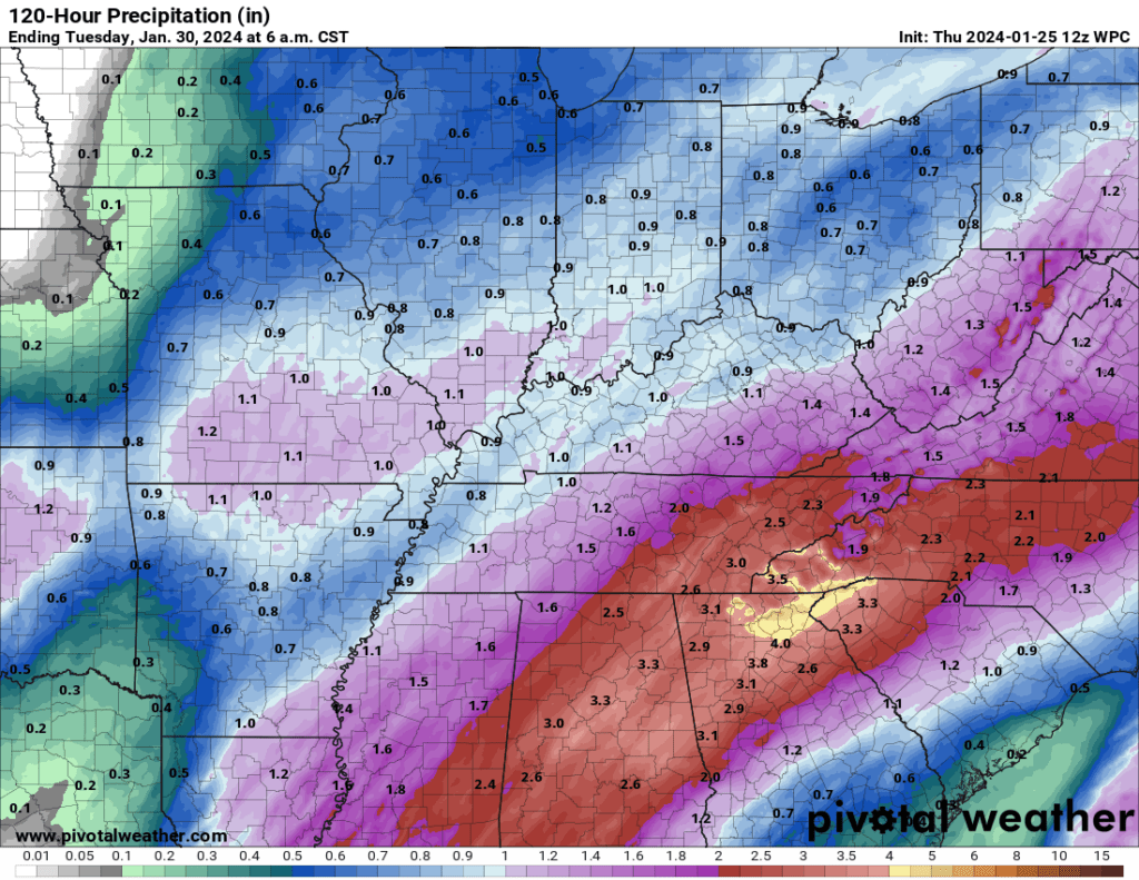
Friday will be dry. More rain arrives late Friday night into Saturday. Woosh! Rain rain rain.
The GFS model shows another rain event Sunday night and Monday, but for now I have left that portion of the forecast dry.
Here is the latest rainfall outlook. Today through Saturday evening.
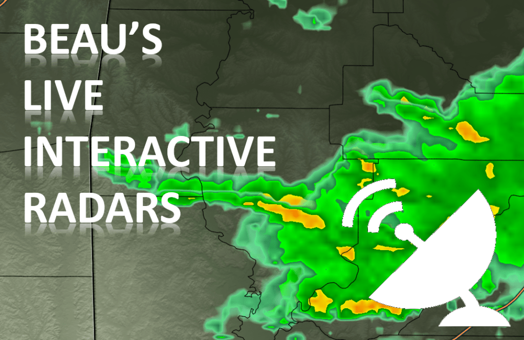
Beau Dodson Weather Radars and Lightning Data
Live Beau Dodson Radars with clickable watches and warnings.
https://beaudodsonweather.com/weather-radars/
Backup radar site in case the above one is not working.
https://weathertalk.com/morani
Regional Radar
https://imagery.weathertalk.com/prx/RadarLoop.mp4
NEW Zoom interactive radar (with storm chaser streams)
https://wtalk.co/AVWG7GM7
Real time lightning tracker system two.
https://map.blitzortung.org/#5.02/37.95/-86.99
Lightning Data (zoom in and out of your local area)
https://wtalk.co/WJ3SN5UZ
Check out our new news website!
https://mylocalnewsfirst.com/