Posted by Meteorologist Beau Dodson
A hot day ahead of us.

A cold front will nudge into the region today. It will linger in the area through at least Monday night/Tuesday. This will bring increasing chances of showers and thunderstorms over the coming days.
Peak shower and thunderstorm chances will be on Sunday and Monday.
Storms that form could produce locally heavy rain and gusty winds. Lightning, as well.
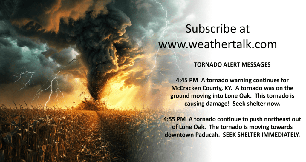
If you have outdoor activates, then you will want to monitor the Beau Dodson Weather Radars. See links below.
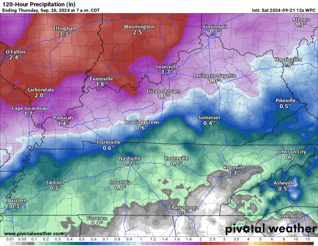
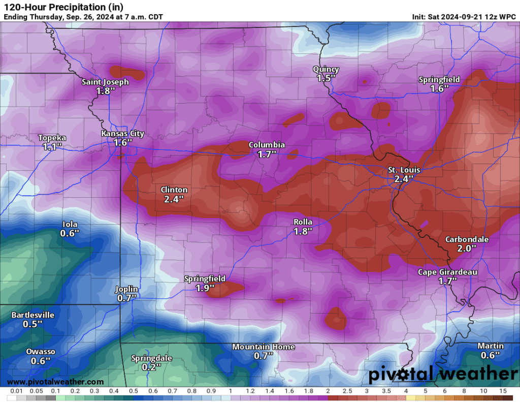
Rainfall totals today through Tuesday will likely range from one to two inches. Locally higher totals are possible. Highest totals are likely to occur over our northern counties. Somewhat lower far south. Here is a graphic. It won’t be exact, of course, but take the general idea from it.
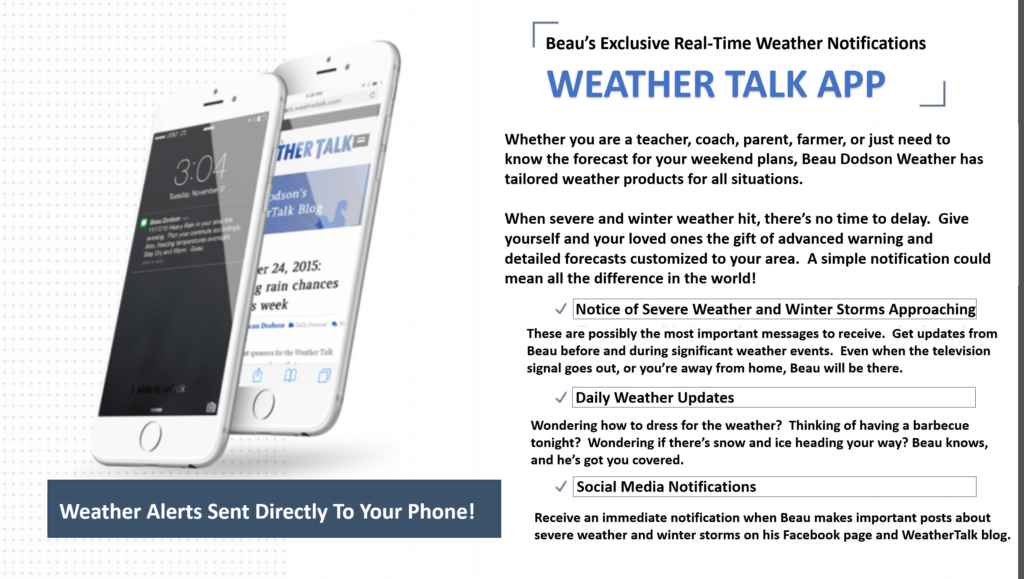
Want to receive more weather information? Straight to your phone!
Beau provides a service through www.weathertalk.com
Subscribe at www.weathertalk.com and then download the Beau Dodson Weather app from the app stores!
Apple users: Beau Dodson Weather App
https://wtalk.co/9EZYG8A8
Android users: Beau Dodson Weather App
https://wtalk.co/ZEWYU8ME
Be sure and have three to five ways of receiving your severe weather information.
One of those sources can be www.weathertalk.com
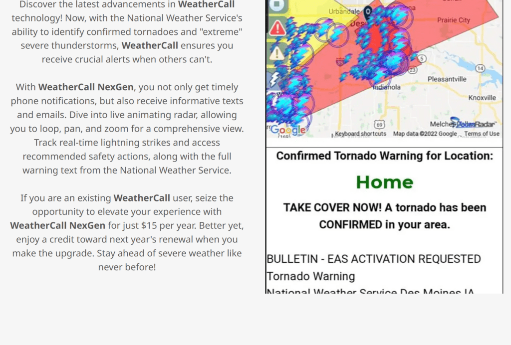
We also have a new service called WeatherCall that will call your cell phone or home phone number IF your home is INSIDE the severe thunderstorm or tornado warning. That service can be found here https://weathercallservices.com/beau-dodson-weather
Check out Beau’s live exclusive interactive weather radars.
Interactive local city-view radars. Clickable watches and warnings.
https://beaudodsonweather.com/weather-radars/