Posted by Meteorologist Beau Dodson
I hope everyone had a nice weekend!
We need rain. The good news is that rain is in the forecast today, tonight, and tomorrow. See the radar links below. Several rounds are likely to impact the region.
A few storms could be intense with strong and gusty wind and small hail. Lightning, of course.
I continue to watch the Gulf of Mexico for the development of a tropical storm or perhaps even a hurricane. The National Hurricane Center does give this system a high chance of development.
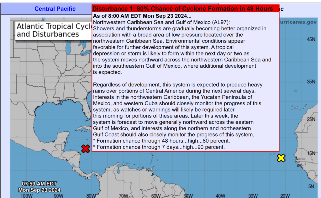
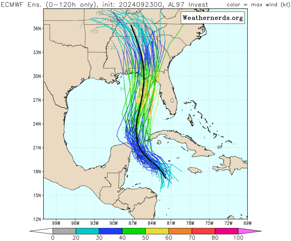
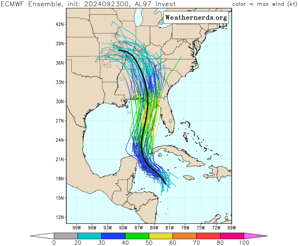
You can see the system in the Caribbean. It is still developing.
Model guidance indicates the system will move northward towards Alabama and Florida over the next few days. Landfall is currently expected to be Thursday into Friday.
The system will then move north northwest. A considerable amount of data shows it curving northwest into our region. If this happens, then it would combine with an upper-level low that is forecast to stall over our local area.
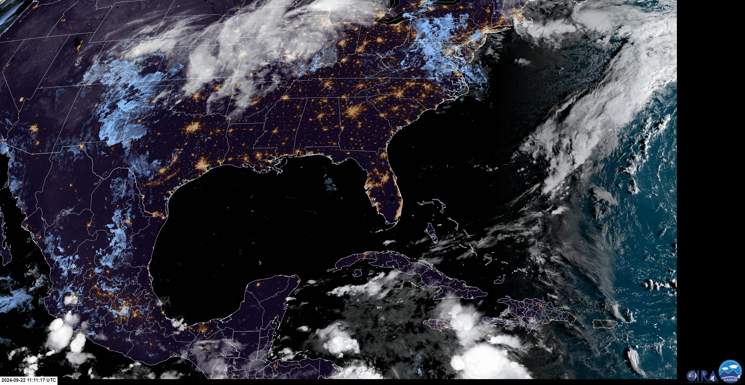
You can see that on this animation. Notice how the two systems combine over our region.
What does all of that mean for our local area? If that verifies, then it would mean widespread showers and thunderstorms mid to late week. Locally heavy rain would be possible, as well.
Confidence is increasing that these two systems will impact our region.
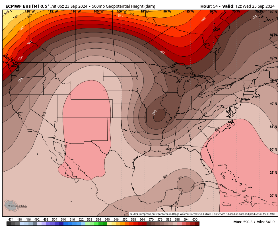
Here are some model charts. These are different models. They show the path of the tropical system. Notice that they curve the system into our local area.
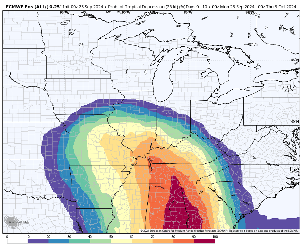
This graphic shows you the probability of a tropical depression impacting the region.
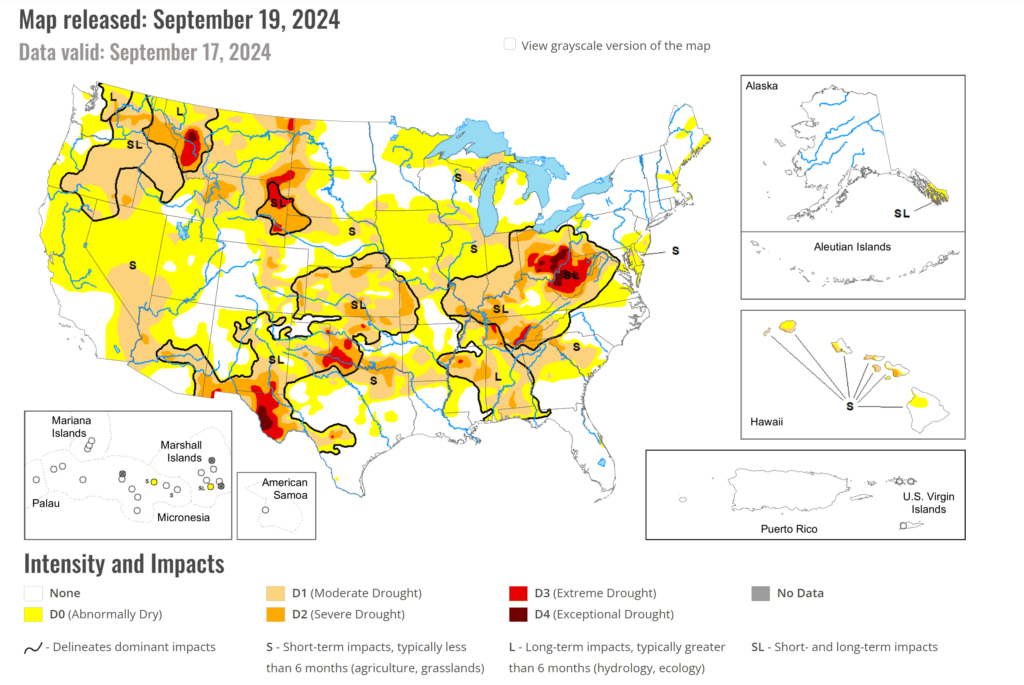
Let’s keep an eye on it. We need this rain. It could put a dent in our current drought conditions.
Here is the latest drought map. Widespread drought in our region and other areas.
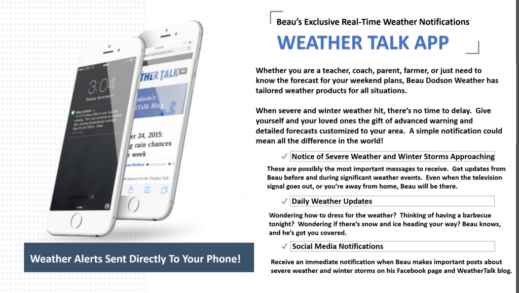
Want to receive more weather information? Straight to your phone!
Beau provides a service through www.weathertalk.com
Subscribe at www.weathertalk.com and then download the Beau Dodson Weather app from the app stores!
Apple users: Beau Dodson Weather App
https://wtalk.co/9EZYG8A8
Android users: Beau Dodson Weather App
https://wtalk.co/ZEWYU8ME
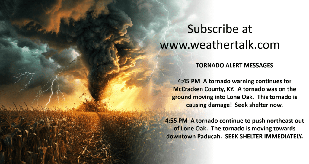
Be sure and have three to five ways of receiving your severe weather information.
One of those sources can be www.weathertalk.com
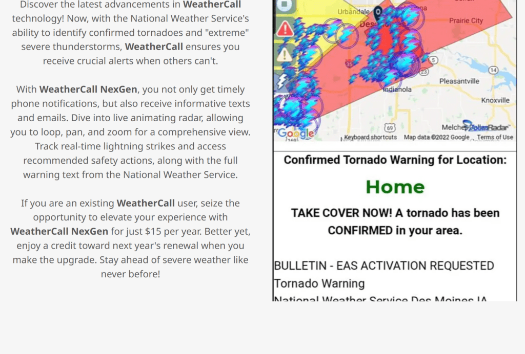
We also have a new service called WeatherCall that will call your cell phone or home phone number IF your home is INSIDE the severe thunderstorm or tornado warning. That service can be found here https://weathercallservices.com/beau-dodson-weather
Check out Beau’s live exclusive interactive weather radars.
Interactive local city-view radars. Clickable watches and warnings.
https://beaudodsonweather.com/weather-radars/